The two villages – Dieulefit-Bourdeaux region

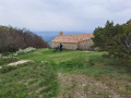
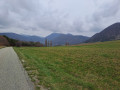
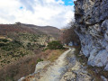
This route will take you from Dieulefit to Le Poët-Laval, two sites steeped in history. Take the time to discover the legacy of the Hospitallers, the lives and exile of 16th-century Protestants, or simply admire the narrow streets and buildings. Along the way, you’ll also enjoy a pine forest with a pleasant, scenic trail.

Details

n°1214124
Creation:
Last update:
Last review:
  • Mountain biking
    Activity: Mountain biking
  • ↔
    Distance: 7.74 mi
  • ◔
    Duration according to the author: 1.5 hrs 
  • ▲
    Difficulty: Moderate

  • ⚐
    Back to start: Yes
  • ↗
    Ascent: + 620 ft
  • ↘
    Descent: - 643 ft

  • ▲
    Highest point: 1,526 ft
  • ▼
    Lowest point: 1,017 ft
  • ⚐ Country: France
  • ⚐
    Areas: Alps, Dauphiné
  • ⚐ City: Dieulefit (26220)
  • ⚑
    Start/End: N 44.523289° / E 5.063408°
  • ❏
    IGN map(s): Ref. 3038SB, 3138OT

  • ◶
    Type of surface:
  •  
     
     
    ■ 33% Road ■ 34% Byway ■ 33% Path
  • ⇧
    Bike carrying: Not specified
  • ▲
    Difficulty: Not specified
  • Hour-by-hour weather

Description of the route

Start from the Place de la Gare in Dieulefit.

Mountain bike route no. 5.

(S/E) From Place de la Gare, head towards the hospital along the Jabron via Rue du Quai Roger Morin, then take the steep climb up to the D638: watch out for cars!

(1) Take a small road opposite. Turn left and head up to Les Vitrouillères.

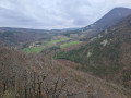
(2) Turn left to reach the plateau: lovely view! Take the ‘Sur les Pas des Huguenots’ trail. Follow a scenic path that descends to the right through the woodland. Cross a ford.

(3) Carry on straight ahead until you turn right along a stream. On your left, you’ll reach the pumping station at the foot of Poët-Laval.

(4) Further on, take a stony path down to the left, then follow another path to join the D540.

(5) Cross the D540: watch out for cars! Follow it to the left for about 50 metres and turn right.

(6) Follow a track uphill to reach Estampes, with beautiful houses in the surrounding area.

(7) From there, follow a picturesque, undulating country lane to a bridge over the Jabron.

(8) A fairly steep climb for 200 metres to enter Dieulefit, then head downhill to the left until you reach the finish (S/E).

Waypoints

  1. S/E : mi 0 - alt. 1,230 ft - Place de la Gare. Cross the square and follow the - Jabron (rivière) - Affluent du Rhône
  2. 1 : mi 0.56 - alt. 1,312 ft - Crossing the D638
  3. 2 : mi 1.13 - alt. 1,490 ft - Les Vitrouillères signpost
  4. 3 : mi 2.38 - alt. 1,142 ft - Ford
  5. 4 : mi 3.81 - alt. 1,161 ft - Pump station signpost
  6. 5 : mi 4.43 - alt. 1,020 ft - Turn left onto the D540
  7. 6 : mi 4.48 - alt. 1,024 ft - On the right: Route des Hubacs
  8. 7 : mi 5.12 - alt. 1,152 ft - Estampes signpost
  9. 8 : mi 7.42 - alt. 1,214 ft - Bridge
  10. S/E : mi 7.74 - alt. 1,230 ft - Place de la Gare

Notes

We strongly recommend that you take the IGN map referred to on these pages with you. Mountain bikers must be self-sufficient; professional guides are available if required. Emergency number: 18 or 112.
For further information, contactthe Dieulefit-Bourdeaux Tourist Office: 04 75 46 42 49 / ot@dieulefit-tourisme.com

Reviews and comments

5 / 5
Based on 1 review

Reliability of the description
5 / 5
Ease of following the route
5 / 5
Route interest
5 / 5
Jean Luc Ravenne
Jean Luc Ravenne

Overall rating : 5 / 5

Date of your route : May 14, 2021
Reliability of the description : ★★★★★ Very good
Ease of following the route : ★★★★★ Very good
Route interest : ★★★★★ Very good
Very busy route : Yes

Best done on foot; a magical walk as far as Poet Laval, but a bit of a slog (on the road) on the way back.
It’s better to do the round trip...

Machine-translated

Other walks in the area

For more walks, use our search engine .

The GPS track and description are the property of this route's author. Please do not copy them without permission.