Country:

 City:
City:


In La Touche, take the road uphill between the wash house and the church. At the third hairpin bend, opposite a hiking sign, there is a large space on the left-hand side of the road where you can park. Take care on the ascent (and later on the descent); the road is narrow and there are several marked speed bumps to channel rainwater runoff.
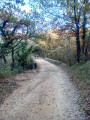
(S/E) Continue along the small road on foot (Chemin des Charpenels). The tarmac gives way to a wide track suitable for vehicles (take care, as there may be some traffic). Ignore a track branching off to the right and head north-east.
(1) Pass a house on your left and turn sharply to the right. Further on, at a place called La Fère, walk between the houses. Then turn sharply to the right and then to the left, keeping roughly level.
(2) At the T-junction, take the path on the right downhill. At a fork in the road, keep left, staying roughly level. At the next fork in the road (elevation 444), head downhill to the right.
(3) At the next Fork in the road, turn left to continue downwards to a small ravine. Take a sharp right-hand bend and descend through the woodland, staying on the right-hand bank of the valley. You’ll reach the Égasiers stream, which may or may not have water in it.
(4) Turn left and follow the stream on your right-hand side.
(5) At a fork in the road, veer to the right and cross the stream. On the other side, take the path furthest to the right, which goes uphill. It curves widely to the right. Then continue straight up to the car park (S/E).

 Local authority
 Moderate
 Visorando Member