


Refine your search for walks in Malzéville
Malzéville walks

 The Malzéville Plateau tour
 Visorando Member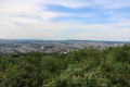
 5.35 mi
 +203 ft
 -207 ft
 2h 40
2h 40
 Easy
Easy
 Departure from Dommartemont (Meurthe-et-Moselle)
A pleasant route on the Malzéville Plateau at the Porte de Nancy, offering a change of scenery while skirting around an aerodrome. The circuit features a variety of natural environments, with sections through woods, along the edge of woods, and across grassy fields and moorland.
Discovering Nancy
 3.56 mi
+26 ft
-26 ft
1h 40
Easy
Departure from Nancy (Meurthe-et-Moselle)
3.56 mi
+26 ft
-26 ft
1h 40
Easy
Departure from Nancy (Meurthe-et-Moselle)
A tour of Nancy city centre, starting from the famous Place Stanislas.
Champigneulles Ponds
3.34 mi
+75 ft
-79 ft
1h 35
Easy
Departure from Champigneulles (Meurthe-et-Moselle)
This short walk follows the main valley of the Forêt de Haye plateau, from the protected marshland to the Étang des Brasseries. Fed by the springs of Champigneulles, the two bodies of water have given the site its name: Belle Fontaine.
From Eulmont Castle to the Tour du Crany
 5.95 mi
+636 ft
-627 ft
3h 15
5.95 mi
+636 ft
-627 ft
3h 15
 Average
Departure from Eulmont (Meurthe-et-Moselle)
Average
Departure from Eulmont (Meurthe-et-Moselle)
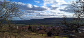
If you love old buildings, this pleasant hike in the commune of Eulmont will allow you to discover
the historic village of Eulmont, see numerous fountains and the church wall, climb the hillsides through orchards to reach the Tour du Crany and enjoy breathtaking views of the Amezule valley!
Circular route of the Moselle via the Meurthe between Jarville and Malzeville
 7.83 mi
+43 ft
-43 ft
3h 40
Average
Departure from Jarville-la-Malgrange (Meurthe-et-Moselle)
7.83 mi
+43 ft
-43 ft
3h 40
Average
Departure from Jarville-la-Malgrange (Meurthe-et-Moselle)
On the Moselle circular route, along the Meurthe between Jarville-la-Malgrange and Malzéville.
A hike mainly on cycle paths or specially designed trails to discover the meanders of the tranquil Meurthe with its birds, passing by the Old Mills of Nancy and the historic monument "La Douera" in Malzéville.
From Lay-Saint-Christophe to Bois de Faulx
 6.50 mi
+663 ft
-663 ft
3h 35
Average
Departure from Lay-Saint-Christophe (Meurthe-et-Moselle)
6.50 mi
+663 ft
-663 ft
3h 35
Average
Departure from Lay-Saint-Christophe (Meurthe-et-Moselle)
A pleasant hike on the forest plateau above Lay-Saint-Christophe. It crosses the Bois d'Eulmont and the Forêt Communale d'Eulmont and offers a very natural route on the outskirts of the city of Nancy. Hikers will be accompanied by the song of numerous birds throughout the route. The village of Lay-Saint-Christophe has 17 fountains, some of which are on or near the path.
From Basse Lay to the Bois de Chavenois
 4.94 mi
+515 ft
-502 ft
2h 45
Average
Departure from Lay-Saint-Christophe (Meurthe-et-Moselle)
4.94 mi
+515 ft
-502 ft
2h 45
Average
Departure from Lay-Saint-Christophe (Meurthe-et-Moselle)
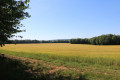
A pleasant hike near the city of Nancy, allowing you to discover the natural beauty of the Meurthe-et-Moselle hillside. This route is quite challenging as the ascents and descents of the hillside are straight and fairly steep. The path through the plateau forest allows you to get close to nature in a wooded environment. Numerous birds will brighten up your walk and, with a bit of luck, you may even see deer in the forest.
Fountains, pond, cross and abbey in Bouxières-aux-Dames
 6.11 mi
+495 ft
-472 ft
3h 15
Easy
Departure from Bouxières-aux-Dames (Meurthe-et-Moselle)
6.11 mi
+495 ft
-472 ft
3h 15
Easy
Departure from Bouxières-aux-Dames (Meurthe-et-Moselle)
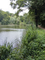
Bouxières-aux-Dames, from the top of its hill, overlooks the A31 motorway.Rich in surprising and bucolic listed sites, come and discover the small heritage of this commune, which recalls the life and beliefs of our ancestors.Just 15 km north of Nancy, this area is well worth exploring.The banks of the Étang de Mérrey and the lawn offer peace and greenery, perfect for a short break.
Please note that the route has been temporarily changed (forest hazard), follow this description.
Around L’Asnée and Laxou-Village
3.52 mi
+354 ft
-351 ft
1h 55
Easy
Departure from Laxou (Meurthe-et-Moselle)
Follow the Asnée stream for a while and, if you wish, cross through the Domaine de l’Asnée. You can then extend your walk and explore the gardens and vegetable patches along the various paths winding through the village of Laxou.
In the middle of the six woods of Saulxures-lès-Nancy
 7.64 mi
+266 ft
-289 ft
3h 45
Average
Departure from Saulxures-lès-Nancy (Meurthe-et-Moselle)
7.64 mi
+266 ft
-289 ft
3h 45
Average
Departure from Saulxures-lès-Nancy (Meurthe-et-Moselle)
A pleasant walk taking you past Saulxures Castle, the pretty village of Saulxures and its surroundings.
Pulnoy, Seichamps and Tomblaine from Saulxures-lès-Nancy.
 8.68 mi
+351 ft
-351 ft
4h 15
Average
Departure from Saulxures-lès-Nancy (Meurthe-et-Moselle)
8.68 mi
+351 ft
-351 ft
4h 15
Average
Departure from Saulxures-lès-Nancy (Meurthe-et-Moselle)
An urban hike and cycle path on the outskirts of Saulxures-lès-Nancy, Pulnoy, Seichamps and Tomblaine.A circular route to discover this urban area, passing through town centres, shopping areas and new housing developments.
Greater Nancy between Pulnoy and Dommartin-sous-Amance
 9.79 mi
+420 ft
-407 ft
4h 50
Average
Departure from Saulxures-lès-Nancy (Meurthe-et-Moselle)
9.79 mi
+420 ft
-407 ft
4h 50
Average
Departure from Saulxures-lès-Nancy (Meurthe-et-Moselle)
Part of the ‘Tour du Grand Nancy’ route, a circular route between Pulnoy and Dommartin-sous-Amance.
The route passes through the towns of Pulnoy and Seichamps, then climbs up to the Haut de Baxa plateau for some stunning views, before reaching the village of Dommartin-sous-Amance via a stony track, passing by the Monteux farm.
Return via a section of cycle path, a stony track and field paths, passing the underground gas storage facilities. The route finishes with a stretch through the Pulnoy woods, running alongside the golf course.
Pulnoy and the surrounding area
 10.10 mi
+423 ft
-430 ft
5h 00
Average
Departure from Saulxures-lès-Nancy (Meurthe-et-Moselle)
10.10 mi
+423 ft
-430 ft
5h 00
Average
Departure from Saulxures-lès-Nancy (Meurthe-et-Moselle)
This walk offers a beautiful view of Nancy and the Château de Saulxures-les-Nancy. You’ll pass through the Cerville underground storage facility and have the chance to see the surroundings of Essey-les-Nancy aerodrome.
Pulnoy Wood
4.55 mi
+272 ft
-253 ft
2h 20
Easy
Departure from Saulxures-lès-Nancy (Meurthe-et-Moselle)
A short route of about 2 hours, through fields and woodland, very pleasant, with little elevation gain.
Route of the city starting from Saulxures-lès-Nancy towards Nancy
 8.84 mi
+148 ft
-148 ft
4h 10
Average
Departure from Saulxures-lès-Nancy (Meurthe-et-Moselle)
8.84 mi
+148 ft
-148 ft
4h 10
Average
Departure from Saulxures-lès-Nancy (Meurthe-et-Moselle)
An urban walk along a cycle path starting from the Bois de Badonfosse.
Starting from Saulxures-lès-Nancy, heading to the Chartreuse de Bosserville via the Bois de Badonfosse, continuing towards the Marne-Rhine Canal at Laneuveville, just outside Nancy, crossing the Meurthe via the Bosserville footbridge.
The walk continues along the canal towards the port of Nancy, passing through Jarville-la-Malgrange and the outskirts of Nancy.
Junction with the Meurthe at Saint-Max, followed by a walk along the Meurthe.
Return via Avenue Eugène Pottier and Rue Salvador Allende.
Circular from Dommartin-sous-Amance via Blanzey, Laître-sous-Amance and Amance
 6.57 mi
+837 ft
-827 ft
3h 45
Average
Departure from Dommartin-sous-Amance (Meurthe-et-Moselle)
6.57 mi
+837 ft
-827 ft
3h 45
Average
Departure from Dommartin-sous-Amance (Meurthe-et-Moselle)
A route of four villages with magnificent views of the countryside (Pain de Sucre, start of the Seille valley) and the Vosges mountains on a clear day. Pass by the Priory of Blanzey, which is private property but accessible on foot.
Greater Nancy between Dommartin-sous-Amance and the Priory of Blanzey
 9.10 mi
+1,129 ft
-1,148 ft
5h 10
Average
Departure from Dommartin-sous-Amance (Meurthe-et-Moselle)
9.10 mi
+1,129 ft
-1,148 ft
5h 10
Average
Departure from Dommartin-sous-Amance (Meurthe-et-Moselle)
On the Tour du Grand Nancy route, a circular route between Dommartin-sous-Amance and the Priory of Blanzey in Bouxières-aux-Chênes. Set off along a country lane to reach Laître-sous-Amance with its medieval church. Climb up to Amance via a small, well-maintained path, taking in the village, the listed church, the hilltop of the old fortified castle and the views over the towns north of Nancy, then over the valley of Bouxières-aux-Chênes and Leyr.
Follow a track to reach part of the village of Bouxières-aux-Chênes and head to the Priory of Blanzey.
Then, via a woodland path, take a short walk through the Bois de Blanzey to visit the tower and the old orchards of Crany. Return to the starting point via a field path and a stony track.
Circular between Dommartin-sous-Amance, Eulmont and Agincourt
 8.20 mi
+541 ft
-568 ft
4h 15
Average
Departure from Dommartin-sous-Amance (Meurthe-et-Moselle)
8.20 mi
+541 ft
-568 ft
4h 15
Average
Departure from Dommartin-sous-Amance (Meurthe-et-Moselle)
A circular starting from Dommartin-sous-Amance to the hillside village of Eulmont with its castle, returning via Agincourt and the Pain de Sucre tour. A short detour can be made to visit the Blanzey chapel, a historic monument.
From Seichamps to the Lenoncourt State Forest
 6.95 mi
+282 ft
-256 ft
3h 25
Average
Departure from Seichamps (Meurthe-et-Moselle)
6.95 mi
+282 ft
-256 ft
3h 25
Average
Departure from Seichamps (Meurthe-et-Moselle)
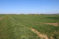
A short walk offering varied scenery, starting from the Seichamps sports complex. It is surprising in the way it offers access to a wide variety of natural environments (countryside, forests, etc.) right on the doorstep of the Greater Nancy metropolitan area. There are some lovely views, particularly of the Malzéville plateau. You’ll also get to see part of the Cerville underground gas storage facility.
In the Parc de l’Embanie
 3.56 mi
+69 ft
-72 ft
1h 40
Easy
Departure from Heillecourt (Meurthe-et-Moselle)
3.56 mi
+69 ft
-72 ft
1h 40
Easy
Departure from Heillecourt (Meurthe-et-Moselle)
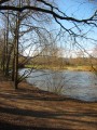
An easy, short walk with no significant elevation gain, suitable for all seasons in the village of Heillecourt, on the outskirts of Nancy. You can explore the beautiful Parc de l’Embanie; although this route passes through or around residential areas, you remain surrounded by nature as you follow footpaths.
Le Grand Couronné
 10.56 mi
+935 ft
-932 ft
5h 40
Average
Departure from Bouxières-aux-Chênes (Meurthe-et-Moselle)
10.56 mi
+935 ft
-932 ft
5h 40
Average
Departure from Bouxières-aux-Chênes (Meurthe-et-Moselle)
A beautiful hike in the Faulx woods.
The Houdemont Pond Route
1.28 mi
+210 ft
-184 ft
0h 45
Easy
Departure from Houdemont (Meurthe-et-Moselle)
A short route exploring the village and the source of the Ruisseau du Fonteno. Marked with Yellow Rings.
The Chapelle des Pauvres and the Parc de Brabois.
 8.63 mi
+1,040 ft
-1,037 ft
4h 50
Average
Departure from Houdemont (Meurthe-et-Moselle)
8.63 mi
+1,040 ft
-1,037 ft
4h 50
Average
Departure from Houdemont (Meurthe-et-Moselle)
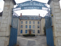
Starting from Houdemont, head towards the Chapelle des Pauvres and its orientation table, passing through the Bois Le Duc.
Walk through the paths and viewpoint of the Parc de Brabois and take a tour of the Jardin du Montet with its chapel.
Then return via the orientation table above the cemetery, descend into the old village and walk through the gardens of Vandœuvre-lès-Nancy.
Return to Houdemont via the Château de la Ronchère.
Greater Nancy – Haye State Forest
 9.56 mi
+535 ft
-538 ft
4h 50
Average
Departure from Villers-lès-Nancy (Meurthe-et-Moselle)
9.56 mi
+535 ft
-538 ft
4h 50
Average
Departure from Villers-lès-Nancy (Meurthe-et-Moselle)
On the ‘Tour du Grand Nancy’ route, a circular stage through the Haye State Forest, starting from Clairlieu and heading towards Les Baraques.
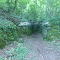
The walk is mainly through woodland on wide tracks and narrow forest paths.
Visit to two blockhouses dating from the First World War and what remains of the Cistercian Abbey of Clairlieu.
On the IGN map, near the coordinates (6), there is a symbol for a cave; in fact, it is enclosed within a building and therefore of no interest.
Circular route between Fléville-devant-Nancy and Laneuveville-devant-Nancy
6.40 mi
+141 ft
-154 ft
3h 05
Easy
Departure from Fléville-devant-Nancy (Meurthe-et-Moselle)
Start at the L’Orée du Bois housing estate, walk a short distance along the diversion canal, then take a short climb towards the Bois des Convers for the view of Nancy, and descend into Laneuveville-devant-Nancy to reach the Marne-Rhine Canal.
Return via the cycle path along the diversion canal.
L’Orée du Bois, l’Embanie, le Fond de Chanot, Hauts de Fléville, the canal
 7.06 mi
+253 ft
-253 ft
3h 30
Average
Departure from Fléville-devant-Nancy (Meurthe-et-Moselle)
7.06 mi
+253 ft
-253 ft
3h 30
Average
Departure from Fléville-devant-Nancy (Meurthe-et-Moselle)
A circular route around Fléville starting from L’Orée du Bois, towards Parc d’Embanie, up to the heights of Fond de Chanot with views of Ludres and Fléville, and a return via the Hauts de Fléville and the connecting canal.
The Clos Cardinal circular walk via the canal and the Roman bridge
 9.09 mi
+243 ft
-259 ft
4h 25
Average
Departure from Fléville-devant-Nancy (Meurthe-et-Moselle)
9.09 mi
+243 ft
-259 ft
4h 25
Average
Departure from Fléville-devant-Nancy (Meurthe-et-Moselle)
A circular walk starting from the Orée du Bois housing estate in Fléville-devant-Nancy, heading to the hamlet of Clos Cardinal via the connecting canal, the Roman bridge and the hamlet of Gerardcourt, and returning via the plain.
Les Deux Malpierre
 6.83 mi
+358 ft
-351 ft
3h 25
Average
Departure from Velaine-en-Haye (Meurthe-et-Moselle)
6.83 mi
+358 ft
-351 ft
3h 25
Average
Departure from Velaine-en-Haye (Meurthe-et-Moselle)
NEW ROUTE
Mostly in the Haye forest near Nancy, this route partly uses unmarked but perfectly passable trails. Follow the instructions as you go along.
After the Second World War, the site was home to an air base, used for 15 years by the US Army, as evidenced by the old concrete paths and buildings.
During the tour, you will also discover a memorial to the Resistance during World War II.
Avant Garde Forest from Pompey
 7.14 mi
+371 ft
-371 ft
3h 35
Average
Departure from Pompey (Meurthe-et-Moselle)
7.14 mi
+371 ft
-371 ft
3h 35
Average
Departure from Pompey (Meurthe-et-Moselle)
Easy circular hike starting from the plateau of the avant-garde in Pompey
Start from the car park near the acrobatic course.
Follow the yellow triangle markings along the entire route.
World War I structures in the Bois du Grand Mont at Amance
 3.83 mi
+282 ft
-295 ft
2h 00
Average
Departure from Amance (Meurthe-et-Moselle) (Meurthe-et-Moselle)
3.83 mi
+282 ft
-295 ft
2h 00
Average
Departure from Amance (Meurthe-et-Moselle) (Meurthe-et-Moselle)
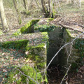
A walk in search of the locations of the batteries in the woods of Côte Jadelot and Grand Mont in Amance.
These batteries defended the soldiers in the Amance en Contrebas State Forest.
Return via the old Amance iron mine.
Circular route that can be classified as moderate despite short forays deep into the forest with a few off-trail sections in search of military structures.
Pompey and the Avant-Garde Forest via the Green Triangle and White Cross
 Association / Club / Walk leader
 5.63 mi
+384 ft
-387 ft
2h 55
Easy
Departure from Pompey (Meurthe-et-Moselle)
5.63 mi
+384 ft
-387 ft
2h 55
Easy
Departure from Pompey (Meurthe-et-Moselle)
Walk organised by the FLI Association of POMPEY. An easy circular walk (a short extension of the 7 km loop) suitable for families, starting from the Avant-Garde fitness trail, mostly in the shade.
Avant-Garde Forest in Pompey – Green Triangle Circular Loop
 4.26 mi
+246 ft
-249 ft
2h 10
Easy
Departure from Pompey (Meurthe-et-Moselle)
4.26 mi
+246 ft
-249 ft
2h 10
Easy
Departure from Pompey (Meurthe-et-Moselle)
Walk organised by the FLI Association of Pompey. A fairly easy circular walk, suitable for families, starting from the Avant-Garde fitness trail. Four further circular walks are available as extensions to this one.
Faulx - Malleloy circular loop
 4.66 mi
+367 ft
-338 ft
2h 30
Easy
Departure from Faulx (Meurthe-et-Moselle)
4.66 mi
+367 ft
-338 ft
2h 30
Easy
Departure from Faulx (Meurthe-et-Moselle)
Short circular walk starting from Faulx, towards Malleloy, passing under the Bois de Rumont on the way there and via the Mauchère Greenway on the way back.
Greater Nancy between Chavigny and Clairlieu
 8.35 mi
+981 ft
-981 ft
4h 40
Average
Departure from Chavigny (Meurthe-et-Moselle) (Meurthe-et-Moselle)
8.35 mi
+981 ft
-981 ft
4h 40
Average
Departure from Chavigny (Meurthe-et-Moselle) (Meurthe-et-Moselle)
On the ‘Tour du Grand Nancy’ route, a circular stage between Chavigny and Clairlieu, returning via Chaligny and the Neuves Maisons iron mine
The walk is largely through woodland.
An urban section takes you through Chaligny and its historic gardens, and part of Neuves Maisons to reach the iron mine.
Circular of the Moselle between Liverdun and Lock No. 5 at Aingeray.
 7.43 mi
+387 ft
-387 ft
3h 45
Average
Departure from Liverdun (Meurthe-et-Moselle)
7.43 mi
+387 ft
-387 ft
3h 45
Average
Departure from Liverdun (Meurthe-et-Moselle)
A circular route starting from Liverdun, passing through the communal woods of La Fourasse, then in front of Château de la Flie, continuing along the Moselle to Aingeray Lock No. 5. Crossing the Moselle and returning via a cycle path along the river.
The Fourasse Circular Loop
 Tourism professional
 6.82 mi
+722 ft
-712 ft
3h 45
Average
Departure from Liverdun (Meurthe-et-Moselle)
6.82 mi
+722 ft
-712 ft
3h 45
Average
Departure from Liverdun (Meurthe-et-Moselle)
This route forms part of a network of 12 ‘Au cœur des Boucles’ trails around Liverdun, offering 80 km of footpaths marked with the oak leaf, the town’s emblem. They allow you to choose a walk to suit you – short, medium or longer – or to create your own route combining any of the four circular loops. These circular loops will introduce you to the old village, whose history is linked to the Moselle, and allow you to enjoy a varied array of woodland settings and sensitive natural areas. As you wander, you’ll discover breathtaking views of the Moselle valley and the medieval village.The long Fourasse circular hike (marked with three green stripes) is a 4½-hour hike. This woodland trail takes you through a variety of forest habitats (coppice, high forest, wetland, deciduous and coniferous woodland). It is possible to complete the route by mountain bike; it’s very easy going apart from the lower section of the descent just before reaching the viewpoint (4).
History of iron
 13.35 mi
+1,319 ft
-1,319 ft
7h 15
Average
Departure from Chavigny (Meurthe-et-Moselle) (Meurthe-et-Moselle)
13.35 mi
+1,319 ft
-1,319 ft
7h 15
Average
Departure from Chavigny (Meurthe-et-Moselle) (Meurthe-et-Moselle)
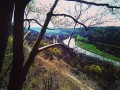
Discover the history of iron around Neuves-Maisons.
Fléville circular
 6.33 mi
+207 ft
-197 ft
3h 05
Easy
Departure from Fléville-devant-Nancy (Meurthe-et-Moselle)
6.33 mi
+207 ft
-197 ft
3h 05
Easy
Departure from Fléville-devant-Nancy (Meurthe-et-Moselle)
An easy walk through part of the Greater Nancy urban area without leaving the countryside.
Chavigny Forest
 5.30 mi
+174 ft
-161 ft
2h 35
Easy
Departure from Chavigny (Meurthe-et-Moselle) (Meurthe-et-Moselle)
5.30 mi
+174 ft
-161 ft
2h 35
Easy
Departure from Chavigny (Meurthe-et-Moselle) (Meurthe-et-Moselle)
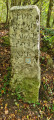
A short walk through the woods on the outskirts of Nancy. No roads to cross. Easy parking next to the forester’s lodge on Route Charlemagne. Take care when setting off again, as the road from the University Hospital towards Chavigny is very busy.
Grand tour of Camp d'Affrique
 5.01 mi
+141 ft
-141 ft
2h 25
Easy
Departure from Ludres (Meurthe-et-Moselle)
5.01 mi
+141 ft
-141 ft
2h 25
Easy
Departure from Ludres (Meurthe-et-Moselle)
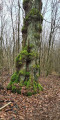
Departure from the Plateau des Loisirs for this very shady hike in the undergrowth around Camp d'Affrique.
Tour of the Ludres plateau via the cliffs and the Cité d'Affrique
 4.58 mi
+161 ft
-161 ft
2h 15
Easy
Departure from Ludres (Meurthe-et-Moselle)
4.58 mi
+161 ft
-161 ft
2h 15
Easy
Departure from Ludres (Meurthe-et-Moselle)
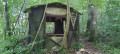
This is an easy hike, passing by the Saint-Joseph cliffs and the Cité d'Affrique, mainly in the woods, offering beautiful views of the Saint-Joseph cliffs and the Moselle valley, and allowing you to explore the ruins of the Cité (also known as Camp) d'Affique, a Gallic archaeological site dating from the early Iron Age, around 500 BC.
The Visorando app is recommended.
Around Gérardcourt and Laneuveville-Devant-Nancy
 7.52 mi
+335 ft
-335 ft
3h 45
Average
Departure from Fléville-devant-Nancy (Meurthe-et-Moselle)
7.52 mi
+335 ft
-335 ft
3h 45
Average
Departure from Fléville-devant-Nancy (Meurthe-et-Moselle)
A pleasant walk around Fléville, Gérardcourt and Laneuveville-Devant-Nancy, combining the countryside (panoramic view of the surrounding towns) and walking along the canal with its locks and birds.
The canals of Laneuveville in front of Nancy.
 6.19 mi
+233 ft
-230 ft
3h 05
Easy
Departure from Fléville-devant-Nancy (Meurthe-et-Moselle)
6.19 mi
+233 ft
-230 ft
3h 05
Easy
Departure from Fléville-devant-Nancy (Meurthe-et-Moselle)
A pleasant walk around Fléville and Laneuveville in front of Nancy, combining the countryside with panoramic views of the surrounding towns, and returning along the Marne-Rhine Canal with its junctions, locks and birds.
From the Ludres plateau to the Houdemont hillsides
 6.83 mi
+564 ft
-564 ft
3h 40
Average
Departure from Ludres (Meurthe-et-Moselle)
6.83 mi
+564 ft
-564 ft
3h 40
Average
Departure from Ludres (Meurthe-et-Moselle)
A roller coaster ride around the Grand Canyon with beautiful views of Nancy, the south of the conurbation, the Vermois and the Vosges (Donon). The route is designed as two circular loops with a viewpoint in the middle. An easy section (start and finish) through the classic forest of the Plateau de Haye, but also a beautiful limestone lawn; a passage by the Fonteno stream in the heart of the old village of Houdemont and a more technical section on the hillside, with alternating flat sections and sometimes steep climbs.
Route updated in December 2025.
From Ludres to Houdemont – Short route
 5.00 mi
+417 ft
-417 ft
2h 40
Average
Departure from Ludres (Meurthe-et-Moselle)
5.00 mi
+417 ft
-417 ft
2h 40
Average
Departure from Ludres (Meurthe-et-Moselle)
The route runs mainly across the plateau with a detour halfway up the hillside to the outskirts of Houdemont. In between, it passes a viewpoint offering a fine view of Nancy, the southern part of the conurbation, the Vermois region and the Vosges (the Donon is visible on a clear day).
A circular route through several villages in Lorraine starting from Custines
14.19 mi
+1,358 ft
-1,365 ft
7h 40
 Difficult
Departure from Custines (Meurthe-et-Moselle)
Difficult
Departure from Custines (Meurthe-et-Moselle)
Starting from Custines, a lovely circular route to explore the Mauchère Valley: beautifulviews of the heights of the Mauchère Valley. The trails offer magnificent panoramic views of the Moselle and Meurthe valleys. The confluence, known as Gueule d’Enfer, where the Moselle and Meurthe meet, is also visible from these viewpoints. The valley was also served by a railway line linking Pompey to Nomeny, which operated from 1810 until the 1950s. This line was decommissioned in the 1980s and subsequently converted into a cycle path, now shared by walkers.
From Fléville to Lupcourt in the footsteps of the past
 7.74 mi
+184 ft
-171 ft
3h 45
Easy
Departure from Fléville-devant-Nancy (Meurthe-et-Moselle)
7.74 mi
+184 ft
-171 ft
3h 45
Easy
Departure from Fléville-devant-Nancy (Meurthe-et-Moselle)
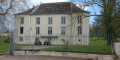
A route combining a visit to Fléville-devant-Nancy with its Renaissance castle and the rolling landscapes of the Vermois; it follows some sections used in the distant past (a Gallo-Roman road) or more recently (harnessed horses at the beginning of the 20th century).
Route updated in January 2026.
Grande Boucle Villageoise in Liverdun
 5.62 mi
+371 ft
-344 ft
2h 55
Average
Departure from Liverdun (Meurthe-et-Moselle)
5.62 mi
+371 ft
-344 ft
2h 55
Average
Departure from Liverdun (Meurthe-et-Moselle)
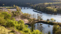
This route forms part of a network of 12 ‘Au cœur des Boucles’ trails around Liverdun, offering 80 km of footpaths marked with the town’s emblem, the oak leaf. They allow you to choose a suitable walk – short, medium or long – or to create your own route combining any of the four circular loops. These circular loops will introduce you to the old village, whose history is linked to the Moselle, and allow you to enjoy a varied array of woodland settings and sensitive natural areas. As you wander, you’ll discover breathtaking views of the Moselle valley and the medieval village.
The Chênot Hazotte circular loop
 4.17 mi
+469 ft
-472 ft
2h 20
Easy
Departure from Liverdun (Meurthe-et-Moselle)
4.17 mi
+469 ft
-472 ft
2h 20
Easy
Departure from Liverdun (Meurthe-et-Moselle)
This route forms part of a network of 12 trails known as ‘Au cœur des Boucles’ around Liverdun, offering 80 km of footpaths marked with the oak leaf, the town’s emblem. This circular route runs mainly through woodland. It is suitable for mountain biking, but the section between (1) and (2) is difficult. This long circular route is signposted with an orange “oak leaf” symbol, the emblem of the town of Liverdun. The long circular route is marked with three horizontal lines, but it is possible to shorten the walk by taking the medium circular route (two horizontal lines) or even the short circular route (one horizontal line). All this is explained on this page of the Liverdun town website.
The Greater Nancy area from Liverdun to the Bois des Hospices de Pompey
 10.29 mi
+945 ft
-928 ft
5h 35
Average
Departure from Liverdun (Meurthe-et-Moselle)
10.29 mi
+945 ft
-928 ft
5h 35
Average
Departure from Liverdun (Meurthe-et-Moselle)
On the ‘Tour du Grand Nancy’ route, a circular stage between Liverdun and the Bois des Hospices de Pompey, passing through the village of Saizerais.
The walk is mainly through woodland, along wide paths.
Visit to the village of Saizerais.
A tour of part of the town of Liverdun, passing, at the entrance, by the old canal which flows beneath the town, then through a cave and back via the old town and its significant heritage.
Montenoy, Brattes, Faulx via Vassuchamp
 7.53 mi
+863 ft
-856 ft
4h 15
Average
Departure from Montenoy (Meurthe-et-Moselle)
7.53 mi
+863 ft
-856 ft
4h 15
Average
Departure from Montenoy (Meurthe-et-Moselle)
A circular walk starting from Montenoy with views of the Natagne and Mauchère valleys. The route alternates between countryside and forest landscapes.
Entrainement montagne ou trail autour du plateau de Ludres
14.09 mi
+2,356 ft
-2,329 ft
8 hrs
 Very difficult
Departure from Ludres (Meurthe-et-Moselle)
Very difficult
Departure from Ludres (Meurthe-et-Moselle)
A very varied route for those who enjoy long hikes or training in the mountains or on trails. Hikers will appreciate the views, while trail runners will enjoy the alternation between flat sections and steep slopes. The route is designed to achieve a relatively high elevation gain/length ratio for this region. There are numerous shortcuts available if needed.Updated in December 2025.
Circuit de Ludres par Messein
 5.95 mi
+866 ft
-843 ft
3h 30
Average
Departure from Ludres (Meurthe-et-Moselle)
5.95 mi
+866 ft
-843 ft
3h 30
Average
Departure from Ludres (Meurthe-et-Moselle)
Circular starting from Ludres, crossing the old village, with panoramic views of the Moselle valley above Messein and crossing the Cité d'Affrique (Camp Leuque). A gentle section on the plateau but also some steep passages. Route designed to accumulate elevation gain (well suited to Nordic walking) but with possible detours.
Route modified at the end of 2025 to take into account previously issued opinions.
In the heart of the Coteaux de Ludres
1.54 mi
+305 ft
-289 ft
1h 00
Easy
Departure from Ludres (Meurthe-et-Moselle)
Discover the landscapes of the Coteaux de Ludres!
The cliffs of Bois des Roches from Chavigny
 3.93 mi
+728 ft
-745 ft
2h 25
Average
Departure from Chavigny (Meurthe-et-Moselle) (Meurthe-et-Moselle)
3.93 mi
+728 ft
-745 ft
2h 25
Average
Departure from Chavigny (Meurthe-et-Moselle) (Meurthe-et-Moselle)
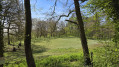
Complete tour of the cliffs overlooking the commune of Messein, following them along the top and at their foot. Beautiful views of the natural evolution of the sedimentary massifs. Caution is advised on the cliff edge.
From Ludres to Chavigny via the Bois de la Grande Fraize
 6.06 mi
+846 ft
-846 ft
3h 30
Average
Departure from Ludres (Meurthe-et-Moselle)
6.06 mi
+846 ft
-846 ft
3h 30
Average
Departure from Ludres (Meurthe-et-Moselle)
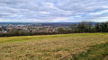
To complete the triptych covering the Ludres plateau (see also Ludres-Houdemont and Ludres-Messein), this circular route mainly covers the commune of Chavigny and takes in the three highlights of the plateau: Camp Leuque, traces of mining activity and a beautiful view of the Vosges mountains.
Through forests and meadows via Chaligny
 4.85 mi
+404 ft
-420 ft
2h 35
Easy
Departure from Maron (Meurthe-et-Moselle) (Meurthe-et-Moselle)
4.85 mi
+404 ft
-420 ft
2h 35
Easy
Departure from Maron (Meurthe-et-Moselle) (Meurthe-et-Moselle)
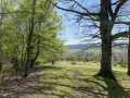
A hike on the outskirts of Nancy offering a variety of landscapes, with forest sections and open areas around Chaligny.
In the land of salt, the salt pans and the hills above Rosières-aux-Salines
12.92 mi
+827 ft
-830 ft
6h 40
Difficult
Departure from Saint-Nicolas-de-Port (Meurthe-et-Moselle)
This long circular walk, which starts at the Saint-Nicolas-de-Port Leisure Park, takes you along a section of the ballast track of a recently disused SNCF railway line and will first lead you to discover the brackish lagoons between the river and the settling basin.
Thesecond part moves away from the valley and takes you westwards through woods, pastures, orchards and farmland, before leading you back to your starting point along a ridge path.