The Moselle circular route between Malzéville and Bouxières

The circular bends in the Moselle as you cycle along the Meurthe cycle paths between Malzéville and Bouxières-aux-Dames.

Details

n°1627576
Creation:
Last update:
Last review:
  • Walking
    Activity: Walking
  • ↔
    Distance: 7.83 mi
  • ◔
    Average duration: 3h 40 
  • ▲
    Difficulty: Average

  • ⚐
    Back to start: Yes
  • ↗
    Ascent: + 118 ft
  • ↘
    Descent: - 118 ft

  • ▲
    Highest point: 758 ft
  • ▼
    Lowest point: 610 ft
  • ⚐ Country: France
  • ⚐ City: Malzéville (54220)
  • ⚑
    Start/End: N 48.709275° / E 6.18072°
  • Accessible from the train station Gare de Champigneulles.
  • ❏
    IGN map(s): Ref. 3315ET
  • Hour-by-hour weather

Photos

Description of the walk

Park in the car park on Rue du Lion d’Or in Malzéville, next to the Pont de Vayringe.

(S/E) Join the cycle path running alongside the Meurthe, heading towards Bouxières-aux-Dames by turning right (leaving the bridge behind you). Continue along the Meurthe on the cycle path.

(1) At the end of the car park, continue along the cycle path beside the River Meurthe, heading slightly to the left. Pass under two high-voltage power lines and then past a small pond.

(2) When you reach the cycle bridge, turn right, join a cycle path, ride alongside the car park and carry on straight ahead to pass under the road bridge.

(3) Take the cycle path on the left, cross over the stream and join the D32d.
Cross the road and take the small road opposite which curves to the left. At the end of the road, before the entrance to the property, take the path on the left which runs alongside the fence and joins Rue du Professeur Montant.

(4) Turn left into Rue François Grandjean and continue straight on.

(5) At the junction at the bottom of the hill, at the entrance to Bouxières-aux-Dames, turn left into Rue du Téméraire. Continue to the large junction on Avenue Foch leading to the Pont de Bouxières.

(6) Turn left towards Champigneulles. Cross the motorway at the traffic lights using the pedestrian crossings and cross the River Meurthe by walking along the footpath on the Pont de Bouxières.

(7) At the roundabout, turn left onto Rue André Ampère. Between two buildings, turn left towards the fire brigade access and join the cycle path running alongside the Meurthe.

(8) At the cycle path, turn right onto it, pass the cycle bridge and carry on straight ahead. Pass the Champigneulles breweries and join a road; continue straight ahead between the railway line and the River Meurthe.

(9) At the sports facilities, veer slightly to the left to rejoin the cycle path, ride alongside a pond, and pass close to the Marne–Rhine Canal.

(10) Then pass the sewage treatment works and head towards the Vayringe bridge.

(11) Take the stairs and turn left onto the footbridge to cross over the River Meurthe. At the end of the footbridge, turn left to return to the starting car park (S/E).


Waypoints

  1. S/E : mi 0 - alt. 640 ft - Car park on Rue du Lion d’Or - Meurthe (rivière)
  2. 1 : mi 0.32 - alt. 640 ft - At the end of the car park
  3. 2 : mi 2.69 - alt. 630 ft - Cycle footbridge
  4. 3 : mi 2.92 - alt. 650 ft - After the road bridge. Towards the - Amezule (rivière)
  5. 4 : mi 3.34 - alt. 748 ft - Rue du Professeur Montant
  6. 5 : mi 3.68 - alt. 692 ft - Entering Bouxières-aux-Dames
  7. 6 : mi 4.01 - alt. 643 ft - Towards the Bouxières bridge
  8. 7 : mi 4.26 - alt. 640 ft - Roundabout in the industrial estate
  9. 8 : mi 4.52 - alt. 623 ft - Cycle path
  10. 9 : mi 5.88 - alt. 643 ft - Sports facilities near the River Meurthe and the - Canal de la Marne au Rhin
  11. 10 : mi 6.88 - alt. 643 ft - Take the stairs and turn left
  12. 11 : mi 7.71 - alt. 640 ft - Vayringe Bridge
  13. S/E : mi 7.83 - alt. 640 ft - Car park on Rue du Lion d’Or

Worth a visit

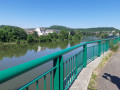
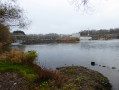
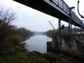
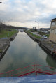
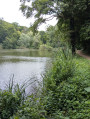
The River Meurthe between Malzéville and Bouxières-aux-Dames, with the small dam beneath the cycle footbridge.
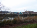
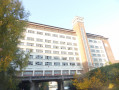
The breweries of Champigneulles.
The imposing Greater Nancy wastewater treatment plant.

Reviews and comments

3.7 / 5
Based on 3 reviews

Reliability of the description
3.3 / 5
Ease of following the route
3.7 / 5
Route interest
4 / 5
Nathalie MOREAU
Nathalie MOREAU

Overall rating : 3.7 / 5

Date of your route : May 12, 2025
Reliability of the description : ★★★★☆ Good
Ease of following the route : ★★★☆☆ Average
Route interest : ★★★★☆ Good
Very busy route : Yes

- A lovely ride in lovely, fine weather.
- A bit of a nuisance, as there were lots of cyclists and a few scooters, but… it is a cycle path, after all!!
It would be better, though, if they were fitted with a bell to warn others of their approach... (very few used theirs or even had one). Accidents can happen in the blink of an eye...
- There’s a bit of a problem at point 3 – namely, which way to go. Actually, on the left, there’s an ‘old’ cycle path! And that’s the way to go!!
- After that, no further problems.

Machine-translated

fanfan
fanfan

Overall rating : 4.3 / 5

Date of your route : Nov 05, 2020
Reliability of the description : ★★★★☆ Good
Ease of following the route : ★★★★★ Very good
Route interest : ★★★★☆ Good
Very busy route : No

This is not the Moselle but the Meurthe: so the Meurthe circular at Malzeville and Bouxières.
At point 3, the description is correct. You need to head towards the industrial estate and walk along its left-hand side, overlooking the road.
From the start to point 2: you follow the course of the Meurthe downstream
From point 8 to point 11, you head back up the course of the Meurthe

Machine-translated

cece47
cece47

Overall rating : 3 / 5

Date of your route : Sep 05, 2020
Reliability of the description : ★★☆☆☆ Disappointing
Ease of following the route : ★★★☆☆ Average
Route interest : ★★★★☆ Good
Very busy route : Yes

I couldn’t complete the whole walk. By the third waypoint, I’d lost my way. To the left, you come across an industrial estate with no way out – unless you were meant to follow the county road. I also carried on along the cycle path until I realised I was straying too far from the route to reach the street indicated. No signposting.

Machine-translated

Other walks in the area

For more walks, use our search engine .

The GPS track and description are the property of this route's author. Please do not copy them without permission.