Chavigny Forest

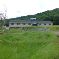
A short walk through the woods on the outskirts of Nancy. No roads to cross. Easy parking next to the forester’s lodge on Route Charlemagne. Take care when setting off again, as the road from the University Hospital towards Chavigny is very busy.

Details

46839100
Creation:
Last update:
Last review:
  • Walking
    Activity: Walking
  • ↔
    Distance: 5.30 mi
  • ◔
    Average duration: 2h 35 
  • ▲
    Difficulty: Easy

  • ⚐
    Back to start: Yes
  • ↗
    Ascent: + 174 ft
  • ↘
    Descent: - 161 ft

  • ▲
    Highest point: 1,355 ft
  • ▼
    Lowest point: 1,198 ft

Photos

Description of the walk

Park next to the Forest Ranger’s House.

(S/E) Take the first path on the right as you leave Route Nanquette, which you will use for the return journey. Continue to the junction with Route Charlemagne.

(1) Turn right and take the first track on the left, between plots 448 and 449. Cross Route Henri Barré and continue to the next track.

(2) Turn left and join the Ligne Historique.

(3) Turn right and follow it to the Carrefour de la Haute Borne.

(4) Turn left onto thefirst Chemin de la Haute Borne.

(5) Take the first track on the right.

(6) When you reach the junction, turn left, then take the second track on the right, heading south-west. Continue until you reach a star-shaped junction.

(7) Turn left to follow Route Charlemagne and head for the Vierge de Chaligny junction.

(8) Turn left, then take the first path on the right, which joins Route Henri Barré, and follow it for 600 m.

(9) Turn right at the second track and you’ll come out onto Route Charlemagne.

(10) Walk about a hundred metres to the left, then turn into the first path on the right. Keep to the right at the next junction and head towards Route Nanquette.

(11) Turn left and head for the car park (S/E).

Waypoints

  1. S/E : mi 0 - alt. 1,253 ft - Maison Forestière car park
  2. 1 : mi 0.82 - alt. 1,227 ft - Route Charlemagne, on the right
  3. 2 : mi 1.46 - alt. 1,198 ft - Junction, on the left
  4. 3 : mi 1.61 - alt. 1,220 ft - Historic Route, on the right
  5. 4 : mi 1.97 - alt. 1,214 ft - A hairpin bend to the left - Carrefour de la Haute Borne (Clairieu)
  6. 5 : mi 2.29 - alt. 1,283 ft - Turn right at the fork
  7. 6 : mi 2.57 - alt. 1,280 ft - Junction: left then right
  8. 7 : mi 2.99 - alt. 1,355 ft - Star junction: take the first track on the left
  9. 8 : mi 3.44 - alt. 1,243 ft - To the left - Vierge de Chaligny (Chaligny)
  10. 9 : mi 3.91 - alt. 1,247 ft - Junction, on the right
  11. 10 : mi 4.19 - alt. 1,270 ft - Route Charlemagne, on the left
  12. 11 : mi 4.67 - alt. 1,280 ft - Route Nanquette, on the left
  13. S/E : mi 5.3 - alt. 1,253 ft - Maison Forestière car park

Reviews and comments

4.3 / 5
Based on 3 reviews

Reliability of the description
4.5 / 5
Ease of following the route
4.3 / 5
Route interest
4 / 5
Christecol
Christecol

Overall rating : 4.5 / 5

Date of your route : Aug 23, 2026
Reliability of the description : Not used / Not applicable
Ease of following the route : ★★★★★ Very good
Route interest : ★★★★☆ Good
Very busy route : No

A pleasant walk with no particular difficulties through a beautiful forest.

Machine-translated

User 29289155

Overall rating : 4.3 / 5

Date of your route : Jun 04, 2026
Reliability of the description : ★★★★★ Very good
Ease of following the route : ★★★★☆ Good
Route interest : ★★★★☆ Good
Very busy route : No

A lovely walk near Nancy. Suitable for everyone. A little shorter (in terms of time) than advertised, but one I’d be very happy to do again.
Under the trees, so lovely when it’s hot

Machine-translated

vge54
vge54

Overall rating : 4 / 5

Date of your route : May 20, 2024
Reliability of the description : ★★★★☆ Good
Ease of following the route : ★★★★☆ Good
Route interest : ★★★★☆ Good
Very busy route : No

There aren’t any particular points of interest, other than a lovely walk in the woods to enjoy what nature has to offer.
Thank you for sharing.

Machine-translated

Other walks in the area

For more walks, use our search engine .

The GPS track and description are the property of this route's author. Please do not copy them without permission.