Country:
 City:
City:


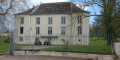
Park at the Armsheim roundabout, in front of the Maison des Associations, in the Orée du Bois housing estate in Fléville-devant-Nancy.
(S/E) Take Rue Beaudelaire, passing the playground and the chapel; continue straight on along the edge of the woods to go up Rue Mozart. At the end of the street, carry on straight for a few metres until you reach a track.
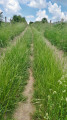
(1) Turn left and enter the woods. After 50 metres, veer right onto a track to pass between two buildings and emerge onto Place de la République. Turn right to cross Rue de Versailles at the pedestrian crossing between the two bus shelters. Then turn left onto a tarmac track running alongside the school.
(2) At the junction with a sandy track (Chemin du Bois Banal), before the barriers, turn right and continue straight on along this track. Cross Rue de la Vanoise and carry on straight ahead. Cross another street and continue through the Résidences du Parc. When you reach Rue de Port Cros, turn right then left to take a path after the last house. Cross over a stream to join a track, then turn right towards Avenue Léon Songeur.
(3) Cross the avenue and continue straight ahead, walking alongside the building. Carry on straight ahead, towards the “Musée du Fer”. At the junction, do not cross the stream but continue alongside it to reach Rue Fonteno. When you reach the start of the street, carry on straight ahead and, at the bend before the bridge over the railway line, take the track on the right to reach Rue du Moulin.
(4) Turn right, then immediately left to go under the railway line. Carry on straight ahead, passing the church on your right. At the junction with Rue de la République, cross the road and continue straight ahead along Rue de Renemont. Take the footbridge to cross over the canal.
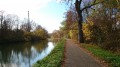
(5) At the end of the footbridge, take the stairs on the left to join the cycle path along the canal. Once on the path, turn right towards lock no. 26, follow it and go under the road bridge. Continue along the path.
(6) After the last building, take an uphill cycle path on the right, then, at the next junction, turn right. At the end of the path, turn right again, then left to reach the roundabout via the car parks. At the roundabout, carry straight on across the car park, then, after the first building, turn left to cross Rue Gabriel Faure.
(7) Once on the pavement, turn right and carry on straight ahead, walking alongside the sports facilities. At the end of the facilities, turn left onto a downhill path to go round the football pitches.
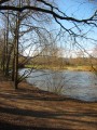
(8) At the northern corner of the pitch, by the lamppost, carry on straight ahead to reach the foot of the dam on the River Meurthe. Join a track, turn right, pass a memorial and continue along the path through the woods to reach the viewpoint overlooking the dam.
(9) Turn back.
(8) At the first street lamp, veer left onto a small path.
(10) Cross over a small concrete weir, then carry on straight ahead. Go over or under the fence and continue straight ahead along the old channel between the Meurthe and the canal to reach the Meurthe.
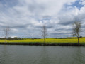
(11) Turn right, follow the riverbank and join a path in the middle of the meadow. At the end of the second pond, reach the bank of the Meurthe to pass through the fence to the right of a metal gate and continue along the track. After 50 metres, turn right onto the track running alongside the fence and continue straight on to reach the canal and the cycle path.
(12) Turn left and carry on towards the bridge. At the start of the bridge, continue along the cycle path by turning right and cross the bridge. At the end of the bridge, follow the cycle path, veering to the right. Then go through the tunnel under the road and carry on straight ahead.
(13) At lock no. 12, turn right to cross over the canal and join the cycle path. Turn left, go under the railway line and continue straight on along the canal. At lock no. 11, cross the road and continue straight on along the canal.
(14) Take the first cycle path leading downhill on the right to join the D71. Cross the road at the pedestrian crossing and join another cycle path. Turn right and carry on straight ahead until you reach the roundabout. Turn left to quickly return to the starting point (S/E).


 Visorando Member
 Easy
Easy