A circular loop through the woods of Pulnoy and Cerville

A short walk to explore the Bois de Cerville and Pulnoy, starting from Saulxures Castle and its surrounding countryside. Cross the unmissable Pulnoy fitness trail and set off to explore the flora and fauna of the mysterious Bois de Cerville. 

Details

n°69776870
Creation:
Last update:
Last review:
  • Walking
    Activity: Walking
  • ↔
    Distance: 3.72 mi
  • ◔
    Average duration: 1h 55 
  • ▲
    Difficulty: Moderate

  • ⚐
    Back to start: Yes
  • ↗
    Ascent: + 282 ft
  • ↘
    Descent: - 279 ft

  • ▲
    Highest point: 1,001 ft
  • ▼
    Lowest point: 728 ft

Description of the walk

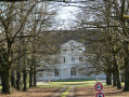
Park near Saulxures Castle.

(S/E) Take the path on the right and follow a completely straight stretch uphill until you reach a power line.

 (1) Turn left at a 90° angle, running parallel to the power line, along a path through the fields, until you reach a building and the gas installation.

(2) Veer right into the clearing, then at the next junction, turn left into the Bois de Cerville. Continue until you reach the power line corridor.

(3) Cross it , then quickly take the first path on the left. Continue along this path, ignoring the paths branching off to the right and left. You’ll reach the junction with the Pulnoy fitness trail.

(4) Turn left onto this trail through the Bois de Saulxutres and continue on almost level ground until you reach the junction with the GR®534.

 (5) Crossthe GR® path; further on, as you leave the forest, you’ll come to a large car park.

 (6) Turn sharply left onto the Chemin du Haut des Vignes and continue until you reach a storage area on the edge of the Chemin Stratégique. 

 (7) Turn right onto this road to return to the car park near the Château (S/E).

Waypoints

  1. S/E : mi 0 - alt. 758 ft - Car park - Château de Saulxures
  2. 1 : mi 0.35 - alt. 728 ft - Power line
  3. 2 : mi 1.2 - alt. 801 ft - Building and gas installation
  4. 3 : mi 1.78 - alt. 869 ft - Passage under the power line
  5. 4 : mi 2.34 - alt. 988 ft - Fitness trail
  6. 5 : mi 2.93 - alt. 932 ft - GR534
  7. 6 : mi 3.23 - alt. 814 ft - Pulnoy Wood car park
  8. 7 : mi 3.39 - alt. 850 ft - Strategic Path
  9. S/E : mi 3.72 - alt. 758 ft - Car park - Château de Saulxures

Notes

Practical advice for the walk

Between (3) and (6). Wildlife is present throughout the area, particularly roe deer, so do remember to take short breaks to observe your surroundings.
(2) Please take care here: the path is often muddy after bad weather and difficult to access in summer, so it is advisable to wear wellies.

Worth a visit

Always be cautious and plan ahead when you're outdoors. Visorando and the author of this route cannot be held responsible for any accidents occurring on this route.

The GR® and PR® markings are the intellectual property of the Fédération Française de Randonnée Pédestre.

Reviews and comments

4 / 5
Based on 2 reviews

Reliability of the description
4.5 / 5
Ease of following the route
4 / 5
Route interest
3.5 / 5
User 752102

Overall rating : 4.3 / 5

Date of your route : Oct 26, 2026
Reliability of the description : ★★★★★ Very good
Ease of following the route : ★★★★☆ Good
Route interest : ★★★★☆ Good
Very busy route : No

A lovely walk with no particular difficulties, and easy to follow thanks to the app!

Machine-translated

User 8122144

Overall rating : 3.7 / 5

Date of your route : Jun 22, 2026
Reliability of the description : ★★★★☆ Good
Ease of following the route : ★★★★☆ Good
Route interest : ★★★☆☆ Average
Very busy route : No

A good stretch of the route is in the shade under the trees, which is lovely. In some places, the path isn’t very clear

Machine-translated

Other walks in the area

For more walks, use our search engine .

The GPS track and description are the property of this route's author. Please do not copy them without permission.