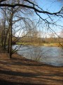
In the Parc de l’Embanie

An easy, short walk with no significant elevation gain, suitable for all seasons in the village of Heillecourt, on the outskirts of Nancy. You can explore the beautiful Parc de l’Embanie; although this route passes through or around residential areas, you remain surrounded by nature as you follow footpaths.

Details

902302
Creation:
Last update:
Last review:
  • Walking
    Activity: Walking
  • ↔
    Distance: 3.56 mi
  • ◔
    Average duration: 1h 40 
  • ▲
    Difficulty: Easy

  • ⚐
    Back to start: Yes
  • ↗
    Ascent: + 69 ft
  • ↘
    Descent: - 72 ft

  • ▲
    Highest point: 801 ft
  • ▼
    Lowest point: 702 ft
  • ⚐ Country: France
  • ⚐ City: Heillecourt (54180)
  • ⚑
    Start/End: N 48.649349° / E 6.194588°
  • ❏
    IGN map(s): Ref. 3315ET
  • Hour-by-hour weather

Photos

Description of the walk

Park in the car park opposite the post office.
(S/E) With your back to the post office and facing the park, follow the tarmac path to the left.

(1) Turn right to enter the park, then immediately left and follow the mill stream on your left. Just before the end, turn right.

(2) Turn right and follow the footpath which crosses or runs alongside residential areas heading south-west. Ignore all side paths.

(3) At the end, go round the houses to follow the edge of the woodland and continue along the path running parallel to the roads.

(4) Turn left and, further on, left again to take a narrow passage between the houses.

(5) Turn right into Rue de Besançon, then left into the cul-de-sac (roundabout), then right into a narrow passage between the houses. Then follow a wide, uphill path heading north-west.

(6) Turn slightly right to go round the pond, then rejoin the path, which is bordered on the left by the Frocourt stream, and return to the starting point on the right (S/E).

Waypoints

  1. S/E : mi 0 - alt. 732 ft - Starting point with car park opposite the post office
  2. 1 : mi 0.12 - alt. 732 ft - Entrance to the park
  3. 2 : mi 0.59 - alt. 702 ft - Footpath on the right
  4. 3 : mi 1.57 - alt. 797 ft - Winding your way round the houses
  5. 4 : mi 2.47 - alt. 751 ft - To the left
  6. 5 : mi 2.65 - alt. 722 ft - On the right, Rue de Besançon
  7. 6 : mi 3.07 - alt. 715 ft - Embanie Pond
  8. S/E : mi 3.56 - alt. 728 ft - Starting point with car park opposite the post office

Reviews and comments

4 / 5
Based on 4 reviews

Reliability of the description
4.3 / 5
Ease of following the route
4.3 / 5
Route interest
3.5 / 5
Genevieve H.
Genevieve H.

Overall rating : 4.7 / 5

Date of your route : Mar 17, 2026
Reliability of the description : ★★★★★ Very good
Ease of following the route : ★★★★★ Very good
Route interest : ★★★★☆ Good
Very busy route : No

A lovely route on the outskirts of town with hardly any tarmac. A variety of paths through and around the park.

Machine-translated

marcheuse54
marcheuse54

Overall rating : 4 / 5

Date of your route : Apr 09, 2024
Reliability of the description : ★★★★☆ Good
Ease of following the route : ★★★★☆ Good
Route interest : ★★★★☆ Good
Very busy route : No

A pleasant route, with no difficulties

Machine-translated

Juliette Courtois
Juliette Courtois

Overall rating : 3.7 / 5

Date of your route : Feb 26, 2023
Reliability of the description : ★★★★☆ Good
Ease of following the route : ★★★★☆ Good
Route interest : ★★★☆☆ Average
Very busy route : No

A pleasant but very easy walk.

Machine-translated

randonneurlamda
randonneurlamda

Overall rating : 3.7 / 5

Date of your route : Mar 12, 2018
Reliability of the description : ★★★★☆ Good
Ease of following the route : ★★★★☆ Good
Route interest : ★★★☆☆ Average

An interesting route, but a bit short.

Machine-translated

Other walks in the area

For more walks, use our search engine .

The GPS track and description are the property of this route's author. Please do not copy them without permission.