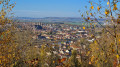
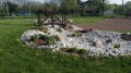
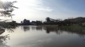
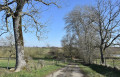
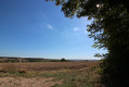
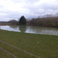
In the land of salt, the salt pans and the hills above Rosières-aux-Salines

This long circular walk, which starts at the Saint-Nicolas-de-Port Leisure Park, takes you along a section of the ballast track of a recently disused SNCF railway line and will first lead you to discover the brackish lagoons between the river and the settling basin.
Thesecond part moves away from the valley and takes you westwards through woods, pastures, orchards and farmland, before leading you back to your starting point along a ridge path.

Details

1949369
Creation:
Last update:
Last review:
  • Walking
    Activity: Walking
  • ↔
    Distance: 12.92 mi
  • ◔
    Average duration: 6h 40 
  • ▲
    Difficulty: Difficult

  • ⚐
    Back to start: Yes
  • ↗
    Ascent: + 827 ft
  • ↘
    Descent: - 830 ft

  • ▲
    Highest point: 994 ft
  • ▼
    Lowest point: 676 ft
  • ⚐ Country: France
  • ⚐ City: Saint-Nicolas-de-Port (54210)
  • ⚑
    Start/End: N 48.624128° / E 6.302266°
  • Accessible from the train station Gare de Dombasle-sur-Meurthe.
  • ❏
    IGN map(s): Ref. 3416E
  • Hour-by-hour weather

Description of the walk

Park at the Leisure Park at the start of Chemin d’Alba in Saint-Nicolas-de-Port, which is on the left after the SNCF viaduct.

(S/E) Follow the Chemin du Viaduc.

(1) Cross the railway line where it is at the same level as the road. Please take care to ensure no train is approaching (2 or 3 trains per week). Take the path running parallel to the track. You will reach a junction of paths.

(2) Continue along the railway line, crossing the Meurthe via the viaduct.

(3) Leave the railway line at the end of the parapet and turn left onto the path below. Follow it until you reach the canal at Dombasle-sur-Meurthe.

(4) Walk alongside it, turning right onto the small road running alongside the canal. Continue to the junction before reaching the D116 county road, which runs above.

(5) Turn right. Keep to the right at all times, between the road and the reservoir. Please note that there is heavy traffic during rush hour.

(6) Head for the right bank of the Meurthe, follow it to reach the access ramp to the viaduct you took earlier.

(3) Return via the path alongside the railway line that you took on the way there, passing the Crayère farm.

(2) Cross the railway line and take the road on the left at the end of the fence surrounding the track. Take the path towards the underpass beneath the A33. Turn left, cross a field and continue uphill alongside the woodland.

(7) Still in the woodland, on the plateau, turn left and head down through the Malmeix woods. Further on, on the left, take the downhill path towards Rosières-aux-Salines.

(8) After the cemetery, turn right and go uphill at the two junctions; turn left twice until you reachthe GRP® Autour de Nancytrail. Follow this path, start climbing after the stream, and exit the Bois du Pont de Pierre. Continue to the entrance of the Bois de la Boulaye at the sign for the Forêt de Rosières-aux-Salines.

(9) Turn right into this woodland and follow the main path (the alternative routes all join up). On leaving the woodland, cross the fields to the path linking the Padoue farm with the Xoudailles farm.

(10) Turn right, then keep to the right at the next junction. Stay on this wide track until you reach the junction with theGRP® Autour de Nancy.

(11) Turn left onto it, following the red and yellow markings. Cross over the A33 motorway. Ignore the first junction on the right and carry on to the second one.

(12) Leave theGRP® and take the path. Turn right shortly afterwards to reach a picnic area. Continue on to rejoin the Chemin du Viaduc. Turn left and follow it back to the leisure ground car park (S/E).


Waypoints

  1. S/E : mi 0 - alt. 696 ft - Car park at the leisure ground
  2. 1 : mi 0.23 - alt. 748 ft - Crossing the railway line
  3. 2 : mi 1.67 - alt. 702 ft - Crossroads near the Crayère farm
  4. 3 : mi 2 - alt. 686 ft - The Meurthe
  5. 4 : mi 2.79 - alt. 689 ft - Canal de la Marne au Rhin
  6. 5 : mi 3.8 - alt. 689 ft - D116 junction
  7. 6 : mi 4.18 - alt. 686 ft - Meurthe (rivière)
  8. 7 : mi 6.07 - alt. 994 ft - Malmeix Wood
  9. 8 : mi 7.06 - alt. 715 ft - Rosières-aux-Salines
  10. 9 : mi 8.75 - alt. 853 ft - Bois de la Boulaye
  11. 10 : mi 9.54 - alt. 758 ft - Chemin Padoue in Xoudaille
  12. 11 : mi 10.61 - alt. 909 ft - GRP Around Nancy
  13. 12 : mi 12.23 - alt. 876 ft - Crossroads leading to the gardens
  14. S/E : mi 12.92 - alt. 696 ft - Car park at the leisure ground

Notes

Drinking water is available inside Rosières Cemetery during opening hours: 8 am – 7 pm from March to September.

Worth a visit

Places to visit in Saint-Nicolas-de-Port:
- the basilica,
- the brewery museum, open daily from 2.30 pm to 6.30 pm.
Things to see in Rosières:
- the National Stud Farm,
- the Ban-Ban (belfry).
Note: for this short detour, it’s best to approach via the cemetery, as this allows you to avoid crossing the very narrow Meurthe bridge, where vehicles scrape past the pavements.

Reviews and comments

4.2 / 5
Based on 3 reviews

Reliability of the description
4.3 / 5
Ease of following the route
4.3 / 5
Route interest
4 / 5
ABat
ABat

Overall rating : 3.7 / 5

Date of your route : Apr 02, 2021
Reliability of the description : ★★★★☆ Good
Ease of following the route : ★★★★☆ Good
Route interest : ★★★☆☆ Average
Very busy route : No

I only did part of the route.
From points 1 to 3, you walk along a ‘vehicle-accessible’ path beside the railway line. It’s pleasant but off-limits: all access points are ‘closed off’ with wire fencing (though you can get round it). From points 3 to 4 and then from 6 back to 3, you walk alongside the meandering Meurthe – it’s really lovely. From points 4 to 5, you walk along the road, which has no pavements, with lorries whizzing past on weekdays. It’s dangerous and very unpleasant. There is a grassy verge alongside, but the saltworks technician who happened to be passing by told us it was private property and off-limits… From 5 to 6, you walk along the cycle path running alongside the road.
I then went from 3 to 2 (the railway line), then from 2 to 7, then to 12 and the finish. That part was lovely, with a really beautiful view.

Machine-translated

mn54710
mn54710

Overall rating : 5 / 5

Date of your route : Sep 27, 2020
Reliability of the description : ★★★★★ Very good
Ease of following the route : ★★★★★ Very good
Route interest : ★★★★★ Very good
Very busy route : No

Hello,
We would need confirmation of authorisation to access the disused railway platform, as announced over a year ago.
Thank you.

Machine-translated

lepere1
lepere1

I’ve only just received the information: this section of the rail network is no longer managed by the SNCF but by SOCORAIL.
One of the company’s regional offices is in Blainville-sur-l’Eau;
I’ll pop round to see if it’s possible to use the section of track bed that’s free of rails
lepere

Machine-translated

Michel JACQUET
Michel JACQUET

Overall rating : 4 / 5

Date of your route : Jun 12, 2019
Reliability of the description : ★★★★☆ Good
Ease of following the route : ★★★★☆ Good
Route interest : ★★★★☆ Good

I thought I knew my local area inside out, but this route – particularly the section that follows the old railway line and crosses the iron bridge at Rosières – is really lovely. It offers some very different views of the river and its meanders. It’s also easy to split this route into three sections to create shorter distances that are more manageable with children. Naturally, I wondered whether we were allowed to use this path running alongside the railway line. We’ll need to clarify this with the SNCF, but the risks are low – certainly much lower than walking along the Rosières road. To be continued.
M Jackson.

Machine-translated

marrinoni
marrinoni

Hello, as a resident living 400 metres away, I can confirm that three or four trains pass by every day where I live, near the tracks.

Machine-translated

lepere1
lepere1

Hello,
Actually, I’m not entirely sure what the situation is regarding the section of disused track (the track no longer physically exists); the rails and sleepers have been removed.
I’ll look into it.
Now, it’s three or four trains a week, not a day.
lepere

Machine-translated

marrinoni
marrinoni

Hello,
Regarding this proposed route, please note that walking along the ballast section of the disused SNCF track is prohibited, and the SNCF police may issue a fine. I have personally been reprimanded for using it; furthermore, it poses a risk when travelling in a group, despite the three or four trains that pass daily.

Machine-translated

Other walks in the area

For more walks, use our search engine .

The GPS track and description are the property of this route's author. Please do not copy them without permission.