Avant-Garde Forest in Pompey – Green Triangle Circular Loop

Walk organised by the FLI Association of Pompey. A fairly easy circular walk, suitable for families, starting from the Avant-Garde fitness trail. Four further circular walks are available as extensions to this one.

Details

70207235
Creation:
Last update:
Last review:
  • Walking
    Activity: Walking
  • ↔
    Distance: 4.26 mi
  • ◔
    Average duration: 2h 10 
  • ▲
    Difficulty: Easy

  • ⚐
    Back to start: Yes
  • ↗
    Ascent: + 246 ft
  • ↘
    Descent: - 249 ft

  • ▲
    Highest point: 1,171 ft
  • ▼
    Lowest point: 978 ft
  • ⚐ Country: France
  • ⚐ City: Pompey (54340)
  • ⚑
    Start/End: N 48.7675° / E 6.110782°
  • ❏
    IGN map(s): Ref. 3315ET
  • Hour-by-hour weather

Photos

Description of the walk

Start from the beginning of the fitness trail. 

(S/E) Head straight ahead, following the blue/yellow/green Triangle markings . Continue to the gate at the end of the fitness trail.

(1)Go straight on until you reach a Fork in the road.

(2) Turn right, following the blue/yellow/green triangular markers . Then keep to the left until you reach a hunting lodge.

(3) Carry on along the path. Go straight on, then take a sharp left-hand bend until you reach the Chemin de Procession.

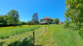
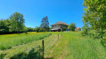
(4) Follow the Green Triangle to the right (do not follow the other triangles which go straight on). Take a slight right-hand bend and you’ll reach the Ferme du Haras: admire the architecture.

(5) Carry on, passing the forest track to reach a small path on the right (marked with a Green Triangle).

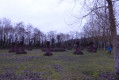
(6) Turn right and carry on straight ahead until you begin a descent leading to a memorial stone.

(7) At the bottom of the descent, go straight on, across the picnic area, following the Blue Triangle, Yellow Triangle, and Green Triangle, until you reach the car park (S/E).

Waypoints

  1. S/E : mi 0 - alt. 997 ft - Start of the fitness trail
  2. 1 : mi 0.58 - alt. 1,070 ft - Barrier at the end of the fitness trail
  3. 2 : mi 1.2 - alt. 1,079 ft - Junction
  4. 3 : mi 1.51 - alt. 991 ft - Hunting lodge
  5. 4 : mi 1.94 - alt. 1,066 ft - Procession Path
  6. 5 : mi 2.42 - alt. 1,142 ft - Ferme du Haras
  7. 6 : mi 2.82 - alt. 1,158 ft - Junction with footpath
  8. 7 : mi 4.07 - alt. 1,037 ft - American soldier memorial
  9. S/E : mi 4.26 - alt. 997 ft - Start of the fitness trail

Notes

Parking in the car park shared by the fitness trail and the treetop adventure course

Signpost showing the various routes marked out by the association: 

  • Green Triangle: 7 km
  • Green Triangle + White Cross: 9 km
  • Yellow Triangle: 12 km
  • Blue Triangle: 16 km
  • Blue Triangle + White Cross: 21 km

QR code to download the route map

Dry toilets at the Avant-Garde site

Worth a visit

Tree-top adventure course

Reviews and comments

4.7 / 5
Based on 2 reviews

Reliability of the description
5 / 5
Ease of following the route
5 / 5
Route interest
4 / 5
User 22691078

Overall rating : 4.7 / 5

Date of your route : Jun 20, 2026
Reliability of the description : ★★★★★ Very good
Ease of following the route : ★★★★★ Very good
Route interest : ★★★★☆ Good
Very busy route : No

The walk is mainly through woodland, except for about 1 km in the middle of the route. In very hot weather, make sure you bring plenty of water, as it gets very hot along this stretch.

Machine-translated

User 2063380

Overall rating : 5 / 5

Date of your route : Aug 06, 2025
Reliability of the description : ★★★★★ Very good
Ease of following the route : ★★★★★ Very good
Route interest : Not used / Not applicable
Very busy route : Yes

nice little walk in the forest

Machine-translated

Other walks in the area

For more walks, use our search engine .

The GPS track and description are the property of this route's author. Please do not copy them without permission.