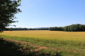
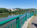
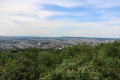
The circular bends in the Moselle between Champigneulles and Frouard

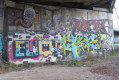
Setting off from Champigneulles, a circular route that follows the Meurthe for its final few kilometres to see where the Moselle and the Meurthe meet at Frouard. Return via the Marne–Rhine Canal, passing by the beautiful graffiti under the Bow String Bridge at Frouard.

Details

n°1658644
Creation:
Last update:
Last review:
  • Walking
    Activity: Walking
  • ↔
    Distance: 8.88 mi
  • ◔
    Average duration: 4h 05 
  • ▲
    Difficulty: Average

  • ⚐
    Back to start: Yes
  • ↗
    Ascent: + 36 ft
  • ↘
    Descent: - 36 ft

  • ▲
    Highest point: 663 ft
  • ▼
    Lowest point: 614 ft
  • ⚐ Country: France
  • ⚐ City: Champigneulles (54250)
  • ⚑
    Start/End: N 48.745845° / E 6.164596°
  • Accessible from the train station Gare de Champigneulles.
  • ❏
    IGN map(s): Ref. 3315ET
  • Hour-by-hour weather

Photos

Description of the walk

The start of the walk is just below the Bouxières Bridge in Champigneulles.
By car, take the Bouxières Bridge towards Champigneulles. At the roundabout, turn right onto Rue de La Pompure, then take the fire brigade access road on the right between the first two buildings to reach a car park by the River Meurthe.

(S/E) Set off along the cycle path towards Frouard, i.e. with your back to the bridge. Go under the motorway and follow a circular route to end up under the motorway again.

(1) Take the cycle path on the right towards Pompey and carry on straight ahead, passing under two high-voltage power lines.

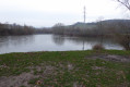
(2) At the bend in the cycle path, carry on straight ahead along the dirt track to see the confluence of the Moselle and the Meurthe.

(3) At the confluence, continue along the dirt track beside the Moselle, signposted ‘Énergie initiation à la découverte’. Pass the pumping station, then go under the Bow String bridge – taking in the numerous graffiti tags – and then under another road bridge.

(4) After the bridge, take the track on the left to join the Chaussée du Ban de la Dame, cross the road and turn right.

Carry on straight ahead through the green spaces, go round both roundabouts on the left and continue straight on alongside the D40E.

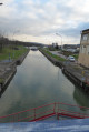
(5) At the roundabout, turn right to cross over the canal opposite the Frouard-Clévant lock. At the end of the bridge, turn left and take the dirt track alongside the canal signposted ‘Metz/Nancy’. Pass under the railway line and follow the canal past lock No. 27.

(6) At the end of the basin, continue along the canal to the left and join Rue de la Gare. Turn left to cross over the canal and, at the end of the bridge, turn right and then right again to join the path along the canal banks.

(7) Turn left. Carry on straight ahead along the canal, go under the motorway and join Rue Gazbriel Bour before the bridge.

(8) Turn left and go under the railway line. After the tunnel, turn right onto Quai Haute Rive and head towards the River Meurthe.

(9) Turn left, take the cycle path and cycle past the breweries in Champigneulles. Pass the cycle bridge and continue straight on to reach the car park (S/E).


Waypoints

  1. S/E : mi 0 - alt. 627 ft - Bouxières Bridge - Meurthe (rivière)
  2. 1 : mi 0.68 - alt. 633 ft - Under the motorway
  3. 2 : mi 2.96 - alt. 614 ft - Straight on at the bend
  4. 3 : mi 3.16 - alt. 617 ft - Point of - Confluence Moselle-Meurthe
  5. 4 : mi 3.6 - alt. 627 ft - Path on the left - Moselle (la)
  6. 5 : mi 4.58 - alt. 633 ft - The roundabout at the Frouard Clévant lock
  7. 6 : mi 5.17 - alt. 653 ft - At the end of the basin
  8. 7 : mi 5.39 - alt. 650 ft - Path along the canal - Canal de la Marne au Rhin
  9. 8 : mi 7.26 - alt. 653 ft - Rue Gabriel Bour
  10. 9 : mi 7.47 - alt. 640 ft - The banks of the Meurthe
  11. S/E : mi 8.88 - alt. 627 ft - Bouxières Bridge

Worth a visit

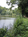
The Meurthe in its final few kilometres.
The confluence of the Moselle and the Meurthe.
The graffiti under the Bow String Bridge.
The large-capacity lock at Frouard Clévant.
The start of the Marne–Rhine Canal and the port of Frouard.
The Champigneulles Breweries.

Reviews and comments

3.7 / 5
Based on 3 reviews

Reliability of the description
3.7 / 5
Ease of following the route
4.3 / 5
Route interest
3 / 5
franchie
franchie

Overall rating : 4.7 / 5

Date of your route : Apr 25, 2021
Reliability of the description : ★★★★★ Very good
Ease of following the route : ★★★★★ Very good
Route interest : ★★★★☆ Good
Very busy route : Yes

I’d done this walk at Christmas 2018, and doing it again on a lovely, sunny Sunday in April makes quite a difference: the cycle paths were a bit crowded, and some cyclists clearly weren’t too keen on sharing their path with pedestrians. The graffiti under the bridges had changed, though it was still done with great skill and humour.

I noticed that you can carry on along the cycle path for a further 100 metres (point 4), which means you don’t end up on the Ban de la Dame road too quickly – which, it’s true, isn’t very pleasant (comment by Mamaude).

Machine-translated

mamaude
mamaude

Overall rating : 2 / 5

Date of your route : Dec 16, 2020
Reliability of the description : ★★☆☆☆ Disappointing
Ease of following the route : ★★★☆☆ Average
Route interest : ★☆☆☆☆ Very disappointing
Very busy route : No

Hello. If you like the noise of the motorway, walking along the road with cars whizzing past, and navigating roundabouts without pavements (extremely dangerous). Go on, then. As for walkers, give it a miss. Apart from the street art under the bridge: NOTHING. Clearly done by a cyclist who thought that by changing the duration it would be suitable for walkers. If I had to give it a mark, being generous: 2 out of 10. And to come all the way from Metz for that!

Machine-translated

franchie
franchie

Overall rating : 4.3 / 5

Date of your route : Dec 25, 2018
Reliability of the description : ★★★★☆ Good
Ease of following the route : ★★★★★ Very good
Route interest : ★★★★☆ Good

A lovely solo walk on a sunny Christmas Day, with perhaps a few too many stretches along the roads, but it’s hard to avoid that. Beautiful contrasts between the landscapes and aquatic wildlife, and the street art under the bridges.

Machine-translated

Other walks in the area

For more walks, use our search engine .

The GPS track and description are the property of this route's author. Please do not copy them without permission.