From Seichamps to the Lenoncourt State Forest

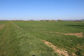
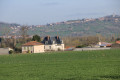
A short walk offering varied scenery, starting from the Seichamps sports complex. It is surprising in the way it offers access to a wide variety of natural environments (countryside, forests, etc.) right on the doorstep of the Greater Nancy metropolitan area. There are some lovely views, particularly of the Malzéville plateau. You’ll also get to see part of the Cerville underground gas storage facility.

Details

6855686
Creation:
Last update:
Last review:
  • Walking
    Activity: Walking
  • ↔
    Distance: 6.95 mi
  • ◔
    Average duration: 3h 25 
  • ▲
    Difficulty: Moderate

  • ⚐
    Back to start: Yes
  • ↗
    Ascent: + 282 ft
  • ↘
    Descent: - 256 ft

  • ▲
    Highest point: 997 ft
  • ▼
    Lowest point: 797 ft

Photos

Description of the walk

(S/E) Leave the car park at the Seichamps sports complex, heading south to go round the stadium. Take the path heading south-east which runs alongside the sports facilities and is blocked by a wooden gate.

(1) At the corner of the sports ground, take the path branching off to the left uphill, which runs alongside the sports complex towards the north-east. At the north-eastern corner, turn right and then immediately left onto a gently ascending path that runs alongside a housing estate on the left some distance away. Continue to the T-junction at the top of the climb.

(2) Turn right towards the south-east onto a good path that runs alongside a double high-voltage power line on your left. The path is almost flat. Further on, it veers slightly to the left and becomes a grassy track, with the Venchère area on your right. Carry on straight ahead, even when the path crosses a large meadow. Just as the path passes under thefirst high-voltage power line, it reaches a four-way junction.

Take the path on the right, which descends towards the D83 road and eventually becomes tarmac.
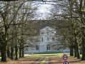
When you reach the D83 road, cross it carefully and follow it to the right, walking along the fairly wide grassy verge (an area ‘protected’ by a dotted line marking at the roadside). Pass the beautiful Arbois estate on your left.

(3) Immediately after this property, turn left onto the narrow path that heads straight south into the woods (hiking signposts at the start of the path). Shortly afterwards, the path runs alongside one of the clearings on the Pulnoy golf course (on your right).

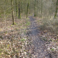
The path begins to climb the hillside where the Bois de Pulnoy is situated. Take thefirst path on the right, which passes above several clearings of the golf course below, on your right. The path is now almost level and follows the hillside south-westwards through the Bois de Pulnoy.
Carry straight on until you reach a crossroads where four paths meet in an X-shape, including theGR®534– GRP®. Here you’ll find a wooden bench at the start of a path leading down towards the Coteaux neighbourhood on your right.

(4) Cross the junction and follow the path opposite towards the south-west. A few dozen metres further on, at the next T-junction, take the path on the left and join the wide Haut des Vignes path coming from Saulxures-les-Nancy.
Cross it and continue straight ahead along a good, flat path on the hillside (be careful not to take the Chemin des Hauts des Vignes uphill towards the top of the hill). See Practical Information.

Follow this path straight on; it largely follows the fitness route and a botanical route.
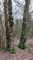
A little further on, turn right towards the Caromel Site to see a remarkable oak tree (signpost – see the ‘During the walk’ section). Less than a hundred metres on, as the path curves to the right, it reaches the foot of the oak tree, where there is an information board.

(5) Return to the main path you were on and follow it to the right. At the next junction, turn left and join the beautiful forest lane along the ridge of the hillside, where theGR®534GRP® runs.

(6) Follow theGR®534to the right towards the Lenoncourt State Forest. Continue straight on along the path, which eventually descends and exits the forest. The path passes under a high-voltage power line. At the next junction, continue straight on along the path known as “Sur les Troyes” towards the D83 road. Right from the start, the path passes under a very high-voltage power line.

(7) Cross the D83 road with care and continue straight ahead along the small tarmac road that crosses the underground gas storage area. On your left, set slightly back from the path, is the Laneuvelotte compression station.
The path climbs a small hill, at the top of which, on your left, is a water reservoir for the site’s safety. Carry on straight ahead to the T-junction with a small road at a place called Le Cerisier.

(8) Turn left and carefully follow the road as it descends gently down the hill towards the hamlet of Voitincourt. There is a beautiful house on your right as you arrive there. The road curves in an S-shape.

(9) At the second bend in the S-bend, turn left onto the path known as the ‘sentier du cendrier’, heading west. At the next junction, first turn right then left to cross the area known as ‘l’Abreuvoir’ and arrive at a T-junction with two high-voltage power lines in the background.

(10) Turn right onto a well-maintained track which runs alongside the high-voltage power lines on your left and joins a small road.

(11) Turn left and follow the road carefully. Pass under the high-voltage power lines and enter Seichamps, walking alongside a small housing estate on your right.
Continue to the junction with Avenue de la Vanoise on the left (shortly after Chemin des Vias, also on the left). Turn left onto Avenue de la Vanoise. Follow it to the junction with Rue de l’Aubisque on the left.

(12) Turn left onto Rue de l’Aubisque, then turn right onto Rue du Tourmalet,the first right. Follow it to the junction with Rue des Ensances. There, head left towards the nearby car park, which marks the end of this route (S/E).

Waypoints

  1. S/E : mi 0 - alt. 801 ft - Car park near the sports facilities
  2. 1 : mi 0.11 - alt. 801 ft - Chemin des Ensances junction
  3. 2 : mi 0.5 - alt. 866 ft - Junction of Chemin Jean Bailly and Chemin des Vias
  4. 3 : mi 1.59 - alt. 797 ft - Junction with the D83 road
  5. 4 : mi 2.66 - alt. 922 ft - Junction with the GR534-GRP
  6. 5 : mi 3.37 - alt. 988 ft - Caromel site – Remarkable oak tree
  7. 6 : mi 3.48 - alt. 988 ft - Junction of the fitness trail – GR534–GRP
  8. 7 : mi 4.28 - alt. 896 ft - Junction of the footpath and the D83 road
  9. 8 : mi 4.8 - alt. 948 ft - T-junction
  10. 9 : mi 5.51 - alt. 827 ft - Junction with the Laneuvelotte road
  11. 10 : mi 5.96 - alt. 856 ft - T-junction
  12. 11 : mi 6.39 - alt. 869 ft - Junction of the footpath and the Voirincourt road
  13. 12 : mi 6.74 - alt. 827 ft - Junction of Avenue de la Vanoise and Rue de l’Aubisque
  14. S/E : mi 6.95 - alt. 801 ft - Car park near the sports facilities

Notes

The car park is located near the sports facilities in Seichamps, close to the junction of Rue des Ensanges and Rue du Tourmalet.

This walk across varied terrain requires suitable footwear.

(4) Editor’s note: on the day the route was recce’d, a sign put up by the forest rangers informed walkers of the presence of processionary caterpillars in the Bois de Saulxures area, which the route will pass through.

This route should be regarded as unmarked as it occasionally follows sections of several different routes. It does not present any real difficulties. Consequently, it is advisable to follow the directions in this description and on the map, whilst also paying attention to the surrounding landscape. Distance markers from the starting point, or even the GPS coordinates of waypoints (including the start), may also help hikers to find their way.

Hike completed by the author on 2 April 2021

Worth a visit

Seichamps
Primarily a farming village with a population of 300 until the late 1950s, Seichamps experienced rapid growth thanks to the development of detached housing estates. In 2011, it entered a new phase of expansion with the creation of a new housing estate, which will eventually see the construction of around 500 homes to the east of the town. This development was accompanied by a redevelopment of the town centre in 2012.

Civil buildings
15th-century remains on a few houses in the church district.
Roussel Garden: an orchard at the end of the Route de Varinchamps, which regularly welcomes nursery school pupils for educational outings to learn about gardening, fruit identification and ecology.
The Martinchamps sports complex, featuring tennis, badminton, football, rugby and archery facilities.
.
Religious buildings
Saint-Lambert’s Church, dating from the 19th century, housing three relics, including a fragment of the Holy Cross.
A 16th-centurypresbytery, rebuilt in 1982. The new presbytery incorporates elements of the original building.
Source: Wikipedia (excerpts)

La Forêt (Saulxures-les-Nancy)
The forest covers around 200 hectares, half of which is municipal land.
Within this forest, several ancient oaks – including a remarkable sessile oak over 300 years old – are preserved and showcased at the ‘Pierre Caromel’ site, situated on the edge of the Pulnoy fitness trail.
A gigantic oak tree that first took root in the 18th century and has withstood both natural threats (storms, ravenous animals, etc.) and man-made ones (loggers, wars, etc.) to reach a height of 33 metres at the far end of the majestic clearing.
After the tree survived the storm of 1999, a farmer from Saulxures, Pierre Caromel, decided to showcase it through this site.
He passed away in 2003, but the oak is still there, watching over a new generation and, no doubt, wondering what on earth these strange people are doing circling round it with their GPS devices…
Height 33 m – Circumference 4.15 m at 1.30 m above ground level – Diameter 1.32 m at 1.30 m above ground level.
Source: official website of the commune of Saulxures-les-Nancy and the ‘Le Roi de la Forêt’ geocaching site

Always be cautious and plan ahead when you're outdoors. Visorando and the author of this route cannot be held responsible for any accidents occurring on this route.

The GR® and PR® markings are the intellectual property of the Fédération Française de Randonnée Pédestre.

Reviews and comments

4.3 / 5
Based on 2 reviews

Reliability of the description
4.5 / 5
Ease of following the route
4.5 / 5
Route interest
4 / 5
morlockbob
morlockbob

Overall rating : 3.7 / 5

Date of your route : Mar 11, 2024
Reliability of the description : ★★★★☆ Good
Ease of following the route : ★★★★☆ Good
Route interest : ★★★☆☆ Average
Very busy route : No

A stroll for a Sunday afternoon when you don’t fancy doing anything too strenuous. A chance to explore a part of the forest I hadn’t been to before. Nothing too exciting, but nothing unpleasant either
Not too far away, there are routes towards Blanzey or Amance which I find more interesting.
But thanks for the route.

Machine-translated

Na54Fle71
Na54Fle71

Overall rating : 5 / 5

Date of your route : May 03, 2021
Reliability of the description : ★★★★★ Very good
Ease of following the route : ★★★★★ Very good
Route interest : ★★★★★ Very good
Very busy route : No

A very varied route through woodland and countryside, with points of interest to see (a 300-year-old tree, industrial underground gas storage facilities).

Machine-translated

Other walks in the area

For more walks, use our search engine .

The GPS track and description are the property of this route's author. Please do not copy them without permission.