Champigneulles Ponds

This short walk follows the main valley of the Forêt de Haye plateau, from the protected marshland to the Étang des Brasseries. Fed by the springs of Champigneulles, the two bodies of water have given the site its name: Belle Fontaine.

Details

102436937
Creation:
Last update:
Last review:
  • Walking
    Activity: Walking
  • ↔
    Distance: 3.34 mi
  • ◔
    Average duration: 1h 35 
  • ▲
    Difficulty: Easy

  • ⚐
    Back to start: Yes
  • ↗
    Ascent: + 75 ft
  • ↘
    Descent: - 79 ft

  • ▲
    Highest point: 797 ft
  • ▼
    Lowest point: 709 ft

Description of the walk

Park in the car park near the lake formed by the Ruisseau des Étangs de Champigneulles.

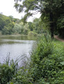
(S/E) Take the path through the Sensitive Natural Area and follow it until you reach the end of the pond.

(1) Take a narrower path that veers off to the right into a woodland of shrubs, walk past the Forest Ranger’s House, then come to another path junction.

(2) Carry on straight ahead, then follow a road to reach the Belle Fontaine Pond embankment.

(3) Walk up the embankment; after climbing a few metres, you’ll reach a new forest path with a view of the pond; continue to the far end of the pond.

(4) Walk alongside the fencing of a water extraction area. The path leads onto a short tarmac section before rejoining the dyke you passed earlier.

(3) Take the path opposite to return via the junction of the path you took on the way there.

(2) Turn right into the woodland to return to the original junction.

(1) Take the path opposite, heading in the opposite direction to your outward journey, to return to the Étangs de Champigneulles car park (S/E).

Waypoints

  1. S/E : mi 0 - alt. 722 ft - Étangs de Champigneulles car park
  2. 1 : mi 0.28 - alt. 712 ft - Crossroads of the circular loop
  3. 2 : mi 0.69 - alt. 725 ft - Forest Ranger’s House Trail
  4. 3 : mi 1.04 - alt. 738 ft - Dike
  5. 4 : mi 1.71 - alt. 738 ft - Étang des Brasseries
  6. S/E : mi 3.34 - alt. 722 ft - Étangs de Champigneulles car park

Notes

The area also has a long history of forestry: following Charles X’s decree of 26 August 1824 establishing France’s first royal forestry school, a forester’s house and its arboretum were built there, though these are now closed to the public. In 1902, water from the plateau was used to feed fish-farming ponds, some of which still exist. The Étang des Brasseries evokes another major part of local history: the Champigneulles brewery, founded on 20 June 1897.
The site is a departmental Sensitive Natural Area covering approximately 346 ha, where nearly 1,500 species have been recorded.

Worth a visit

Other walks in the area

For more walks, use our search engine .

The GPS track and description are the property of this route's author. Please do not copy them without permission.