


jacques.nys

 Visorando Member
 Premium user
 - Location: Gembloux
- Gender: man
- Website: https://les-balades-de-papyness-et-mamyness.be
Sign up:
Published route(s)
 On the roof of Belgium
 10.53 mi
 +499 ft
 -512 ft
 5h 15
5h 15
 Average
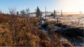
 Departure from Baelen (Province de Liège)
This hike on the Hautes Fagnes plateau in the Hautes-Fagnes-Eifel Natural Park will take you to the highest point in Belgium, where you can discover its unique flora and landscape. The hike is more enjoyable during the week (fewer people) in good weather or when there is snow on the ground.
Sart-Custinne, its forests and the Houille valley
 10.59 mi
+1,083 ft
-1,083 ft
5h 50
10.59 mi
+1,083 ft
-1,083 ft
5h 50
 Difficult
Departure from Gedinne (Province de Namur)
Difficult
Departure from Gedinne (Province de Namur)
A circular walk starting from Sart-Custinne through the forests and along the streams of Gedinne. A magnificent walk for lovers of (almost) untouched nature.
A difficult hike, not because of its length, gradient or terrain, but because of its route and the lack of visible landmarks in the forest.
Around Leffe Abbey
 9.41 mi
+1,076 ft
-1,060 ft
5h 15
Average
Departure from Dinant (Province de Namur)
9.41 mi
+1,076 ft
-1,060 ft
5h 15
Average
Departure from Dinant (Province de Namur)
Who doesn't know the Belgian beer called 'Leffe'?
This walk will introduce you not to this excellent range of Belgian beers, but to the wooded and rural surroundings of the abbey on the banks of the Meuse, where it was originally brewed.
From Ternell to the Walloon Fagne – La Helle
 14.07 mi
+1,286 ft
-1,296 ft
7h 35
Difficult
Departure from Eupen (Province de Liège)
14.07 mi
+1,286 ft
-1,296 ft
7h 35
Difficult
Departure from Eupen (Province de Liège)
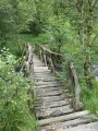
Discover one of Belgium’s wildest rivers, the Helle (Hill in German), starting from the old forest house at Ternell, and the Hautes-Fagnes where it rises. A long nature walk over varied terrain: forest paths (deciduous and spruce), dry and wet grassy paths and tracks, boardwalks (over very marshy ground), stony paths, tarmac paths.
In the land of Toine Culot
 9.11 mi
+1,109 ft
-1,086 ft
5h 10
Average
Departure from Viroinval (Province de Namur)
9.11 mi
+1,109 ft
-1,086 ft
5h 10
Average
Departure from Viroinval (Province de Namur)
A lovely circular walk in the land of Toine Culot, the mayor of Trignolles (Treignes). A chance to discover Arthur Masson’s fictionalised version of the Toinade at the Espace Arthur Masson. An international hike… as it ventures about 400 metres into French territory.
Soulme and the Hermeton valley
 10.23 mi
+758 ft
-761 ft
5h 20
Average
Departure from Doische (Province de Namur)
10.23 mi
+758 ft
-761 ft
5h 20
Average
Departure from Doische (Province de Namur)
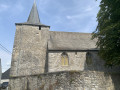
A circular walk exploring the water resources of the Hermeton between Vodelée and Soulme, as well as three listed sites: the Notre-Dame de Bonne Fontaine Chapel, the Moulin de Soulme and the Sainte-Colombe Church in Soulme.Updated May 2026 following various comments:(7) the footbridge near Moulin Bayot is now closed to the public. You must continue straight on to the road and turn right twice to rejoin the original route at Moulin Bayot. Bonus: you pass by the Hermeton waterfall, which is magnificent in frosty weather.(16) Pass the turnstile and follow the river closely... the footpath is still very much public despite the ‘private property’ sign.(19) Take the road to the right and return to the starting point. The path that used to run between the gardens has been removed.
Cross-border walk to Lake Val Joly
 14.05 mi
+856 ft
-856 ft
7h 10
Average
Departure from Sivry-Rance (Hainaut)
14.05 mi
+856 ft
-856 ft
7h 10
Average
Departure from Sivry-Rance (Hainaut)
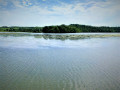
Long hike starting from Sautin in the municipality of Sivry-Rance, through the Bois de Bruyère towards Lac du Val Joly, in the French municipality of Eppe-Sauvage, partly following the Transylvestre andGR®®125Tour de l'Entre-Sambre-et-Meuse trails. Wooded and rural, the route alternates between forest trails, country lanes and local roads.
In the Land of Walkers in Thy-le-Château
 10.82 mi
+502 ft
-512 ft
5h 25
Average
Departure from Walcourt (Province de Namur)
10.82 mi
+502 ft
-512 ft
5h 25
Average
Departure from Walcourt (Province de Namur)
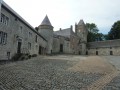
A beautiful circular walk starting from Thy-le-Château to discover a little of the region's industrial past as well as its natural (countryside and forests) and human (castles, churches, chapels) treasures.
Along the way, you will have the opportunity to discover the Marches de l'Entre-Sambre-et-Meuse.
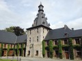
From Bioul to Saint-Gérard: a few castles and an old abbey
 9.36 mi
+509 ft
-499 ft
4h 45
Average
Departure from Anhée (Province de Namur)
9.36 mi
+509 ft
-499 ft
4h 45
Average
Departure from Anhée (Province de Namur)
Discovering several castles and an ancient abbey, this circular walk between Bioul and Saint-Gérard runs alongside the Neffe woods and crosses beautiful countryside. The Château de Bioul, a wine-growing estate, is well worth a visit.
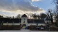
Orne, countryside and castles around a stream in Walloon Brabant
 8.25 mi
+407 ft
-417 ft
4h 10
Average
Departure from Chastre (Brabant Wallon)
8.25 mi
+407 ft
-417 ft
4h 10
Average
Departure from Chastre (Brabant Wallon)
A rural hike in Walloon Brabant, discovering a few villages crossed by the Orne and its tributaries.
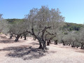
The Crêtes de Cruzières
 6.41 mi
+863 ft
-869 ft
3h 40
Average
Departure from Saint-André-de-Cruzières (Ardèche)
6.41 mi
+863 ft
-869 ft
3h 40
Average
Departure from Saint-André-de-Cruzières (Ardèche)
Vineyards and olive groves at the foot of the Montagne de la Serre and Serre de Cruzières. Panoramic view of the Barjac plain and the Cévennes.
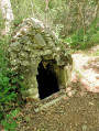
La Dent du Serret
 5.92 mi
+899 ft
-889 ft
3h 30
Average
Departure from Montclus (Gard) (Gard)
5.92 mi
+899 ft
-889 ft
3h 30
Average
Departure from Montclus (Gard) (Gard)
A medieval gem offering beautiful views of the meanders of the Cèze river on a walk that is shorter than its namesake, the 'Circuit de la Dent du Serret'.
Heathland, chestnut trees and old drovers' roads in Bonnevaux
 7.19 mi
+1,693 ft
-1,683 ft
4h 45
Difficult
Departure from Bonnevaux (Gard) (Gard)
7.19 mi
+1,693 ft
-1,683 ft
4h 45
Difficult
Departure from Bonnevaux (Gard) (Gard)
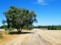
Set off to explore ancient drovers' roads (transhumance routes for herds) across arid, windswept plateaus. Chestnut trees (almost) everywhere, broom a little higher up, and then high-altitude moorland covered in heather and pine trees – that’s what this hike has in store! As well as magnificent views of the surrounding countryside. There are also quite a few stones on the ascents (up to the junction with theGRP® 4) and descents – take particular care between (8) and (9).
Broadway Tower
 4.22 mi
+735 ft
-735 ft
2h 35
4.22 mi
+735 ft
-735 ft
2h 35
 Easy
Departure from Broadway (Worcestershire)
Easy
Departure from Broadway (Worcestershire)
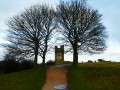
Broadway and its highest tower castle in the Cotswolds is ideally located for exploring this hilly region of the English countryside and a part of the Cotswold Way (National Trail 164km running north-to-south).
In good weather, the top of Broadway Tower offers a 360° view, especially of the Welsh landscape to the west.
Cotswolds - Hailes Abbey
 4.84 mi
+600 ft
-577 ft
2h 45
Easy
Departure from Stanway (Gloucestershire)
4.84 mi
+600 ft
-577 ft
2h 45
Easy
Departure from Stanway (Gloucestershire)
A walk in the heart of the Cotswolds, its countryside, its hills and its woods from the ruins of Hailes Abbey, taken over from the National Trust. This circuit takes part of the Cotswolds Way, a hiking trail that crosses the Cotswolds from North to South for 164 km (from Chipping Campden to Bath).
Alternative route around the Wiesensteig
 9.54 mi
+2,080 ft
-2,093 ft
6h 10
Average
Departure from Bad Peterstal-Griesbach (Regierungsbezirk Freiburg)
9.54 mi
+2,080 ft
-2,093 ft
6h 10
Average
Departure from Bad Peterstal-Griesbach (Regierungsbezirk Freiburg)
A hike alternating between forests and sloping pastures in the typical Black Forest landscape, with lovely green valleys and babbling brooks.
More accessible all year round from the Dollenberg car park (accessible via the B28 road), this alternative route is slightly longer than the official 13.4 km ‘Wiesensteig’ route recommended by the Bad Peterstal Griesbach Tourist Office.
Sauvenière and its countryside
 9.02 mi
+82 ft
-72 ft
4h 15
Average
Departure from Gembloux (Province de Namur)
9.02 mi
+82 ft
-72 ft
4h 15
Average
Departure from Gembloux (Province de Namur)
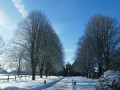
A countryside walk with not too much elevation gain, ideal for stretching your legs in any season, but which can also be done in winter.You’re unlikely to come across many people, apart from a few rabbits hopping about (in the distance) in the middle of the fields: it’s much easier to spot them on the snow than when they blend into the ground or hide amongst the vegetation.
Circular from Reichenstein to the Schwarzbach pond via Kreuz im Venn
 8.24 mi
+774 ft
-787 ft
4h 30
Average
Departure from Belgium
8.24 mi
+774 ft
-787 ft
4h 30
Average
Departure from Belgium
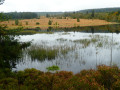
This cross-border walk on the border between the Hautes Fagnes and Germany between Montjoie (Monschau) and Sourbrodt (Waimes) starts on the RAVeL (Belgian enclave of the Vennbahn) at the former Reichenstein stop near the Reichenstein Convent (Kloster) on the road between Mützenich and Kalterherberg.Discover this pure joy away from the tourist crowds in the Hautes Fagnes.
Chapels and old mills starting from Oizy
 7.75 mi
+994 ft
-994 ft
4h 25
Average
Departure from Bièvre (Province de Namur)
7.75 mi
+994 ft
-994 ft
4h 25
Average
Departure from Bièvre (Province de Namur)
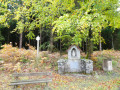
This circular walk, starting from the Oizy Chapel, takes you through the woods to discover fishing ponds, chapels and old mills.The return route takes you through the countryside and areas of intensive Christmas tree plantations.A superb walk to enjoy in autumn, when the trees change colour at different rates and mushrooms abound in the undergrowth.Unfortunately, the Mitauge Mill isn’t very visible… hidden by vegetation on either side.A key site of the Resistance during the Second World War, the Gros-Fays Mill is much better showcased.
Countryside and forests around Ourt
 7.00 mi
+525 ft
-509 ft
3h 40
Average
Departure from Libramont-Chevigny (Province de Luxembourg)
7.00 mi
+525 ft
-509 ft
3h 40
Average
Departure from Libramont-Chevigny (Province de Luxembourg)
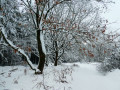
Set off to explore the native region of the Western Ourthe. This rural walk is offered as a short version of the long, signposted “Voie Saint-Antoine” route.A blanket of snow and overcast skies were the conditions for this hike undertaken on 1 January 2021.Much enjoyed... and also much appreciated that it wasn’t any longer, as making our way through 30 to 40 cm of snow to clear certain paths isn’t as easy as it looks: wet feet and trousers up to the knees, despite suitable kit, didn’t discourage us.Definitely one to repeat in other seasons and under different weather conditions.
Burnontige and Les Arsins
 9.29 mi
+1,050 ft
-1,076 ft
5h 10
Average
Departure from Ferrières (Belgique) (Province de Liège)
9.29 mi
+1,050 ft
-1,076 ft
5h 10
Average
Departure from Ferrières (Belgique) (Province de Liège)
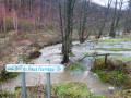
This long circular walk, centred on the theme of the old local road, winds through the woods and countryside around Burnontige. In winter,the paths are waterlogged; others are very slippery where a thin layer of ice remains, and streams swollen with rushing water overflow onto the paths and tracks in many places. The thaw can be sudden.
Three borders circuit in Ouren
 11.48 mi
+1,486 ft
-1,460 ft
6h 35
Average
Departure from Burg-Reuland (Province de Liège)
11.48 mi
+1,486 ft
-1,460 ft
6h 35
Average
Departure from Burg-Reuland (Province de Liège)
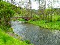
A long walk in the heart of the Eifel countryside, passing through three European countries: Belgium, Germany and the Grand Duchy of Luxembourg. You will discover the memorial dedicated to the founding of the Europe of Six.In addition to the landscapes of the Our valley and some of its tributaries, you will discover the incomparable Welchenhausen museum and its "sculpture trail".
La Ramée and the Brabant countryside
 11.69 mi
+312 ft
-328 ft
5h 40
Average
Departure from Incourt (Belgique) (Brabant Wallon)
11.69 mi
+312 ft
-328 ft
5h 40
Average
Departure from Incourt (Belgique) (Brabant Wallon)
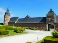
A sense of solitude prevails in these vast rural expanses.Few roads, few tracks, plenty of country lanes – some with grass that isn’t too short, and the traditional cobblestones of Walloon Brabant – will take you through the countryside to discover farms with monumental porches.The morning mist or the afternoon sun lend markedly different atmospheres to these majestic buildings and to the countryside, which is devoted to growing vegetables and cereals, as well as to livestock farming and the production of apples and pears.
Soiron naturally between Olne and Lambermont
 10.22 mi
+1,686 ft
-1,670 ft
6h 10
Average
Departure from Pepinster (Province de Liège)
10.22 mi
+1,686 ft
-1,670 ft
6h 10
Average
Departure from Pepinster (Province de Liège)
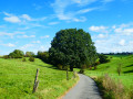
Starting from the pretty Place du Moulin in Soiron – one of the most beautiful villages in Wallonia – after admiring the old wash house, the walk gradually heads west into the countryside and offers a beautiful view of the Bola valley. The entrance to Olne crosses the Bois d'Olne and takes the beautiful Côte en Égypte before branching off to descend into the valley. The climb up the Croupet du Bois is hard on the calves, as is the descent on a bend in the Vesdre l'Est. At the viewpoint over the Vesdre, the route heads due east across meadows towards Cornesse and Wegnez, to the Paire sports complex, where it turns north towards the splendid wooded area of Tribomont and the bottom of Fiérain on the edge of Lambermont (Verviers). The route offers beautiful countryside scenery and some panoramic views of this pretty, hilly region.
Hike without description to be followed with the Visorando app.
A few markers on the Ourthe side
 10.93 mi
+620 ft
-597 ft
5h 35
Average
Departure from Gouvy (Province de Luxembourg)
10.93 mi
+620 ft
-597 ft
5h 35
Average
Departure from Gouvy (Province de Luxembourg)
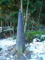
You’ll cover almost 18 kilometres and will also come across two other very different types of boundary markers: two stone ones marking the former Belgian-Prussian border and two metal ones, still very much in use, between Belgium and the Grand Duchy of Luxembourg.The Eastern Ourthe, meanwhile, is not very prominent, but towards the end of the route you’ll walk alongside a beautiful nature reserve on the banks of its tributary, known as the Fooschtbaach in the Grand Duchy and the Pihon in Belgium.
In the footsteps of the iron miners
 11.60 mi
+1,585 ft
-1,568 ft
6h 45
Average
Departure from Musson (Province de Luxembourg)
11.60 mi
+1,585 ft
-1,568 ft
6h 45
Average
Departure from Musson (Province de Luxembourg)
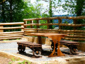
This very natural route takes you on a journey of discovery through the wooded hills on the border between the Batte (Belgium) and Coulmy (France) valleys.Anyone with even a passing interest in the region's industrial history will also discover its mining and steel-making past, highlighted by the Transfrontier Iron Mines Trail and a number of information panels along the route.The trail passes by some of the iron mines that brought prosperity to the region in the 19th and 20th centuries, as well as the Musson slag heap, which over time collected all the slag from the mines on the Musson and Halanzy sides. Now cleaned up, it has been turned into a nature reserve managed by the DNF (Nature and Forestry Division).
Cross-border Trappist route in Hamont-Achel
11.59 mi
+39 ft
-39 ft
5h 20
Average
Departure from Hamont-Achel (Province de Limbourg)
Pine, oak (local and American species) and birch forests, moors, crops, pastures, ponds... this is the natural scenery that awaits you on this hike.
Let’s take a stroll through the woods towards Vivy
 12.85 mi
+1,486 ft
-1,499 ft
7h 10
Average
Departure from Bouillon (Belgique) (Province de Luxembourg)
12.85 mi
+1,486 ft
-1,499 ft
7h 10
Average
Departure from Bouillon (Belgique) (Province de Luxembourg)
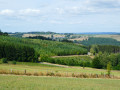
Let’s take a stroll through the woods whilst the wolf and the hunter are not there…This woodland walk offers lovely views of the countryside, not of the meandering Semois river nearby, but of the surrounding countryside and a few villages: Gros-Fays and Rochehaut, to name but two.The mix of deciduous and coniferous trees, grassy and stony paths, and forest and countryside trails makes for a well-balanced walk that never becomes monotonous.With a 460-metre elevation gain, it is not particularly difficult. Only the final climb from the Moulin de Liresse is a bit of a slog.Away from the beaten track and tourist hotspots, this walk is ideal for recharging your batteries in the forest and making the most of the natural surroundings.
Mer and Belle Meuse starting from Bérismenil
 9.75 mi
+1,175 ft
-1,145 ft
5h 30
Average
Departure from La Roche-en-Ardenne (Province de Luxembourg)
9.75 mi
+1,175 ft
-1,145 ft
5h 30
Average
Departure from La Roche-en-Ardenne (Province de Luxembourg)
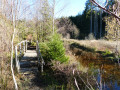
Mer or Mère … signposts and place-name signs use both spellings. This stream rises in the hills south of Samrée and flows gently from cascade to cascade as far as Maboge, where it joins the Ourthe.Further on, the other main stream on this walk is indeed called the Belle Meuse and has recently been colonised by beavers, judging by photos taken in 2017 – when there was virtually no sign of them and fording the stream posed no major problem – and in 2022, when crossing the path at km 14 is impossible without the small wooden bridges added at the side or without putting on waders. It, too, rises in the hills, at La Fange aux Mochettes to the north-east of Samrée, and flows southwards to join the Martin Moulin stream between Achouffe and Engreux.
From Chlorophylle to La Houssière
 11.04 mi
+1,237 ft
-1,220 ft
6h 10
Average
Departure from Manhay (Province de Luxembourg)
11.04 mi
+1,237 ft
-1,220 ft
6h 10
Average
Departure from Manhay (Province de Luxembourg)
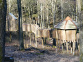
This hike, half in the forest and half in the countryside, starts at the car park of Chlorophylle Park, a forest theme park offering recreation, education and art. The path starts between the reception building, restaurant, terrace, toilets and souvenir shop, and the park itself.
Farms and castles starting from Natoye
 11.82 mi
+689 ft
-679 ft
6h 00
Difficult
Departure from Hamois (Province de Namur)
11.82 mi
+689 ft
-679 ft
6h 00
Difficult
Departure from Hamois (Province de Namur)
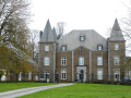
There are more farms than castles: shrewd lords of the manor managed in their day to have them built away from public roads, and their descendants are keen to preserve these privileges.Nevertheless, the delightfully undulating countryside offers walkers the pleasure of discovering a farm here and a castle there, in varying states of repair.
Between Ardenne and Famenne
 11.15 mi
+1,276 ft
-1,273 ft
6h 15
Average
Departure from Tellin (Province de Luxembourg)
11.15 mi
+1,276 ft
-1,273 ft
6h 15
Average
Departure from Tellin (Province de Luxembourg)
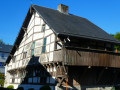
Part countryside, part woodland, the walk offers lovely views across the slopes of the Lomme Valley and its surroundings.Of particular note are the Notre-Dame de Haurt Chapel and the nearby disused quarry (a protected site), the Clusure viewpoint, the Maison Espagnole, the Château de Burlin estate, the beautifully renovated farmhouse on Rue Belair, and the Notre-Dame des Pauvres Chapel – to name but a few of the walk’s highlights.
The Mines in Differdange
 10.53 mi
+1,004 ft
-1,020 ft
5h 45
Average
Departure from Differdange (Luxembourg (Country))
10.53 mi
+1,004 ft
-1,020 ft
5h 45
Average
Departure from Differdange (Luxembourg (Country))
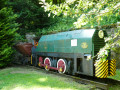
The mines, the mines of yesterday, the iron mines... this is the main theme of this hike.Fond-de-Gras is the most informative site on this subject: it was the station where narrow-gauge trains converged to unload iron ore into standard-gauge wagons bound for the steelworks and blast furnaces of Pétange, Differdange and others in Belgium and Germany.
Around the Bernistap Canal
 11.96 mi
+860 ft
-886 ft
6h 15
Average
Departure from Houffalize (Province de Luxembourg)
11.96 mi
+860 ft
-886 ft
6h 15
Average
Departure from Houffalize (Province de Luxembourg)
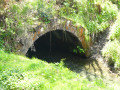
The Bernistap Canal is a section of the canal that the Dutch had planned to build to link the Rhine to the Meuse via the Moselle and the Ourthe. Begun in 1827 during the reign of WilliamI, King of the Netherlands, work was suspended in 1830 during the Belgian revolution and finally abandoned when the Grand Duchy of Luxembourg gained independence. This canal has an underground section, the entrance to which on the Belgian side is still visible at km 1, if you are feeling adventurous. A few information panels are located along the canal between km 1 and km 2, as well as on the Luxembourg side (except for the section leading to the village of Hoffelt).
A detour via Bocq from Bauche
 10.85 mi
+1,362 ft
-1,375 ft
6h 10
Average
Departure from Assesse (Province de Namur)
10.85 mi
+1,362 ft
-1,375 ft
6h 10
Average
Departure from Assesse (Province de Namur)
The walk takes you on a journey of discovery through the most wooded part of the Bocq valley, between the hamlets of Bauche and Chansin.The Bocq is the birthplace of numerous quarries and of the railway line that once linked Yvoir to Ciney, thereby facilitating the transport of quarry products. There are numerous drinking water abstraction points, now managed by VIVAQUA, as well as the brewery of the same name situated in the heart of Purnode.
The Luxembourg Ardennes between Troisvierges and Drauffelt
 11.92 mi
+1,460 ft
-1,804 ft
6h 45
Average
Departure from Troisvierges (Luxembourg (Country))
11.92 mi
+1,460 ft
-1,804 ft
6h 45
Average
Departure from Troisvierges (Luxembourg (Country))
Set off to explore the north of the Grand Duchy of Luxembourg and, in particular, Clervaux Abbey.
Please note: this hike is not circular and is based on the concept of walks from station to station. We chose to leave our vehicle at the free P+R car park at Drauffelt station, from where the train takes hikers to Troisvierges free of charge (1 train per hour on track 1).
Terres Rouges between Esch-sur-Alzette and Kayl
 11.33 mi
+1,079 ft
-1,106 ft
6h 10
Average
Departure from Esch-sur-Alzette (Luxembourg (Country))
11.33 mi
+1,079 ft
-1,106 ft
6h 10
Average
Departure from Esch-sur-Alzette (Luxembourg (Country))
This magnificent walk takes you on a journey of discovery through the former mining sites operated by the A.R.B.E.D between Esch-sur-Alzette, Schifflange and Kayl. It is offered by the CFL (Luxembourg's railway company) as part of its Hike & Rail range of hiking trails from station to station and has been slightly modified by us at the start and finish.
From station to station: from Drauffelt to Wiltz
 12.51 mi
+1,617 ft
-1,594 ft
7h 10
Difficult
Departure from Munshausen (Luxembourg (Country))
12.51 mi
+1,617 ft
-1,594 ft
7h 10
Difficult
Departure from Munshausen (Luxembourg (Country))
Signposted by the CFL in both directions as part of the ‘Hike & Rail’ scheme, this walk starts from Drauffelt. It offers a wonderful variety of panoramic views of this part of the Luxembourg Ardennes, as well as sections through woodland and villages, including Enscherange, Knaphoscheid, Eschweiler, Erpeldange and Weidingen.
Around the Asselborn Mill
 12.51 mi
+1,076 ft
-1,089 ft
6h 40
Difficult
Departure from Wincrange (Luxembourg (Country))
12.51 mi
+1,076 ft
-1,089 ft
6h 40
Difficult
Departure from Wincrange (Luxembourg (Country))
A truly beautiful walk that’s hard to capture in just a few photos! It forms a figure-of-eight, with a long circular loop to the east of Asselborn followed by a slightly shorter circular loop to the west of Asselborn.
Marvellous rock formations from Bollendorf-Pont
 13.13 mi
+2,552 ft
-2,546 ft
8h 15
Difficult
Departure from Berdorf (Luxembourg (Country))
13.13 mi
+2,552 ft
-2,546 ft
8h 15
Difficult
Departure from Berdorf (Luxembourg (Country))
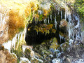
This magnificent, fairly challenging walk takes you on a journey of discovery through some of the cross-border natural beauty of the Sûre Valley and its tributaries.It’s hard to list all the interesting spots – there are so many.To name just a few: the Mandrack Pass is so narrow that an adult cannot walk through it upright whilst carrying a rucksack; the Tränenlay is at its most enchanting in winter; and Beaufort Castle is an attraction all year round.
La Cresse des Chevaux
 10.23 mi
+1,532 ft
-1,532 ft
6h 00
Difficult
Departure from La Roche-en-Ardenne (Province de Luxembourg)
10.23 mi
+1,532 ft
-1,532 ft
6h 00
Difficult
Departure from La Roche-en-Ardenne (Province de Luxembourg)
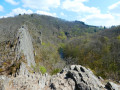
This walk is quite challenging, not so much because of its length or total elevation gain, but rather due to the number of obstacles encountered along the Ourthe: mud, water, rocks that are difficult to cross and fallen trees often force walkers to stray from the ‘official’ paths and wind their way both horizontally and vertically. Challenging, then, but well worth the trip. The more adventurous may want to take a short detour to the Cheslé site.
Felsenweg and Prümerburg
 11.27 mi
+1,112 ft
-1,083 ft
6h 10
Average
Departure from Irrel (Eifelkreis Bitburg-Prüm)
11.27 mi
+1,112 ft
-1,083 ft
6h 10
Average
Departure from Irrel (Eifelkreis Bitburg-Prüm)
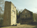
This walk not only offers views of magnificent rock formations in its southern section but also some regional gems, such as the ruins of the medieval Prümerburg Castle, the Westwall Museum site, the river rapids and the splendid suspension bridge spanning them, as well as the Roman villa at Holsthum.All in all, including the last two points mentioned, the walk is a good kilometre longer than the standard signposted ‘Felsenweg 5’ route.It is worth noting that the walk is mainly through woodland but, at its northern end, offers magnificent views of the rolling countryside around Holsthum. You can see quite a few orchards (apples, pears, cherries) as well as hop fields.
On the edge of the Namur Condroz, starting from Maillen
 12.44 mi
+1,516 ft
-1,506 ft
7h 05
Difficult
Departure from Assesse (Province de Namur)
12.44 mi
+1,516 ft
-1,506 ft
7h 05
Difficult
Departure from Assesse (Province de Namur)
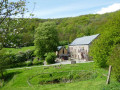
Combining woodland and countryside in a delightfully undulating landscape between Bocq and Mont, this walk does not pass through the historic centre of Crupet – with its Carondelet keep, grotto and parish priest – but instead takes in the Domaine d’Ahinvaux and its disc golf course, as well as the unmissable (and well-hidden) Château de Tricointe and its beautifully renovated square-shaped farmhouse.
When Mother Nature awakens, starting from Navaugle
 10.46 mi
+702 ft
-686 ft
5h 25
Average
Departure from Rochefort (Belgique) (Province de Namur)
10.46 mi
+702 ft
-686 ft
5h 25
Average
Departure from Rochefort (Belgique) (Province de Namur)
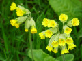
When Mother Nature awakens, all our senses come alive! A lovely walk to take in early spring, when the leaves on the trees are a vibrant green and the first flowers are beginning to bloom and bring colour to the verges.
The Semois near Cornimont
 13.35 mi
+2,365 ft
-2,365 ft
8h 10
Difficult
Departure from Bièvre (Province de Namur)
13.35 mi
+2,365 ft
-2,365 ft
8h 10
Difficult
Departure from Bièvre (Province de Namur)
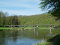
Quite a physical challenge due to its length and cumulative elevation gain, this lovely walk, set in magnificent surroundings, also requires a bit of off-trail walking at times to cross certain streams. Nothing too daunting, but you may occasionally need to stray from the paths and climb or descend a little through the countryside. The most challenging part is reaching the banks of the Semois from Rochehaut. The steep path, which is very poorly marked at km 8.5, is more like a trail run route than a hiking trail. Otherwise, it’s simply splendid. You pass the old mills at Liresse and (near) Gros-Fays, next to the footbridge at Frahan and across the one at Mouzaive. There’s just a short stretch of tarmac between Alle and Mouzaive and on the hillside before Gros-Fays.
The devilish rocks of the Müllerthal
 13.47 mi
+1,972 ft
-1,946 ft
7h 55
Difficult
Departure from Berdorf (Luxembourg (Country))
13.47 mi
+1,972 ft
-1,946 ft
7h 55
Difficult
Departure from Berdorf (Luxembourg (Country))
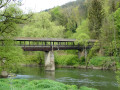
This fairly challenging hike in the Müllerthal region takes you on a journey of discovery to devilish spots on either side of the Sûre: the Devil’s Island (Teufelsinsel) on the Luxembourg side and the Devil’s Hole (Teufelsloch) on the German side.The route between Berdorf and Bollendorf passes through many well-known spots in the region, notably Casselt and the Mandrack Pass, where you’ll need to take off your rucksack to navigate the narrow passage between the rock faces.The Teufelsloch is very similar, the only difference being that here it is possible to go round the obstacle.
The Chassart Plain
 8.91 mi
+131 ft
-108 ft
4h 15
Average
Departure from Fleurus (Hainaut)
8.91 mi
+131 ft
-108 ft
4h 15
Average
Departure from Fleurus (Hainaut)
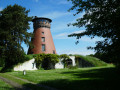
Inthe 19th century, the Dumont family founded the Établissements de Chassart, modernised agriculture and livestock farming, and set up a sugar factory following the development of beet cultivation in the region. This was followed by the creation of a distillery and the production of the famous Chassart Vieille Cuvée genever. In 1906, the family name was ennobled to Dumont de Chassart.
From Solières to La Sarte in Ben
 9.47 mi
+807 ft
-817 ft
5h 05
Average
Departure from Province de Liège
9.47 mi
+807 ft
-817 ft
5h 05
Average
Departure from Province de Liège
Whilst the local authorities offer a few signposted walks, there are clearly not many walkers in the area… and yet the region is well worth the effort!Lovely rolling countryside alternates with woodland sections (mainly deciduous) of all kinds: stony paths, wide tracks and winding trails, sometimes as muddy as you could wish for.
Family walk in Poix-Saint-Hubert
 4.62 mi
+528 ft
-512 ft
2h 35
Easy
Departure from Saint-Hubert (Belgique) (Province de Luxembourg)
4.62 mi
+528 ft
-512 ft
2h 35
Easy
Departure from Saint-Hubert (Belgique) (Province de Luxembourg)
The children in the group will love it… some of the adults, perhaps a little less so: around km 1, the GR®17 follows a barely visible path through mature forests, young spruce trees, young birch trees, broom and also a few brambles. It’s quite refreshing with the morning dew or after a good downpour!
Circular forest loop between Poix-Saint-Hubert and Hatrival
 6.93 mi
+860 ft
-843 ft
3h 55
Average
Departure from Saint-Hubert (Belgique) (Province de Luxembourg)
6.93 mi
+860 ft
-843 ft
3h 55
Average
Departure from Saint-Hubert (Belgique) (Province de Luxembourg)
This mainly woodland walk takes the walker from the centre of Poix-Saint-Hubert to the outskirts of Hatrival, where the route passes by the Écurie des Îles (a horse breeding and trading centre) before branching off into the woods again. There isa short stretch through fairly wild, overgrown terrain in the Bois de Poix around the 1 km mark. Shortly after the 7.5 km mark, the route literally plunges down the eastern slope of the Lomme (still known as L’Homme in some places) and passes under the Brussels–Luxembourg railway line. After a steep climb of a few hundred metres, the walk turns right to head back down towards the station and the starting point, passing by the village school.