


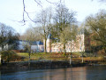
(S/E) This woodland walk starts at Le Châtelet and follows the right bank of the Rulles upstream to the Pont d’Oye.
(1) You then switch to the opposite bank to continue towards the former forges, skirting the Fabrique pond (2), which you walk halfway round before returning to the right bank and then moving away from it to follow the course of the Fagne Jean Simon stream (4) up to the (forest and very minor) road linking Habay-la-Neuve to Martelange.
A short stretch of tarmac further on (5) and the walk continues once more along forest tracks towards the Arlune, which it follows as far as the outskirts of Léglise (Vlessart-Louftemont) before turning due west towards Anlier (7).
Once the summit is reached beyond Rousse Colas (8), the route begins a long descent to the Gris Bofet stream (9) and the junction with the Chemin de la Croix (11), and further on to Winchabay (12), a shooting club situated in a former quarry.
The return route first runs alongside the marshes and the pond fed by the Arlune (14) before heading towards another pond and the wetlands along the Rulles.
Habay along the water’s edge


Plenty of deciduous trees, few conifers, a few fine historical and architectural discoveries… as well as a charming gastronomic gem serving ‘Plats canailles’ at La Bleue Maison.
Details
Creation:
Last update:
Last review:
–
–
-
 Activity: Walking
-
 Distance: 11.28 mi
-
 Average duration: 5h 50
-
 Difficulty: Moderate
-
-
 Back to start: Yes
-
 Ascent: + 705 ft
-
 Descent: - 709 ft
-
-
 Highest point: 1,585 ft
-
 Lowest point: 1,217 ft
-
 Country:
Belgium
-
 Area: Massif des Ardennes
-
 City:
Habay
-
 Start/End: N 49.730922° / E 5.652493°
-


 Hour-by-hour weather
Photos
Description of the walk
Waypoints
- S/E : mi 0 - alt. 1,237 ft - Châtelet Park
- 1 : mi 1.17 - alt. 1,280 ft - Pont d’Oye site and pond
- 2 : mi 1.54 - alt. 1,296 ft - Étang de la Fabrique
- 3 : mi 2.47 - alt. 1,312 ft - Picnic shelter
- 4 : mi 3.71 - alt. 1,398 ft - Fagne Jean Simon
- 5 : mi 4.4 - alt. 1,503 ft - The Allée Miest
- 6 : mi 5.42 - alt. 1,385 ft - Bois le Prêtre
- 7 : mi 6.46 - alt. 1,391 ft - Côte d’Arlune
- 8 : mi 7.17 - alt. 1,572 ft - Rousse Colas
- 9 : mi 7.72 - alt. 1,486 ft - Gris Bofet stream
- 10 : mi 8.51 - alt. 1,371 ft - Picnic table
- 11 : mi 9.2 - alt. 1,329 ft - Chemin de la Croix and picnic table
- 12 : mi 9.76 - alt. 1,283 ft - Shooting Range
- 13 : mi 9.82 - alt. 1,332 ft - Champ Gilot
- 14 : mi 10.44 - alt. 1,270 ft - Étang Remy
- 15 : mi 10.94 - alt. 1,224 ft - The Rulles
- S/E : mi 11.28 - alt. 1,237 ft - Châtelet Park
Other walks in the area
Anlier Forest, former Prince's forges and Château du Pont d'Oye
 Visorando Member
 8.35 mi
+581 ft
-558 ft
4h 20
Moderate
 Departure from Habay (Province de Luxembourg)
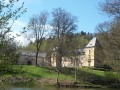
Circular in the Anlier forest starting from Habay-la-Neuve, discovering the various ponds used for the forges.
Habay-la-Neuve – Tintange
 13.79 mi
+1,204 ft
-1,073 ft
7h 25
 Difficult
Departure from Habay (Province de Luxembourg)
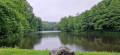
After reaching the Château du Pont d’Oye, the walk begins with a pleasant route through the woodland, skirting the ponds before moving away from them to join a secondary gravel road. This takes us over hill and dale through the forest up to the heights of Martelange, a border town between Belgium and the Grand Duchy of Luxembourg.
Forest users’ route towards Anlier
 AONB6.04 mi
+410 ft
-433 ft
3h 10
 Easy
Departure from Habay (Province de Luxembourg)
For families out hiking, curious holidaymakers, and forest lovers… Starting from the heart of the Anlier Forest, the forest visitors’ route takes you along the most beautiful paths and tracks to meet those who experience the forest on a daily basis. After a stop at the landscape viewing platform, you’ll encounter life-size sculptures of characters typical of the forest throughout this 10-kilometre walk. Through information panels, they’ll tell you about their passion and their work, as well as how they go about sharing this precious environment. One by one, you’ll come across the forest ranger, the red deer, the timber merchant, the hunter, the woodcutter, the forager, the logger, the hiker, the mountain biker and the naturalist. And perhaps some other unexpected encounters… Keep your eyes peeled – even in the deepest silence, life is everywhere in the forest!
Forest trail starting from Anlier, passing through Behême and Thibessart
 11.58 mi
+837 ft
-837 ft
6h 05
Moderate
Departure from Habay (Province de Luxembourg)
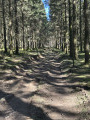
The route is mainly through woodland. Choose autumn for the colours or a sunny day to enjoy the scent of pine trees warmed by the sun.
A moderate hike in terms of length, with no difficulties to be expected.
Circular route in the Anlier Forest starting from Heinstert
 8.44 mi
+768 ft
-794 ft
4h 35
Moderate
Departure from Attert (Province de Luxembourg)
A peaceful route through woods and valleys. The Anlier Forest covers over 7,000 hectares. It is the largest contiguous beech forest in Belgium. It is here that the black stork has made its grand return to Wallonia, after a century of absence.
The descent along the Rulles
 10.13 mi
+814 ft
-830 ft
5h 20
Moderate
Departure from Martelange (Province de Luxembourg)
Mainly through woodland, this walk offers a delightful variety of trees and shrubs, whilst providing beautiful wild flowers and berries, as well as lovely undergrowth depending on the season. Walking here in silence is sure to increase your chances of encountering small—or not-so-small—wildlife as you round a bend in the path.
Thibessart Pond via the Mellier Forges, starting from Rulles
 11.98 mi
+1,083 ft
-1,056 ft
6h 25
Moderate
Departure from Habay (Province de Luxembourg)
The magnificent Thibessart Pond, on the Mandebras Stream, features a bird and dragonfly observation point. An educational trail has been created there, focusing on dragonflies.
In the Anlier forest in Vlessart
5.13 mi
+282 ft
-423 ft
2h 35
Easy
Departure from Léglise (Province de Luxembourg)
We are on the Ardennes plateau, the terrain is not steep, and we can admire the beautiful Ardennes countryside. Basically, we are circling around the relay antenna used to broadcast television programmes. It is a haven of peace and tranquillity. We did it in ideal weather conditions, but you should expect the harsh, windy climate of the Ardennes, where we often have snow in winter.
For more walks, use our search engine .
The GPS track and description are the property of this route's author. Please do not copy them without permission.

