Country:

 City:
City:



No detailed description ...
Follow the route after downloading it locally to your smartphone via the Visorando app, as there isn’t necessarily mobile coverage everywhere along this mostly wooded route.
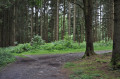
(7) The suggested walk heads up into the woods along the path branching off to the right. Walkers wishing to take a slightly shorter route (600 m) with a little less elevation gain (80 m) should continue straight on, skirting the campsites. Please note that the route is tarmac all the way to (8) with little traffic out of season (when the campsites are unoccupied) but a lot of traffic in season (when the campsites are busy).
 Visorando Member

 Difficult
 Easy
Easy