


There are no benches or picnic tables along the route… it really is off the beaten track!
Head a little further to (6), where a few rocks on the bridge provide a place to sit.
There are only a few hundred metres of tarmac in Volaiville, Traimont and on either side of the sports ground/village hall in Witry.
Peace and quiet amidst nature in Volaiville


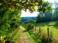
This superb region, half countryside and half woodland, is delightfully undulating, fairly sparsely populated and well off the beaten track – excellent ingredients for a successful, peaceful and relaxing walk in the heart of nature, with beautiful scenery to boot. With a bit of luck, you might even have the chance to startle a herd of deer or wild boar as you approach.
Details
Creation:
Last update:
Last review:
-
 Activity: Walking
 -
 Distance: 12.17 mi
 -
 Average duration: 6h 35
 -
 Difficulty: Difficult
 -
-
 Back to start: Yes
 -
 Ascent: + 1,181 ft
 -
 Descent: - 1,201 ft
 -
-
 Highest point: 1,647 ft
 -
 Lowest point: 1,342 ft
-
 Country:
Belgium
Country:
Belgium
-
 Area: Massif des Ardennes
 -
 City:
Léglise
City:
Léglise -
 Start/End: N 49.872157° / E 5.612961°
 -


 Hour-by-hour weather
Photos
Waypoints
- S/E : mi 0 - alt. 1,378 ft - Volaiville Church - Sûre ou Sauer (rivière)
- 1 : mi 1.96 - alt. 1,467 ft - Traimont
- 2 : mi 2.84 - alt. 1,588 ft - Entrance to the forest
- 3 : mi 4.24 - alt. 1,604 ft - Grands Alieus
- 4 : mi 7.25 - alt. 1,404 ft - La Basseille
- 5 : mi 8.3 - alt. 1,457 ft - Unused area
- 6 : mi 8.52 - alt. 1,394 ft - Small bridge
- 7 : mi 9.88 - alt. 1,512 ft - Exit from the forest
- 8 : mi 10.65 - alt. 1,568 ft - Rue d’Everlange
- 9 : mi 12.02 - alt. 1,348 ft - Moyémont Stream
- S/E : mi 12.17 - alt. 1,378 ft - Volaiville Church
Notes


Other walks in the area
Discovering the Forest of Anlier and the church of La Misbour
 Visorando Member
 8.84 mi
+610 ft
-614 ft
4h 35
8.84 mi
+610 ft
-614 ft
4h 35
 Moderate
 Departure from Fauvillers (Province de Luxembourg)
A route through the Anlier Forest near Fauvillers and a visit to the ruins of La Misbour Church.
A stroll through woods and meadows in Fauvillers
 7.86 mi
+1,007 ft
-1,017 ft
4h 30
Moderate
Departure from Fauvillers (Province de Luxembourg)
7.86 mi
+1,007 ft
-1,017 ft
4h 30
Moderate
Departure from Fauvillers (Province de Luxembourg)
A village nestled on the edge of the Anlier forest, come and discover its wooded surroundings dotted with meadows and unobstructed views.
Chaumont and the La Strange Valley
 6.85 mi
+676 ft
-666 ft
3h 45
Moderate
Departure from Vaux-sur-Sûre (Province de Luxembourg)
6.85 mi
+676 ft
-666 ft
3h 45
Moderate
Departure from Vaux-sur-Sûre (Province de Luxembourg)
The Ardennes aren’t just made up of coniferous forests… There are also valleys, pastures, hay meadows, copses and farmland… Come and discover this other side of the Ardennes with this circular route through open countryside.
Remience Route
 12.07 mi
+627 ft
-633 ft
6h 05
Difficult
Departure from Vaux-sur-Sûre (Province de Luxembourg)
12.07 mi
+627 ft
-633 ft
6h 05
Difficult
Departure from Vaux-sur-Sûre (Province de Luxembourg)
Once upon a time, there was a railway line numbered 163 that linked Libramont to Gouvy via Bastogne. It is the small stretch of the Ardennes situated between Remience and Morhet, to the north of this disused railway line, that this walk invites you to discover.The alternation between forest and countryside provides the variety of experiences essential to any good walk.Although there are a few rather gloomy stretches of pine forest here and there, the walk ends with a splendid stretch of forest, as wild as you could wish for, around the 18 km mark.Architecture-wise: a small castle hidden in the woods near Morhet Station and the Chapel of Remience (where a touch of AI helps remove the countless power lines that spoil the photos).
Loop from Warnach
13.72 mi
+1,358 ft
-1,381 ft
7h 30
Moderate
Departure from Fauvillers (Province de Luxembourg)
A walk starting from Warnack and passing through Strainchamps, Hotte, Bodange, Wisemback and Radelange. Part of the route is in Luxembourg. The walk is mainly on forest paths with little tarmac.
In the Anlier forest in Vlessart
5.13 mi
+282 ft
-423 ft
2h 35
 Easy
Departure from Léglise (Province de Luxembourg)
Easy
Departure from Léglise (Province de Luxembourg)
We are on the Ardennes plateau, the terrain is not steep, and we can admire the beautiful Ardennes countryside. Basically, we are circling around the relay antenna used to broadcast television programmes. It is a haven of peace and tranquillity. We did it in ideal weather conditions, but you should expect the harsh, windy climate of the Ardennes, where we often have snow in winter.
Walk between Wideumont and Molinfaing
 12.42 mi
+650 ft
-640 ft
6h 15
Difficult
Departure from Libramont-Chevigny (Province de Luxembourg)
12.42 mi
+650 ft
-640 ft
6h 15
Difficult
Departure from Libramont-Chevigny (Province de Luxembourg)
Those who love nature and solitude will be in their element: it is possible not to encounter a single hiker on this circular route, which is half countryside and half woodland, even on a fine summer’s day. You may come across some roe deer.
Tintange – Benonchamps
 12.12 mi
+1,339 ft
-1,394 ft
6h 45
Difficult
Departure from Fauvillers (Province de Luxembourg)
12.12 mi
+1,339 ft
-1,394 ft
6h 45
Difficult
Departure from Fauvillers (Province de Luxembourg)
Today, I’m inviting you on a short trip through the Grand Duchy of Luxembourg, travelling from one Belgian village to another. The route takes in roads, paths and forest trails, and, if you’re lucky, you might spot roe deer or fallow deer in the undergrowth.
For more walks, use our search engine .
The GPS track and description are the property of this route's author. Please do not copy them without permission.

