


This route is a near-exact combination of the southern section of the ‘Circular Walk to Sohier, one of Wallonia’s most beautiful villages’ and the northern section of the ‘Sourd d’Ave and Croix de Jeumont’ walk.
A circular loop around Wellin starting from Sohier


A walk from Sohier, one of Wallonia’s most beautiful villages, to Chanly via the Wellin viewpoint and the Maria footbridge over the Lesse. The return route takes in the Croix de Jeumont and the Sourd d’Ave. Situated between the region’s two enormous quarries, this walk alternates between countryside and woodland, offering some lovely panoramic views of the area.
Details
Creation:
Last update:
Last review:
–
–
-
 Activity: Walking
 -
 Distance: 17.07 mi
 -
 Average duration: 9h 30
 -
 Difficulty: Very difficult
 -
-
 Back to start: Yes
 -
 Ascent: + 1,860 ft
 -
 Descent: - 1,886 ft
 -
-
 Highest point: 1,276 ft
 -
 Lowest point: 614 ft
-
 Country:
Belgium
Country:
Belgium
-
 Area: Massif des Ardennes
 -
 City:
Wellin
City:
Wellin -
 Start/End: N 50.068492° / E 5.070957°
 -


 Hour-by-hour weather
Photos
Description of the walk
Waypoints
- S/E : mi 0 - alt. 1,014 ft - Sohier car park
- 1 : mi 1.25 - alt. 843 ft - Source de Lomprez
- 2 : mi 2.54 - alt. 1,188 ft - Margouyet
- 3 : mi 3.9 - alt. 1,132 ft - Wellin Viewpoint
- 4 : mi 4.17 - alt. 925 ft - Wéri viewpoint
- 5 : mi 5.78 - alt. 702 ft - Maria Footbridge over the - lesse (rivière) - Belgique
- 6 : mi 7.1 - alt. 682 ft - Le Baligan
- 7 : mi 8.19 - alt. 817 ft - Miseri stream
- 8 : mi 8.97 - alt. 617 ft - Chanly – Picnic area - lesse (rivière) - Belgique
- 9 : mi 9.75 - alt. 843 ft - Croix Denis
- 10 : mi 10.84 - alt. 899 ft - Croix de Jeumont
- 11 : mi 11.56 - alt. 850 ft - Carrière des Limites
- 12 : mi 12.58 - alt. 728 ft - Sourd d’Ave
- 13 : mi 14.43 - alt. 928 ft - Fond des Vaux Quarry
- 14 : mi 15.5 - alt. 843 ft - Lomprez Cemetery
- 15 : mi 16.65 - alt. 971 ft - Notre-Dame des Sept Douleurs
- 16 : mi 16.96 - alt. 994 ft - Sohier Castle
- S/E : mi 17.07 - alt. 1,014 ft - Sohier car park
Notes
Please note: some sections/paths/trails between (10) and (13) are not, as of 2026, yet listed or visible on OSM or IGN Belgium maps. The route is fully accessible and has been part of the range of (new) local, signposted walks since the summer of 2025.
La Croix de Jeumont (10) and Le Sourd d’Ave (12) are (unfortunately) situated close to the motorway, the former overlooking it, the latter almost directly beneath the Fond des Vaulx viaduct.
Other walks in the area
Circular walk starting from Sohier
 Visorando Member
 15.12 mi
+1,745 ft
-1,772 ft
8h 30
15.12 mi
+1,745 ft
-1,772 ft
8h 30
 Difficult
 Departure from Wellin (Province de Luxembourg)
A walk from Sohier, one of the most beautiful villages in Wallonia, to Chanly, via the Wellin viewpoint and the Maria footbridge over the Lesse. The return route takes you through the centre of Wellin, then south of the Fond des Vaux quarry and past the Lomprez cemetery. This walk alternates between countryside and woodland, offering some lovely views of the region, notably the Croix de Jeumont to the north and the former Resteigne quarry to the east.
Through mountains and valleys from Lomprez
 14.41 mi
+1,378 ft
-1,388 ft
7h 50
Difficult
Departure from Wellin (Province de Luxembourg)
14.41 mi
+1,378 ft
-1,388 ft
7h 50
Difficult
Departure from Wellin (Province de Luxembourg)
With sections in the countryside offering magnificent panoramic views of the Famenne and Calestienne regions and beautiful forest sections alternating between deciduous and coniferous trees, this long circular walk is one of the 2025 proposals from the Wellin Tourist Office. It is part of a series comprising a large circular 50 km and four other smaller circular ones, including this one.It is worth noting that the circular route passes through Sohier, one of the most beautiful villages in Wallonia, with its pretty stone houses: don't miss the old village hall/school, the church and the castle.
Circular starting from the old communal mill in Lomprez.
 12.06 mi
+1,362 ft
-1,352 ft
6h 45
Difficult
Departure from Wellin (Province de Luxembourg)
12.06 mi
+1,362 ft
-1,352 ft
6h 45
Difficult
Departure from Wellin (Province de Luxembourg)
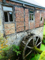
This long walk, which is mostly through forest for just over half of the route, starts behind the imposing church of Lomprez with its turrets. The old village mill is nearby. While the street-facing building and its dormer window (whose pulley has disappeared) are in good condition, the rear and the old wheel are in need of restoration. There are a few difficulties on this route: see the "description" box.
Le Sourd d'Ave and La Croix de Jeumont
 7.51 mi
+614 ft
-591 ft
4h 00
7.51 mi
+614 ft
-591 ft
4h 00
 Moderate
Departure from Wellin (Province de Luxembourg)
Moderate
Departure from Wellin (Province de Luxembourg)
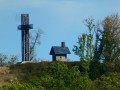
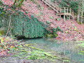
The route takes turns along the GR® Monts d'Ardenne trail and the Wellin circular, via Monts and Vaulx.The Sourd d'Ave is a resurgence of the Ry d'Ave located opposite the N835, between the E411 and the N94. There are better places, but there is no choice. The route is equipped with stairs and ropes, making it safe and secure. You can admire the work of the beavers there!The stone Jeumont Cross dated from the late 19th century. It fell during a storm in 1984 (remains can be seen on the site), and a wooden version was erected by the Fraternité de Tibériade in 2022. The site is part of the Natura 2000 network and the chapel at the top of the hill is listed as protected heritage in Wallonia.In addition to opening up onto rolling countryside landscapes, the trail comes quite close to two gigantic quarries, Fond des Vaulx and Les Limites. Both are worth a closer look where possible!
In the Great Forest of Saint-Hubert, immerse yourself among streams and woods.
 6.43 mi
+732 ft
-702 ft
3h 35
Moderate
Departure from Wellin (Province de Luxembourg)
6.43 mi
+732 ft
-702 ft
3h 35
Moderate
Departure from Wellin (Province de Luxembourg)
Starting from the old Redu railway station, now converted into a lodge, take a walk through the Grande Forêt de Saint-Hubert, along the Ry des Glands, then the Ry de Houssi and finally along the Lesse. Immerse yourself in the forest, among conifers and deciduous trees.
The Lesse, the forest and the old country lane
 10.72 mi
+1,348 ft
-1,345 ft
6h 05
Moderate
Departure from Wellin (Province de Luxembourg)
10.72 mi
+1,348 ft
-1,345 ft
6h 05
Moderate
Departure from Wellin (Province de Luxembourg)
Centred around the River Lesse and the old local road that linked Wellin to Graide, this entirely woodland walk spans the municipalities of Wellin, Daverdisse and Libin.The route alternates between sections of signposted local walks, Grande Randonnée trails, the Entre-Lesse-et-Lomme circular route and other unmarked paths, which are consequently very little used. It is likely to be on one of these latter paths that you’ll have the chance to spot the odd wild animal, such as wild boars fleeing from one of their favourite haunts.The route mainly follows footpaths and tracks, with only two sections on tarmac: one around the magnificent Daverdisse Mill, and the other on the small road linking Daverdisse to Redu.
Between Wellin and Daverdisse
 7.18 mi
+1,414 ft
-1,430 ft
4h 30
Moderate
Departure from Wellin (Province de Luxembourg)
7.18 mi
+1,414 ft
-1,430 ft
4h 30
Moderate
Departure from Wellin (Province de Luxembourg)
In the north of the province of Luxembourg, on the border between the Ardennes and the Famenne, a hike in the Great Forest of Saint-Hubert to discover the serenity of the forest, a few historic buildings and beautiful views.
Circular in Famenne starting from the Château de Lavaux-Sainte-Anne
 13.83 mi
+1,020 ft
-1,014 ft
7h 15
Difficult
Departure from Rochefort (Belgique) (Province de Namur)
13.83 mi
+1,020 ft
-1,014 ft
7h 15
Difficult
Departure from Rochefort (Belgique) (Province de Namur)
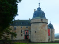
Lavaux-Saint-Anne is an ideal place to start a hike that is half countryside, half forest, not only in Famenne but also in Calestienne. The route offers beautiful panoramic views of the Famenne depression. The Château de Lavaux-Sainte-Anne is listed as a major heritage site in Wallonia. It is open to visitors and features 32 furnished and decorated rooms, 3 themed museums, a wetland area and a deer park.Revogne Castle is not open to visitors but is clearly visible on arrival in the village from the other side of the Wimbe. The route passes through the old gate of the medieval enclosure and the small church located on the hillside below the castle. The third historical gem of the hike is the imposing building of the Ferme d'Esclaye. However, the castle is not visible from public paths.
For more walks, use our search engine .
The GPS track and description are the property of this route's author. Please do not copy them without permission.

