


 Country:
 City:
City:


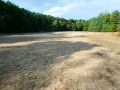
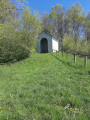
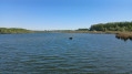
Whilst the history of the Arbre à Loques and the chapel situated right next to it is described on an information board, there are no explanatory signs at the Fontaine Bouillante site – with its gas bubbles bursting to the surface of the pond – nor at the Mer de Sable site.
The Arbre à Loques, the Fontaine Bouillante and the Mer de Sable


Whilst interesting sites such as the Stambruges Communal Forest, the Mer de Sable, the Fontaine Bouillante and the Ath-Blaton Canal are already well documented, here is a slightly different suggestion that takes in the Arbre à Loques and follows the canal along a forest path rather than the towpath used by so many cyclists!
Details
Creation:
Last update:
Last review:
–
–
-
 Activity: Walking
 -
 Distance: 8.41 mi
 -
 Average duration: 4h 05
 -
 Difficulty: Moderate
 -
-
 Back to start: Yes
 -
 Ascent: + 207 ft
 -
 Descent: - 226 ft
 -
-
 Highest point: 325 ft
 -
 Lowest point: 174 ft
Photos
Waypoints
- S/E : mi 0 - alt. 276 ft - Mer de Sable hiking car park
- 1 : mi 0.14 - alt. 266 ft - The Arbre à Loques
- 2 : mi 1.28 - alt. 177 ft - Canal Blathon-Ath - Belgique
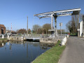
- 3 : mi 4.05 - alt. 197 ft - View of the drawbridge - Canal Blathon-Ath - Belgique
- 4 : mi 4.83 - alt. 253 ft - Fontaine Bouillante
- 5 : mi 5.68 - alt. 259 ft - Picnic table
- 6 : mi 6.22 - alt. 322 ft - Picnic table
- 7 : mi 6.73 - alt. 299 ft - Path/trail not very visible
- 8 : mi 8.15 - alt. 240 ft - Mer de Sable
- S/E : mi 8.41 - alt. 276 ft - Mer de Sable hiking car park
Notes
Other walks in the area
La Mer de Sable, the Fontaine Bouillante and the Blaton-Ath Canal
 Visorando Member
 6.41 mi
+171 ft
-144 ft
3h 05
6.41 mi
+171 ft
-144 ft
3h 05
 Easy
Easy
 Departure from Belœil (Hainaut)
An easy walk accessible to all at Mer de Sable, in the undivided forest of Stambruges, to discover the Fontaine Bouillante and return along the Blaton-Ath canal on the towpath.
The Ath-Blaton Canal between Belœil and Stambruges
 7.74 mi
+49 ft
-49 ft
3h 35
Moderate
Departure from Belœil (Hainaut)
7.74 mi
+49 ft
-49 ft
3h 35
Moderate
Departure from Belœil (Hainaut)
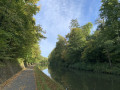
Pleasant walk along the Ath-Blaton Canal and return through the woods of Belœil Castle.
Belœil – Hyon
 14.45 mi
+207 ft
-279 ft
6h 50
14.45 mi
+207 ft
-279 ft
6h 50
 Difficult
Departure from Belœil (Hainaut)
Difficult
Departure from Belœil (Hainaut)
This eighth stage is certainly not the most pleasant part of this tour of Wallonia, as it passes through a heavily built-up area. Nevertheless, it is interesting to explore the Borinage not only through its countryside but also through its towns. You’ll find both aspects here. Accommodation with a local host.
The Stambruges Forest, the Bouillante Spring and Belœil Castle
 8.95 mi
+151 ft
-151 ft
4h 15
Moderate
Departure from Belœil (Hainaut)
8.95 mi
+151 ft
-151 ft
4h 15
Moderate
Departure from Belœil (Hainaut)
Discover the undivided forest of Stambruges, its avenues and paths, and the mystery of the Fontaine Bouillante. Follow the narrow streets of Belœil and Stambruges and marvel at the Château du Prince de Ligne, the ‘Belgian Versailles’.
Two other walks are available: “The Ath-Blaton Canal between Belœil and Stambruges” and “The Mer de Sable, the Fontaine Bouillante and the Blaton-Ath Canal”. This one is intended as a summary of the two (excluding the Mer de Sable) but follows different paths and lanes.
A picturesque corner of the Borinage and the Harchies Marshes
 8.11 mi
+79 ft
-108 ft
3h 50
Moderate
Departure from Bernissart (Hainaut)
8.11 mi
+79 ft
-108 ft
3h 50
Moderate
Departure from Bernissart (Hainaut)
This is an easy walk to visit a picturesque corner of the Borinage region along old miners' paths and discover the charm of the Harchies marshes.
Bernissart’s river, railway, geological and ornithological heritage
 11.89 mi
+177 ft
-167 ft
5h 35
Moderate
Departure from Bernissart (Hainaut)
11.89 mi
+177 ft
-167 ft
5h 35
Moderate
Departure from Bernissart (Hainaut)
A walk that follows the old Pommeroeul–Antoing and Blaton–Ath canals, takes the old L80/78A Blaton–Bernissart railway line, runs alongside the Bernissart Museum’s geological trail, and ends with country lanes and the Marais d’Harchies
Best done in dry weather! Sections ofthe GR® 121 and 412 are very muddy (almost impassable) in wet weather.
River, railway and geological heritage trail in Bernissart
 6.94 mi
+115 ft
-115 ft
3h 15
Moderate
Departure from Bernissart (Hainaut)
6.94 mi
+115 ft
-115 ft
3h 15
Moderate
Departure from Bernissart (Hainaut)
A walk that follows the old Pommeroeul–Antoing and Blaton–Ath canals, takes the old L80/78A Blaton–Bernissart railway line, and ends with country lanes running alongside the geological trail of the Bernissart Museum.
Bird Trail at the Marais d’Harchies
4.20 mi
+377 ft
-381 ft
2h 15
Easy
Departure from Bernissart (Hainaut)
Discover one of Wallonia’s richest natural sites!
Located in the Haine Valley, this 550-hectare area is a wetland of international importance (Natura 2000). This flat route, accessible to all (pushchairs welcome), takes you through vast reed beds, ponds and woodland, offering numerous vantage points from which to admire herons, ducks and, with a bit of luck, the elusive bittern.
For more walks, use our search engine .
The GPS track and description are the property of this route's author. Please do not copy them without permission.

