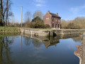
Countryside and the canal from Obaix

This mainly rural circular route starting from Obaix takes you on a journey of discovery not only through the agricultural plain in the triangle enclosed by the motorway network between Gosselies, La Louvière and Nivelles, but also along a southern section of the Charleroi–Brussels Canal. The icing on the cake: the route passes through the ‘Refuge nature de l’Étang de Launoy’, managed by Natagora.

Details

n°111201248
Creation:
Last update:
Last review:
–
  • Walking
    Activity: Walking
  • ↔
    Distance: 12.00 mi
  • ◔
    Average duration: 5h 45 
  • ▲
    Difficulty: Moderate

  • ⚐
    Back to start: Yes
  • ↗
    Ascent: + 276 ft
  • ↘
    Descent: - 282 ft

  • ▲
    Highest point: 535 ft
  • ▼
    Lowest point: 394 ft

Photos

Description of the walk

A few details:
(8) If you wish to avoid the detour through the woods, continue along the towpath rather than taking the path that climbs gently to the right. There are plenty of fallen branches and trees between (8) and (9).
(10) The OSM (OpenStreetMap) base map does not show the path that climbs from the towpath towards the top of the embankment. It is clearly there on the ground… it is a simple, fairly little-used track.

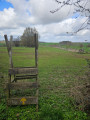
(14) After the turnstile, veer slightly to the left and look out for the next turnstile (15) situated at the corner of the barn on the other side of the meadow.

Waypoints

  1. S/E : mi 0 - alt. 446 ft - Obaix Cemetery
  2. 1 : mi 0.8 - alt. 482 ft - Notre-Dame de Lourdes Chapel or Jean-le-Boucher Chapel
  3. 2 : mi 1.55 - alt. 400 ft - Canal Charleroi-Bruxelle
  4. 3 : mi 1.93 - alt. 427 ft - Natagora Nature Refuge
  5. 4 : mi 2.52 - alt. 427 ft - Launoy Pond (Natagora)
  6. 5 : mi 3.7 - alt. 463 ft - Malhian Farm
  7. 6 : mi 4.72 - alt. 417 ft - Gouy-lez-Piéton station
  8. 7 : mi 5.11 - alt. 417 ft - Towpath
  9. 8 : mi 6.3 - alt. 433 ft - Forest detour
  10. 9 : mi 7 - alt. 417 ft - End of the forest detour
  11. 10 : mi 7.45 - alt. 407 ft - Route linking the canal to the top of the embankment
  12. 11 : mi 7.83 - alt. 512 ft - Sainte-Hermelle wayside shrine
  13. 12 : mi 9.56 - alt. 489 ft - Bernimont farms
  14. 13 : mi 10.76 - alt. 486 ft - Distant view of the old Buzet windmill
  15. 14 : mi 11.62 - alt. 443 ft - Turnstile
  16. 15 : mi 11.68 - alt. 446 ft - Turnstile
  17. S/E : mi 12 - alt. 446 ft - Obaix Cemetery

Notes

There are plenty of benches along the first few kilometres of the route between Obaix and Pont-à-Celles. There are none beyond (2)!

The (forest) tracks and (country) lanes may be (very) muddy depending on the season or the weather.

Other walks in the area

For more walks, use our search engine .

The GPS track and description are the property of this route's author. Please do not copy them without permission.