


This walk can very easily be split into
- a circular loop => carry on straight ahead at (12) to reach (S/E).
- a circular loop => from (S/E): walk past the cemetery and Sainte-Aldegonde Church and head straight to point (12).


The mainly urban section at the start allows you to discover some of the gems of the two Écaussinnes (Écaussinnes-Lalaing and Écaussinnes-d’Enghien) before heading out into the countryside between Ronquières and Feluy via the magnificent Senette valley. A walk with two distinct character, which can very easily be split into a short urban stroll and a longer countryside walk.


 Country:
Belgium
 City:
Écaussinnes



This walk can very easily be split into
Countryside and castles around Écaussinnes 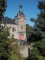 8.69 mi
+561 ft
-574 ft
4h 30
Moderate
 Departure from Braine-le-Comte (Hainaut)
Grand tour of the Bois de la Houssière
 7.35 mi
+410 ft
-430 ft
3h 45
Moderate
Departure from Braine-le-Comte (Hainaut)
Ronquières inclined plane, Canal and Old Brussels-Charleroi Canal
 8.04 mi
+348 ft
-377 ft
4h 00
Moderate
Departure from Braine-le-Comte (Hainaut)
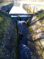
Discover the locks of the old canal in the province of Hainaut
 7.39 mi
+302 ft
-308 ft
3h 40
 Easy
Departure from Seneffe (Hainaut)
Les Longues Hayes
 7.58 mi
+141 ft
-151 ft
3h 35
Moderate
Departure from Le Rœulx (Hainaut)
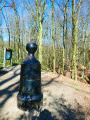
Ronquières and the ‘Bonhomme de Fer’
 10.50 mi
+640 ft
-643 ft
5h 25
Moderate
Departure from Braine-le-Comte (Hainaut)
Braine-le-Comte – Meslin-l’Evèque
 16.43 mi
+230 ft
-417 ft
7h 45
 Difficult
Departure from Braine-le-Comte (Hainaut)
Arquennes, Bois d'Arpes and the old Brussels-Charleroi canal
 7.02 mi
+279 ft
-299 ft
3h 30
Moderate
Departure from Seneffe (Hainaut)
For more walks, use our search engine .
The GPS track and description are the property of this route's author. Please do not copy them without permission.
Scan this QR code with your smartphone's camera.
To open this route on your smartphone, you must have the Visorando app installed. If not, got to the Apple Store (iPhone) or Google Play Store (Android) to download the app.
 Visorando Member
 Tourist office

