


 Country:
 City:


There are quite a few tarmac paths or small country roads with little traffic.
Take care when crossing the N93 on both occasions.
Circular route around Houtain-le-Val


These vast agricultural landscapes offer the advantage of peace and solitude, disturbed only by the occasional tractor in the fields, farm lorries transporting crops or, from time to time, the microlight runway at Baisy-Thy. Although the Genappe Sugar Factory Settling Tanks Nature Reserve is generally closed to the public, the route passes by a birdwatching post situated on the edge of the reserve.
Details
Creation:
Last update:
Last review:
–
–
-
 Activity: Walking
-
 Distance: 10.77 mi
-
 Average duration: 5h 10
-
 Difficulty: Moderate
-
-
 Back to start: Yes
-
 Ascent: + 233 ft
-
 Descent: - 207 ft
-
-
 Highest point: 545 ft
-
 Lowest point: 358 ft
Photos
Waypoints
- S/E : mi 0 - alt. 364 ft - Loupoigne football pitch
- 1 : mi 0.45 - alt. 404 ft - Observation post
- 2 : mi 2.19 - alt. 472 ft - Fork in the road
- 3 : mi 2.52 - alt. 466 ft - The Folles and Pontaille farms
- 4 : mi 2.99 - alt. 486 ft - Rue de Ninove
- 5 : mi 3.58 - alt. 505 ft - Fork in the road
- 6 : mi 4.79 - alt. 492 ft - La Haie Farm
- 7 : mi 5.34 - alt. 489 ft - St Martin’s Tree
- 8 : mi 6.13 - alt. 545 ft - Ferme du Seigneur
- 9 : mi 7.34 - alt. 535 ft - Baisy-Thy microlight centre
- 10 : mi 8.26 - alt. 476 ft - Route
- 11 : mi 8.79 - alt. 440 ft - Domaine L – Crémant de Wallonie
- 12 : mi 9.33 - alt. 400 ft - Loupoigne – Loncée
- 13 : mi 10.41 - alt. 377 ft - Loupoigne Castle
- S/E : mi 10.77 - alt. 364 ft - Loupoigne football pitch
Notes
Worth a visit
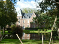
Off the route: Houtain-le-Val Castle (private), beautifully restored
Other walks in the area
Baisy-Thy, Sart-Dames-Avelines and the Ways Marker
 Visorando Member
 4.21 mi
+197 ft
-194 ft
2h 05
 Easy
 Departure from Genappe (Brabant Wallon)
A lovely circular route through the countryside between Baisy-Thy (Genappe) and Sart-Dames-Avelines (Villers-la-Ville), passing by the "Borne de Ways" and crossing the Ry d'Hez twice. The route takes you along the picturesque "Sentier des Échaliers".
Short circular loop through the Bois de Bérinnes in Genappe
 1.91 mi
+161 ft
-151 ft
1h 00
Easy
Departure from Genappe (Brabant Wallon)
A short, almost entirely shaded circular loop in the beautiful little Bois de Bérinnes forest in Genappe. Part of the route runs alongside the Ry d'Hez stream, which has been transformed by beavers. At the start and end of the walk, there are views of some very pretty gardens.
A walk through fields and along field edges from Bousval
3.99 mi
+243 ft
-233 ft
2h 05
Easy
Departure from Genappe (Brabant Wallon)
A lovely, easy walk. It follows sunken paths along field edges and through open countryside. Ideal during the hunting season, as all the paths are open. Start from the car park on Rue de la Forge, near the Ravel.
The Bois Pigeolet and the Châtelet towards Sart-Dames-Avelines
 3.91 mi
+157 ft
-161 ft
1h 55
Moderate
Departure from Villers-la-Ville (Belgique) (Brabant Wallon)
A 6 km circular route that is as pleasant as it is varied, taking you through fields and woods. The route passes through Le Châtelet, the former feudal manor of the lords of Marbais. The route and description are partly (and very loosely) inspired by ‘Walk No. 7’ proposed by the Villers-la-Ville Tourist Office.
A grand tour around Villers-la-Ville Abbey
 11.34 mi
+860 ft
-860 ft
6h 00
Moderate
Departure from Villers-la-Ville (Belgique) (Brabant Wallon)
This country and forest walk takes you on a long tour around the ruins of Villers-la-Ville Abbey (well worth a visit) along a beautiful array of village paths, country lanes and forest trails.
Country walk to the "Vieux Manands"
 3.44 mi
+171 ft
-171 ft
1h 45
Easy
Departure from Genappe (Brabant Wallon)
Starting from the historic site of "Napoleon's last headquarters", this walk will introduce you to a region that is too often overlooked. You will take a quiet road, a dirt track and then paths over a small river before climbing up to a road that you will quickly cross to find another path at the bottom of the garden... And there you are in the centre of Plancenoit for a short while. Very quickly, your steps will take you back to crossroads combining tarmac (a little) and natural ground to cross the river again, then pastures and a historic farm, ending up on a very, very quiet road.
Route du Bois d’Hez: Ry d’Hez and Quatre Chênes
4.60 mi
+266 ft
-266 ft
2h 20
Easy
Departure from Genappe (Brabant Wallon)
A walk through woods and fields around Villers-la-Ville Abbey. This route takes you through the beautiful Bois d’Hez (covered in bluebells in April), as well as the natural habitat of beavers (if you take a short detour to the Ry du Marais des Chiens) and the lovely ‘Plateau des 4 Chênes’, from where you can see Sart-Dames-Avelines and Baisy-Thy in the distance. Towards the end of the route, you’ll also walk alongside the wall of the Abbey Farm.
The Bois de l'Étoile and the Bois Pinchet
3.34 mi
+292 ft
-285 ft
1h 45
Easy
Departure from Villers-la-Ville (Belgique) (Brabant Wallon)
A circular route through the Bois de l'Étoile and across the very pleasant residential neighbourhood of Bois Pinchet, starting from the car park at Villers-la-Ville Abbey. A peaceful and varied route with few roads.
For more walks, use our search engine .
The GPS track and description are the property of this route's author. Please do not copy them without permission.

