Country:

 City:
City:


Below are some details regarding the more challenging sections and possible shortcuts or extensions:
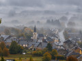
(1) The suggested walk turns left. The first shortcut suggested here avoids the difficult sections between (2) and (4) but misses the viewpoint over the village of Muno (4). For the shortcut, turn right and then immediately left. Pass under the RAVeL viaduct and head towards (6).
(2) The suggested walk takes the grassy path that branches off to the right. The section between (2) and (3) is very quiet, and nature is gradually reclaiming the area: fallen trees and overgrown scrub. Here, at (2), you can continue along the wide path and, further on, take the first path branching off to the right (following the Green Rectangle marker no. 3). This leads to point (3).
(3) For the standard walk, turn right. For the first extended route, carry on straight ahead. Please note: this is where the second difficulty arises: the path becomes a track… which is difficult to find due to timber extraction work (autumn 2026). Once found, the path also turns out to be very little used. It runs along the edge of a former clear-cut area on the right-hand side as far as (4). Numerous young trees are growing on this unmaintained path, making the route difficult between (3) and (4).
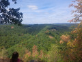
(4) Continue along the path. It turns into an easily passable forest track. At the crossroads, head up to the left and enter France. Follow this track, avoiding all paths leading to the left. Join a track running perpendicular to it and turn right twice to take a sunken track downhill. At the next crossroads, turn left onto a track that runs alongside a meadow until you reach (5).
(5) Turn right onto the road and head towards (6).
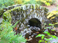
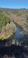
(6) Turn left, cross the stream via the bridge and take the first forest track on the left.
(7) The track is hidden beneath a carpet of leaves. It is no longer very visible. Follow the GPS track via the Visorando app for a few hundred metres until you find a visible track again.
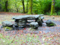
(10) After the picnic shelter, head down the path and turn right at the first junction until you see a gate on the left between the path and the RAVeL.
(11) Go through this gate, closing it behind you, and take the RAVeL to the left.
(12) The suggested walk continues straight on along the RAVeL, passing under the bridge. Here, about 50 metres before the bridge, you can turn left onto the path – a small, leafy tunnel – which leads out into a meadow 10 metres further on. Walk up the meadow to the right, following the RAVeL, until you reach the path. Turn right, cross the bridge over the RAVeL and head for the junction at (14).
(15) A faintly visible path branches off to the right. It is blocked by a removable electric fence. Climb over the fence and close it behind you. The path descends, becomes a footpath, crosses a woodland and turns back into a grassy country lane as it emerges from the woodland. Continue along this path to Watrinsart (16)
(17) The suggested walk continues straight on, joins a small country road and passes above the beautifully restored Ferme du Prieuré. For those who fancy a bit more, turn left and follow the GRP® 162. It passes through Lambermont and reaches (19) by passing beneath the Ferme du Prieuré.
 Visorando Member
 Moderate

 Easy
Easy