


It is recommended that you follow the route in the suggested direction, as the path on either side of (2) is considerably easier to walk up than down and is strongly advised against when walking down in wet weather.
The rest of the route poses no problems in terms of elevation gain, whether going uphill, downhill or in wet weather.
On the heights of the Amblève, starting from Aywaille


Set off to explore the countryside and forests on the heights of the Amblève around the centre of Aywaille, passing in particular through the Goiveux Former Quarries Nature Reserve, the Warnoumont Forest, the Florzé ridge path, the hamlets of Lillé and Martinrive, the former quarries at Chambralles and the meadows of Cwimont.
Details
Creation:
Last update:
Last review:
–
–
-
 Activity: Walking
 -
 Distance: 11.65 mi
 -
 Average duration: 6h 50
 -
 Difficulty: Moderate
 -
-
 Back to start: Yes
 -
 Ascent: + 1,663 ft
 -
 Descent: - 1,644 ft
 -
-
 Highest point: 1,050 ft
 -
 Lowest point: 371 ft
-
 Country:
Belgium
Country:
Belgium
-
 Areas: Massif des Ardennes,
 -
 City:
Aywaille
City:
Aywaille -
 Start/End: N 50.476062° / E 5.678115°
 -


 Hour-by-hour weather
Photos
Waypoints
- S/E : mi 0 - alt. 397 ft - Aywaille municipal car park - Amblève (rivière) - Belgique
- 1 : mi 0.35 - alt. 587 ft - Former quarries at Goiveux
- 2 : mi 0.67 - alt. 663 ft - High vantage point
- 3 : mi 1.47 - alt. 945 ft - Heid des Gattes Nature Reserve
- 4 : mi 2.13 - alt. 958 ft - Battle of 1794 between the French and the Austrians
- 5 : mi 3.16 - alt. 820 ft - Warnoumont Wood
- 6 : mi 5.06 - alt. 981 ft - Tige de Florzé
- 7 : mi 6.01 - alt. 804 ft - The hamlet of Lillé
- 8 : mi 6.8 - alt. 860 ft - Rouvreux
- 9 : mi 7.97 - alt. 410 ft - Martinrive - Amblève (rivière) - Belgique
- 10 : mi 8.35 - alt. 551 ft - Chambralles (old quarries)
- 11 : mi 9.39 - alt. 833 ft - Fork in the road on the outskirts of Awan
- 12 : mi 11 - alt. 417 ft - Railway line
- S/E : mi 11.65 - alt. 394 ft - Aywaille municipal car park - Amblève (rivière) - Belgique
Notes
Other walks in the area
ADEPS walk along the Ravel d'Aywaille
 Visorando Member3.28 mi
+108 ft
-121 ft
1h 35
Visorando Member3.28 mi
+108 ft
-121 ft
1h 35
 Easy
Easy
 Departure from Aywaille (Province de Liège)
5km route of the ADEPS 2026 walk. It allows you to discover the surroundings of Aywaille along the Amblève river.
A treasure hunt is offered as part of this activity.
This route is suitable for pushchairs.
Septroux circular loop
6.58 mi
+951 ft
-958 ft
3h 50
Moderate
Departure from Aywaille (Province de Liège)
A superb walk around Aywaille. It takes you through the region, passing by magnificent spots and offering a circular route around Septroux.
The views are breathtaking, ensuring you'll take home some memorable souvenirs.
ADEPS walk to Septroux and the Bois de Bougneuse Hé
2.99 mi
+453 ft
-453 ft
1h 45
Moderate
Departure from Aywaille (Province de Liège)
A superb walk around Aywaille. It allows you to discover the surroundings of the town, through the Bois de Bougneuse Hey, first uphill and then downhill.
A very nice walk, perfect for a pleasant outing.
Septroux, Chambralle and Oneux via Au Grand Fawe
10.11 mi
+1,004 ft
-991 ft
5h 30
Moderate
Departure from Aywaille (Province de Liège)
A superb walk around Aywaille. It takes you through the region, passing by some magnificent spots.
There are plenty of viewpoints to take in the scenery and create lasting memories.
The hike passes through Chambralle and Oneux.
Septroux, Chambralle and Oneux
12.91 mi
+1,516 ft
-1,529 ft
7h 15
Moderate
Departure from Aywaille (Province de Liège)
A superb walk around Aywaille. It takes you through the region, passing by some magnificent spots. There are plenty of viewpoints to ensure you'll have some memorable souvenirs. The hike alternates between wooded areas and open spaces.
The Amblève Valley starting from Florzé
 7.43 mi
+751 ft
-725 ft
4h 05
Moderate
Departure from Sprimont (Province de Liège)
7.43 mi
+751 ft
-725 ft
4h 05
Moderate
Departure from Sprimont (Province de Liège)
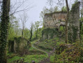
This walk, starting from Florzé Castle, runs alongside the Amblève valley at a distance and returns through the fields and woods of the Sprimont region.
NB: description updated on 30.12.22
Remouchamps - Stoumont
 10.35 mi
+2,077 ft
-1,444 ft
6h 35
Moderate
Departure from Aywaille (Province de Liège)
10.35 mi
+2,077 ft
-1,444 ft
6h 35
Moderate
Departure from Aywaille (Province de Liège)
This stage ofthe GRP® 571 starts in Remouchamps, passes through Sedoz and Fonds de Quarreux close to the Amblève, follows the Chefna stream to the border of the Sources Nature Park and descends into the valley to finish in Stoumont.
Circular route to Xhoris from Harzé
 4.73 mi
+656 ft
-640 ft
2h 45
Easy
Departure from Aywaille (Province de Liège)
4.73 mi
+656 ft
-640 ft
2h 45
Easy
Departure from Aywaille (Province de Liège)
This route takes you through alternating woods and hedgerows with occasional unobstructed views of the countryside. The forests are generally not very overgrown. If you remain quiet, you may see game.
For more walks, use our search engine .
The GPS track and description are the property of this route's author. Please do not copy them without permission.

