


 Country:
 City:
City:


A few points to note:
(2) Caution: you will be crossing a main road, which you must follow for approximately 250 metres (wide grassy verge).
(5) Here the path crosses the Mortier stream (official name) or the Richelette (local or common name) and follows it.
This is where the tricky bit begins, as walkers often cannot avoid the stream bed. Wellies are essential after heavy rain. There is also a small sign at the junction of the paths stating that wellies are recommended… for everyone, big and small!
(9) Caution: you will be crossing the same A-road as in (2).
(12) After the viewpoint overlooking Val-Dieu Abbey, the path descends into the pasture and reaches a gate/turnstile. Go through this turnstile and do not continue along the meadow through the woodland, but take the path that climbs to the top of the embankment and joins the road.
Circular wooded walk in the Pays de Herve starting from Charneux


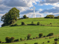
The Pays de Herve is known for its green, rolling countryside, its hedgerows, its stone walls, its large farms, its livestock and its fruit trees dotted amongst the pastures. This circular walk takes you on a journey to discover part of this area between Charneux, Bolland, Mortier and Saint-André.
Details
Creation:
Last update:
Last review:
–
–
-
 Activity: Walking
 -
 Distance: 13.50 mi
 -
 Average duration: 7h 25
 -
 Difficulty: Difficult
 -
-
 Back to start: Yes
 -
 Ascent: + 1,368 ft
 -
 Descent: - 1,381 ft
 -
-
 Highest point: 1,020 ft
 -
 Lowest point: 469 ft
Photos
Description of the walk
Waypoints
- S/E : mi 0 - alt. 755 ft - Charneux Church
- 1 : mi 0.25 - alt. 715 ft - Haméval Castle and Farm
- 2 : mi 1.69 - alt. 1,010 ft - Herve North Business Park
- 3 : mi 2.72 - alt. 814 ft - Former Convent
- 4 : mi 3.6 - alt. 876 ft - Above Bolland
- 5 : mi 4.7 - alt. 656 ft - Mortier or Richelette Stream
- 6 : mi 5.32 - alt. 679 ft - Mortier
- 7 : mi 6.02 - alt. 682 ft - Monceau
- 8 : mi 6.61 - alt. 499 ft - Loneux Stream
- 9 : mi 7.27 - alt. 669 ft - Saint-André
- 10 : mi 8.46 - alt. 486 ft - Asse Stream
- 11 : mi 9.71 - alt. 630 ft - Mauhin
- 12 : mi 10.35 - alt. 591 ft - Above Val-Dieu Abbey
- 13 : mi 11.23 - alt. 650 ft - Fork in the road
- 14 : mi 12.48 - alt. 843 ft - Charneux Cross
- S/E : mi 13.5 - alt. 755 ft - Charneux Church
Notes
There is a large picnic table with a barbecue just after you come out of the small copse between (9) and (10).
Worth a visit
Val-Dieu Abbey
Other walks in the area
Boucle de la Croix in Charneux
 Visorando Member6.55 mi
+568 ft
-571 ft
3h 30
Visorando Member6.55 mi
+568 ft
-571 ft
3h 30
 Moderate
 Departure from Herve (Province de Liège)
This loop takes you through green countryside, small hamlets typical of the region, and the rolling landscapes of the Pays de Herve. It is a perfect hike for nature lovers, relaxation and discovering rural heritage.
The hike usually starts in the village of Charneux, often from Rue Petit Vinâve. The route is well marked in red, making it easy to follow even for less experienced hikers.
Circular starting from Val Dieu
 4.22 mi
+390 ft
-394 ft
2h 15
4.22 mi
+390 ft
-394 ft
2h 15
 Easy
Departure from Aubel (Province de Liège)
Easy
Departure from Aubel (Province de Liège)
Short hike starting from Val Dieu, passing by the interesting viewpoint of the Knuppelstock bunker and the meadows of the Aubel region, Herve plateau.
Farms and the Old Convent around Bolland
4.07 mi
+518 ft
-502 ft
2h 20
Easy
Departure from Herve (Province de Liège)
Crossing through Bois Bolland. Discover old farmhouses typical of the Pays de Herve.
A 6.6 km walk through a hilly region, ideal for families, but not suitable for pushchairs due to the need to navigate over stepping stones. Wellies recommended.
Follow the Yellow Rectangle markings.
Walk suggested by the Pays de Herve.
In the Melen countryside
4.36 mi
+217 ft
-217 ft
2h 10
Easy
Departure from Soumagne (Province de Liège)
Discover Melen and its countryside, its footpaths; walk across its meadows and admire the village from a lovely vantage point.
In the land of Liège syrup
7.45 mi
+469 ft
-463 ft
3h 50
Moderate
Departure from Aubel (Province de Liège)
A beautiful circular route starting from the lovely village of Aubel, taking you through meadows, idyllic paths and wooded areas, passing close to the Berwinne. On a sunny day, take in these magnificent landscapes. A route that won’t disappoint.
On the blackthorn path
5.67 mi
+331 ft
-348 ft
2h 55
Easy
Departure from Soumagne (Province de Liège)
A lovely, very rural route in the beautiful Soumagne region.
For more walks, use our search engine .
The GPS track and description are the property of this route's author. Please do not copy them without permission.

