


There are a few benches along the route, particularly from Ruy onwards. There is a picnic shelter and BBQ area (13).
Very little tarmac.
Ignore the few ‘Private property, no entry’ signs: the entire route is open to the public and follows, for the most part, sections of signposted local walking trails.
The route may be muddy in places depending on the season and/or the weather.
One major drawback: peace and quiet cannot be guaranteed when motor racing events are taking place on the Spa-Francorchamps route.
The Roannay Valley and Mont des Brumes


Set off to explore the northern part of the magnificent Roannay Valley between Francorchamps (the Consoux district) and Moulin du Ruy. Alternating between woodland and countryside scenery, with lovely views of both the valley floor and its two slopes, the route is sure to delight you. Whilst the walk does not go over the summit of Mont des Brumes, it does cross the downhill ski run and its ski lifts.
Details
Creation:
Last update:
Last review:
–
–
-
 Activity: Walking
-
 Distance: 10.39 mi
-
 Average duration: 6h 05
-
 Difficulty: Moderate
-
-
 Back to start: Yes
-
 Ascent: + 1,467 ft
-
 Descent: - 1,483 ft
-
-
 Highest point: 1,814 ft
-
 Lowest point: 984 ft
-
 Country:
Belgium
-
 Area: Massif des Ardennes
-
 City:
Stavelot
-
 Start/End: N 50.462035° / E 5.948913°
-


 Hour-by-hour weather
Photos
Waypoints
- S/E : mi 0 - alt. 1,608 ft - Consoux / Gros Bois
- 1 : mi 0.98 - alt. 1,804 ft - Near Malchamps
- 2 : mi 2.25 - alt. 1,234 ft - Near the Roannay stream – outbound
- 3 : mi 2.95 - alt. 1,378 ft - Near Chevrouheid
- 4 : mi 4.22 - alt. 1,010 ft - Ruy
- 5 : mi 4.35 - alt. 997 ft - The stream at
- 6 : mi 4.67 - alt. 1,171 ft - Roumez
- 7 : mi 5 - alt. 1,266 ft - Exbomont
- 8 : mi 5.45 - alt. 1,424 ft - Above Moulin du Ruy
- 9 : mi 6.07 - alt. 1,650 ft - Grandes Fagnes
- 10 : mi 6.95 - alt. 1,329 ft - Mont des Brumes ski slope
- 11 : mi 8.16 - alt. 1,362 ft - Neuville
- 12 : mi 8.57 - alt. 1,217 ft - Near the Roannay stream – return
- 13 : mi 9.88 - alt. 1,463 ft - Picnic shelter and BBQ
- S/E : mi 10.39 - alt. 1,608 ft - Consoux / Gros Bois
Notes
Worth a visit
Off the route:
- the Coo Waterfall to the south-west,
- the Berinzenne estate and the Fagne de Malchamps to the north-west,
- the pretty little town of Stavelot.
Other walks in the area
The Roannay Valley starting from Francorchamps
 Visorando Member
 7.60 mi
+1,027 ft
-1,043 ft
4h 25
Moderate
 Departure from Stavelot (Province de Liège)
A circular route almost entirely through woodland along the River Roannay. This route combines two walks: Le Roannay, Yellow Cross and Hé Stienne Red Rectangles.
The Malchamps fens
 6.56 mi
+751 ft
-768 ft
3h 40
Moderate
Departure from Jalhay (Province de Liège)
Walk in the Malchamps Fagnes region through peat bogs, forests and meadows. Set off at sunrise with the sound of deer bellowing in the background.
The Belvédère de la Reine, starting from Hockal
 2.26 mi
+262 ft
-262 ft
1h 15
 Easy
Departure from Jalhay (Province de Liège)
This lovely, short and easy walk will take you to the Pont du Centenaire and the Belvédère de la Reine.
From the Malchamps Fagnes to the Barisart Springs
 6.99 mi
+817 ft
-827 ft
3h 55
Moderate
Departure from Spa (Province de Liège)
Set off to explore the western part of the Malchamps Fagnes, with a superb view to the east from the top of the Berinzenne Tower. Then head west along the ridge towards the Col du Rosier before turning off into the forest towards the Thiers des Rexhons ski run. A little further on, you’ll discover the Spa springs. The path linking the Fontaine de la Géronstère (to the south) with the Barisart spring (to the north) is simply splendid. And the path leading up towards Pouhon Pia is just as interesting. All that remains is to make your way back to the starting point, passing close to the picnic and barbecue area at the Domaine de Berinzenne.
The Malchamps moor and the Roannay stream
 11.62 mi
+1,240 ft
-1,253 ft
6h 25
Moderate
Departure from Spa (Province de Liège)
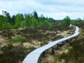
Whilst the two highlights of this walk are mentioned in the title, the rest of the route is through woodland and offers some fine views of the opposite slope and Mont des Brumes.Starting from the Domaine de Bérinzenne, the route heads due south, crosses the old Vecquée and descends towards Andrimont, where it turns eastwards to reach Chevrouheid and the Pont de Neuville over the Roannay stream.The walk follows the course of the Roannay for a good two kilometres, crossing numerous footbridges, and leaves it shortly before its source.This is followed by a bit of a winding route through a well-ventilated forest alternating between spruce and deciduous trees before reaching Malchamps.After the pylons, the route enters the Fagne de Malchamps via a path through the Vecquée covered with wooden decking to keep your feet dry. The Fagne landscape is guaranteed (moors, marshes, peat bogs, pools, shrubs and native flora) both from the path and from the top of the panoramic observation tower.
Loop around Creppe from Bérinzenne
 10.99 mi
+1,125 ft
-1,132 ft
6h 00
Moderate
Departure from Spa (Province de Liège)
Starting from the car park at Domaine de Bérinzenne, the hike begins by crossing the site before gradually entering the forest for just over a third of its total distance. This is followed by a few kilometres of countryside around the village of Creppe before rejoining the forest at the bottom of the Bois de Mambaye. After passing the castle of the same name, which has been converted into a nature education centre, the route quickly joins the Meyerbeer stream and follows it upstream to the Fontaine de Géronstère, one of the many springs in the spa town. Food and refreshments are available on site. Return through the forest and uphill to the starting point.
La Hoëgne and La Statte
 10.57 mi
+1,115 ft
-1,106 ft
5h 50
 Difficult
Departure from Jalhay (Province de Liège)
This magnificent walk, mainly through woodland, offers a leisurely exploration of two of the three iconic streams of the Hautes-Fagnes on the south-western side of Baraque Michel. The route follows one stream upstream and the other downstream.Feel free to walk the route in both directions, as the experience of a rushing stream is often better when walking upstream. You will most likely discover other aspects of it.The third stream in the region is the Sawe, which the route follows very briefly between kilometres 2 and 3. Numerous footbridges and boardwalks make it easier to navigate this wild, picturesque, sometimes chaotic, sometimes muddy environment, where the paths are covered in rocks and roots.
For more walks, use our search engine .
The GPS track and description are the property of this route's author. Please do not copy them without permission.

