


At (4) a picnic table or bench...
In the woods of Arville


From the small car park at the back of the Arville barbecue area (at the end of Rue de la Supinette), the walk heads through the countryside towards the Lozet Biai pond. At Le Paradis, the route enters the woods and remains there almost all the way to the finish.
Wide paths or narrow tracks, stony, muddy, grassy and even a bit soggy in places, are the main features of this route. Only 600 metres of tarmac at the start and a 200-metre break about a third of the way along the route allow you to keep your boots reasonably dry… you can wipe your boots clean when crossing a few small fords further on, but recent forestry work will almost certainly quickly undo any cleaning efforts.
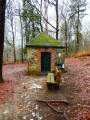
Apart from the ever-present forest, walkers pass by the Halifax memorial as well as the Notre-Dame de Bon-Secours Chapel, also known as the Chapelle du Cheny du Mont, where there is a bench.
On the way back, there’s a lovely view on the horizon of the outskirts of Arville.
Details
Creation:
Last update:
Last review:
–
–
-
 Activity: Walking
 -
 Distance: 9.45 mi
 -
 Average duration: 5h 05
 -
 Difficulty: Moderate
 -
-
 Back to start: Yes
 -
 Ascent: + 823 ft
 -
 Descent: - 827 ft
 -
-
 Highest point: 1,696 ft
 -
 Lowest point: 1,198 ft
-
 Country:
Belgium
Country:
Belgium
-
 Area: Massif des Ardennes
 -
 City:
Saint-Hubert (Belgique)
City:
Saint-Hubert (Belgique) -
 Start/End: N 50.038765° / E 5.309215°
 -


 Hour-by-hour weather
Photos
Waypoints
- S/E : mi 0 - alt. 1,407 ft - Arville picnic area and barbecue
- 1 : mi 0.73 - alt. 1,316 ft - Au Paradis
- 2 : mi 2.52 - alt. 1,604 ft - Halifax Memorial
- 3 : mi 4.44 - alt. 1,480 ft - Parfond Ri
- 4 : mi 6.84 - alt. 1,335 ft - Chapel and bench at Cheni du Mont
- S/E : mi 9.45 - alt. 1,407 ft - Arville picnic area and barbecue
Notes
Other walks in the area
The River Lomme between Arville and Smuid
 Visorando Member
 9.90 mi
+938 ft
-925 ft
5h 20
Moderate
9.90 mi
+938 ft
-925 ft
5h 20
Moderate
 Departure from Saint-Hubert (Belgique) (Province de Luxembourg)
Starting from Arville cemetery, the walk heads due north at first, then turns west to reach the Chapelle du Cheny du Mont.The second stop is the Rocher de Marie Gobaille, named after a legendary witch. It is from this point that the route begins to follow the course of the River Lomme upstream.The third stop is the Sainte-Adeline Canal, running alongside the River Lomme, with its small hydroelectric power station and, further on, the old mill at Pont-à-Smuid.This is followed by a short detour to the other side of the Brussels–Luxembourg railway line to follow the route of an old local track, and a return to the starting point after crossing both the River Lomme and the railway line once more and skirting the motocross route near the Ferme du Val-de-Poix.The entire route runs through woodland from the second kilometre onwards.
Circular forest loop between Poix-Saint-Hubert and Hatrival
 6.93 mi
+860 ft
-843 ft
3h 55
Moderate
Departure from Saint-Hubert (Belgique) (Province de Luxembourg)
6.93 mi
+860 ft
-843 ft
3h 55
Moderate
Departure from Saint-Hubert (Belgique) (Province de Luxembourg)
This mainly woodland walk takes the walker from the centre of Poix-Saint-Hubert to the outskirts of Hatrival, where the route passes by the Écurie des Îles (a horse breeding and trading centre) before branching off into the woods again. There isa short stretch through fairly wild, overgrown terrain in the Bois de Poix around the 1 km mark. Shortly after the 7.5 km mark, the route literally plunges down the eastern slope of the Lomme (still known as L’Homme in some places) and passes under the Brussels–Luxembourg railway line. After a steep climb of a few hundred metres, the walk turns right to head back down towards the station and the starting point, passing by the village school.
In the woods of Poix Saint-Hubert
 5.71 mi
+741 ft
-738 ft
3h 15
Moderate
Departure from Saint-Hubert (Belgique) (Province de Luxembourg)
5.71 mi
+741 ft
-738 ft
3h 15
Moderate
Departure from Saint-Hubert (Belgique) (Province de Luxembourg)
A walk through the woods of the Val de Poix. Suitable at any time of year: in summer for the cool air, in autumn for the colours, or in the snow for a peaceful atmosphere.
Walk in Val de Poix
 5.78 mi
+554 ft
-541 ft
3h 10
5.78 mi
+554 ft
-541 ft
3h 10
 Easy
Departure from Saint-Hubert (Belgique) (Province de Luxembourg)
Easy
Departure from Saint-Hubert (Belgique) (Province de Luxembourg)
Circular forest to discover the Chapel of Notre-Dame de Bon Secours, the Rocher Marie Gobaille and ending along the Lomme with its two 19th-century buildings, formerly hydroelectric power stations.
Family walk in Poix-Saint-Hubert
 4.62 mi
+528 ft
-512 ft
2h 35
Easy
Departure from Saint-Hubert (Belgique) (Province de Luxembourg)
4.62 mi
+528 ft
-512 ft
2h 35
Easy
Departure from Saint-Hubert (Belgique) (Province de Luxembourg)
The children in the group will love it… some of the adults, perhaps a little less so: around km 1, the GR®17 follows a barely visible path through mature forests, young spruce trees, young birch trees, broom and also a few brambles. It’s quite refreshing with the morning dew or after a good downpour!
Discover the essentials of Mirwart
 4.41 mi
+505 ft
-486 ft
2h 30
Easy
Departure from Saint-Hubert (Belgique) (Province de Luxembourg)
4.41 mi
+505 ft
-486 ft
2h 30
Easy
Departure from Saint-Hubert (Belgique) (Province de Luxembourg)
Glacière, ponds, arboretum, Croix des Bûcherons: circular around Mirwart Castle.
The grand tour of Mirwart
 9.92 mi
+1,086 ft
-1,056 ft
5h 30
Moderate
Departure from Saint-Hubert (Belgique) (Province de Luxembourg)
9.92 mi
+1,086 ft
-1,056 ft
5h 30
Moderate
Departure from Saint-Hubert (Belgique) (Province de Luxembourg)
Glacière, ponds, arboretum, Croix des Bûcherons, but also Croix des Morts, La Lomme, Rocher de Marie Gobaille. Let's set off on the grand tour of Mirwart.
A woodland walk to Mirwart Castle
 9.87 mi
+876 ft
-896 ft
5h 20
Moderate
Departure from Saint-Hubert (Belgique) (Province de Luxembourg)
9.87 mi
+876 ft
-896 ft
5h 20
Moderate
Departure from Saint-Hubert (Belgique) (Province de Luxembourg)
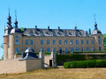
Set off to explore the vast forest of Saint-Hubert from Mirwart, taking a more open route through the rural hills of Arville. On the return journey, the route follows the meandering course of the River Lomme and its numerous passages under the railway line before climbing up the avenue leading to Mirwart Castle, which was splendidly renovated at the start ofthe 21st centuryand transformed into a hotel, restaurant and venue for receptions, seminars and outdoor events.
For more walks, use our search engine .
The GPS track and description are the property of this route's author. Please do not copy them without permission.

