


It is, of course, possible to complete this walk using nothing more than the route downloaded via the Visorando app, but using the Totemus mobile app and the roadbook – which is gradually revealed after each stage of the treasure hunt – enhances its informative and educational value (navigation, location identification and historical, geographical or ecological context through texts and photographs) for everyone, whilst incorporating a real appeal for children through its playful nature.
Totem of the Knights of Opprebais


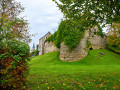
Revitalising the concept of the treasure hunt and pioneering educational and fun routes in partnership with local tourism stakeholders, Totemus offers you the chance to discover the main heritage and natural features of the village of Opprebais, just as the knights who once lived in these parts might have done.
Details
Creation:
Last update:
Last review:
–
–
-
 Activity: Walking
-
 Distance: 2.96 mi
-
 Average duration: 1h 25
-
 Difficulty: Easy
-
-
 Back to start: Yes
-
 Ascent: + 72 ft
-
 Descent: - 75 ft
-
-
 Highest point: 446 ft
-
 Lowest point: 341 ft
-
 Country:
Belgium
-
 City:
Incourt (Belgique)
-
 Start/End: N 50.680338° / E 4.797962°
-


 Hour-by-hour weather
Photos
Description of the walk
Waypoints
- S/E : mi 0 - alt. 381 ft - Opprebais centre – Rue Axiale
- 1 : mi 0.21 - alt. 394 ft - Fork in the road
- 2 : mi 0.57 - alt. 443 ft - Gustot Mill
- 3 : mi 0.86 - alt. 407 ft - Saint-Aubain Church
- 4 : mi 1.6 - alt. 348 ft - Path around the old quarry
- 5 : mi 2.3 - alt. 384 ft - Nature area and playground
- S/E : mi 2.96 - alt. 381 ft - Opprebais centre – Rue Axiale
Notes
Mixed route: tracks/paths and village streets/tarmac roads between villages.
Other walks in the area
The Brabant countryside, starting from Sart-Risbart
 Visorando Member
 8.14 mi
+184 ft
-171 ft
3h 55
 Moderate
 Departure from Incourt (Belgique) (Brabant Wallon)
This short walk through the Brabant countryside, including a visit to the Champt’aine Nature Reserve, offers a chance to get some fresh air and recharge your batteries away from the hustle and bustle of the big cities. Thelandscapes vary greatly depending on the season.
La Ramée and the Brabant countryside
 11.69 mi
+312 ft
-328 ft
5h 40
Moderate
Departure from Incourt (Belgique) (Brabant Wallon)
A sense of solitude prevails in these vast rural expanses.Few roads, few tracks, plenty of country lanes – some with grass that isn’t too short, and the traditional cobblestones of Walloon Brabant – will take you through the countryside to discover farms with monumental porches.The morning mist or the afternoon sun lend markedly different atmospheres to these majestic buildings and to the countryside, which is devoted to growing vegetables and cereals, as well as to livestock farming and the production of apples and pears.
Thorembais-Saint-Trond – Louvain-la-Neuve
 9.44 mi
+138 ft
-246 ft
4h 30
Moderate
Departure from Perwez (Brabant Wallon)
A point of transition. Moving from the tranquillity of the countryside to the bustling life of a university town, from buildings that are sometimes very old to the modernity of a city built in the20th century. From quiet country lanes with little traffic to the approach to one of the region’s busiest motorways, and then on to the pedestrianised centre of the university campus – some will miss the former, whilst others will revel in the atmosphere of the new town.
Forest walk at Fort des Voiles
 8.96 mi
+682 ft
-696 ft
4h 45
Moderate
Departure from Chaumont-Gistoux (Brabant Wallon)
The Fort des Voiles, also known as Ferme Rose for obvious reasons, was successively used as a glass furnace, a flour mill and a fish farm (trout).The name Fort des Voiles is thought to come from a distortion of "for à voires", which in Walloon means "glass furnace".In the 17th century, the glass industry required a lot of wood, which would explain its geographical location.The fish farm was created a little further down, along the Ruisseau du Glabais stream, and operated from 1950 until around 2000, when the presence of beavers and a sewage treatment plant, located upstream of the stream and inadequately protected against flooding, forced the owners to cease operations for health reasons.The current buildings date from the 1920s.
In Brabant Hesbaye via Jodoigne-Souveraine
9.43 mi
+453 ft
-456 ft
4h 45
Moderate
Departure from Jodoigne (Brabant Wallon)
Enjoy the fresh air in the rolling countryside south of Jodoigne.Fields and crops await you.Things to see along the route: a few chapels, Dongelberg Castle (a kind of local coliseum that has suffered the ravages of time), a cross commemorating a former French military cemetery, in the distance the twisted bell tower of the Chapel of Notre-Dame-du-Marché on the Grand-Place in Jodoigne, the pretty village of Jauchelette.
Circular route around Melin and Gobertange
3.43 mi
+167 ft
-154 ft
1h 45
Easy
Departure from Jodoigne (Brabant Wallon)
A walk around Melin and Gobertange offering the chance to discover some beautiful stone buildings in Gobertange. This route was explored during a 5 km ADEPS walk in Melin on 13 August 2023.
Walk between Hèze, Roux-Miroir and Longueville
 10.52 mi
+440 ft
-456 ft
5h 15
Moderate
Departure from Grez-Doiceau (Brabant Wallon)
Hèze, Piétrebais, Roux-Miroir, Longueville … the first part is almost exclusively rural, passing by the Ferme du Grand Hacquedeau, which has been magnificently renovated and set off to its best advantage in an idyllic setting. After Longueville, the route becomes more wooded, crosses the Bois de Bonlez, passes the Ferme du Fort des Voiles before continuing through the Bois de Glabais and heading back up into the countryside overlooking Hèze on the southern side.
Circular route around Grez-Doiceau
4.87 mi
+230 ft
-226 ft
2h 25
Easy
Departure from Grez-Doiceau (Brabant Wallon)
A short 8 km circular walk starting from the Grez-Doiceau Post Office. This walk takes you along the cycle path, footpaths, fields and woods. You will pass through a few streets in Grez-Doiceau, but the route is mostly sheltered from traffic, except for a straight stretch towards Biez. A simple yet varied route ideal for daily walks starting from Grez.
For more walks, use our search engine .
The GPS track and description are the property of this route's author. Please do not copy them without permission.

