


There are quite a few benches and picnic tables along this route.
Between Laval and the western Ourthe, starting from Lavacherie


The valleys of the western Ourthe, its tributary the Laval, and the Orti Nature Reserve are particularly interesting at the start. After Wachirock, a succession of lovely countryside scenes unfolds, with panoramic views across this beautiful, rolling region. The stretch between Tillet and Amberloup offers a particularly relaxing atmosphere. The return journey along the outskirts of Tonny, through the countryside, in the undergrowth or along the edges of woodland, provides a very pleasant finale to this easy walk.
Keen observers will probably spot the odd remnant of a work of art near the nature reserve, the gigantic white building of the holiday centre overlooking Amberloup, and the Château du Celly in the direction of the Cheslin Rocks. Happy spotting! Well worth a go in any season!
Details
Creation:
Last update:
Last review:
–
–
-
 Activity: Walking
 -
 Distance: 9.36 mi
 -
 Average duration: 5h 00
 -
 Difficulty: Moderate
 -
-
 Back to start: Yes
 -
 Ascent: + 837 ft
 -
 Descent: - 817 ft
 -
-
 Highest point: 1,542 ft
 -
 Lowest point: 1,188 ft
-
 Country:
Belgium
Country:
Belgium
-
 Area: Massif des Ardennes
 -
 City:
Sainte-Ode
City:
Sainte-Ode -
 Start/End: N 50.052394° / E 5.510318°
 -


 Hour-by-hour weather
Photos
Waypoints
- S/E : mi 0 - alt. 1,257 ft - Former Lavacherie school
- 1 : mi 1.08 - alt. 1,214 ft - Footbridge over the - Ourthe occidentale (rivière) - Affluent de l'Ourthe
- 2 : mi 1.61 - alt. 1,230 ft - Artwork ‘Maiandros’ by Norska
- 3 : mi 1.74 - alt. 1,247 ft - Laval Stream
- 4 : mi 2.62 - alt. 1,247 ft - Wachirock Estate
- 5 : mi 3.68 - alt. 1,388 ft - Ménil farms
- 6 : mi 5.45 - alt. 1,319 ft - Tillet
- 7 : mi 6.64 - alt. 1,247 ft - Amberloup
- 8 : mi 7.03 - alt. 1,253 ft - Tonny
- 9 : mi 7.56 - alt. 1,470 ft - Hunting lodge
- 10 : mi 8.64 - alt. 1,355 ft - The Mâle Racine stream
- S/E : mi 9.36 - alt. 1,257 ft - Former Lavacherie School
Notes
Other walks in the area
Chapelle de la Bonne Dame and Cheslin Viewpoint
 Visorando Member
 6.15 mi
+725 ft
-705 ft
3h 30
Moderate
6.15 mi
+725 ft
-705 ft
3h 30
Moderate
 Departure from Sainte-Ode (Province de Luxembourg)
From the beautiful village of Lavacherie, set off to explore the Chapelle de la Bonne Dame and the Cheslin viewpoint. On your way back, pass by the Golet campsite and through the village streets, where magnificent houses built from local stone come into view.
Cheslin loop
 10.40 mi
+1,198 ft
-1,201 ft
5h 50
Moderate
Departure from Sainte-Ode (Province de Luxembourg)
10.40 mi
+1,198 ft
-1,201 ft
5h 50
Moderate
Departure from Sainte-Ode (Province de Luxembourg)
This beautiful hike in Sainte-Ode takes you on a journey of discovery through the valleys of the Ourthe, Baseille and Laval streams, alternating between forest and pretty panoramic views of this region of the Ardennes, with a return trip through the Orti Nature Reserve.
Circular route via Lavacherie
 13.01 mi
+866 ft
-846 ft
6h 45
13.01 mi
+866 ft
-846 ft
6h 45
 Difficult
Departure from Sainte-Ode (Province de Luxembourg)
Difficult
Departure from Sainte-Ode (Province de Luxembourg)
As a result, the walk is more rural than wooded, offering more panoramic views of this beautiful region. Whilst the natural scenery is lovely, don’t expect too many architectural or artistic highlights: there are a few works of art along the old country lane between Amberloup and Lavacherie, the Saint-Hubert Chapel in Bonnerue and the Church of Saint-Ouen in Tillet with its separate bell tower, but that’s about it.
The Art Trail of the Orti Nature Reserve
 2.59 mi
+92 ft
-105 ft
1h 15
2.59 mi
+92 ft
-105 ft
1h 15
 Easy
Departure from Sainte-Ode (Province de Luxembourg)
Easy
Departure from Sainte-Ode (Province de Luxembourg)
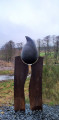
The walk begins in an orchard with heritage fruit varieties and an apiary, before following a sunken path that descends to the bottom of the Laval Valley. Beavers, ponds, artistic installations... so many discoveries await you.
In the Laval and Western Ourthe valleys
 6.15 mi
+453 ft
-430 ft
3h 15
Moderate
Departure from Sainte-Ode (Province de Luxembourg)
6.15 mi
+453 ft
-430 ft
3h 15
Moderate
Departure from Sainte-Ode (Province de Luxembourg)
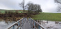
A few sculptures, a bit of nature reserve with the occasional sign of beavers here and there, and a bit of countryside: that’s what this walk has to offer.
Around the Basseille Stream
 10.57 mi
+1,043 ft
-1,027 ft
5h 45
Moderate
Departure from Tenneville (Province de Luxembourg)
10.57 mi
+1,043 ft
-1,027 ft
5h 45
Moderate
Departure from Tenneville (Province de Luxembourg)
The Ruisseau de Basseille has its source in the Fagne de la Borne near the Saint-Hubert Aerodrome and flows into the western Ourthe near Ortheuville. This walk follows its course more or less closely for about 6 km.
Passing through La Basseille
 5.27 mi
+673 ft
-673 ft
3h 00
Easy
Departure from Tenneville (Province de Luxembourg)
5.27 mi
+673 ft
-673 ft
3h 00
Easy
Departure from Tenneville (Province de Luxembourg)
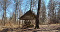
Set off to explore the River La Basseille, a tributary of the Ourthe which rises in Saint-Hubert. The river, whose banks form a Nature Reserve, flows exclusively through the Forest of Freyr for around 10 km.
Please note: there are two sections that are more difficult to follow; a GPX track is recommended.
Ardennes circular starting from Champlon
 10.52 mi
+961 ft
-935 ft
5h 40
Moderate
Departure from Tenneville (Province de Luxembourg)
10.52 mi
+961 ft
-935 ft
5h 40
Moderate
Departure from Tenneville (Province de Luxembourg)
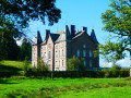
The hike takes you on a journey of discovery through the countryside and forests on the heights of the Deux Ourthes Natural Park. The balanced alternation between panoramic views and deciduous and coniferous forests provides all the ingredients for a beautiful and enjoyable outing in nature.
For more walks, use our search engine .
The GPS track and description are the property of this route's author. Please do not copy them without permission.

