


The Brabant countryside, starting from Sart-Risbart


This short walk through the Brabant countryside, including a visit to the Champt’aine Nature Reserve, offers a chance to get some fresh air and recharge your batteries away from the hustle and bustle of the big cities. Thelandscapes vary greatly depending on the season.
Details
Creation:
Last update:
Last review:
–
–
-
 Activity: Walking
 -
 Distance: 8.14 mi
 -
 Average duration: 3h 55
 -
 Difficulty: Moderate
 -
-
 Back to start: Yes
 -
 Ascent: + 184 ft
 -
 Descent: - 171 ft
 -
-
 Highest point: 499 ft
 -
 Lowest point: 322 ft
-
 Country:
Belgium
Country:
Belgium
-
 City:
Incourt (Belgique)
City:
Incourt (Belgique) -
 Start/End: N 50.68282° / E 4.764223°
 -


 Hour-by-hour weather


Photos
Waypoints
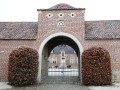
- S/E : mi 0 - alt. 456 ft - Notre-Dame Chapel
- 1 : mi 2.41 - alt. 476 ft - Arnelle
- 2 : mi 3.78 - alt. 351 ft - Champt’aine Nature Reserve
- 3 : mi 3.88 - alt. 322 ft - Old local road between Courcelles and Incourt
- 4 : mi 5.3 - alt. 407 ft - Menhir
- 5 : mi 5.83 - alt. 443 ft - Rue Alphonse Robert
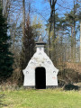
- 6 : mi 6.6 - alt. 499 ft - Chapel of the Loving God
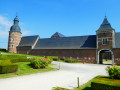
- 7 : mi 7.62 - alt. 466 ft - Fontenelle Castle
- S/E : mi 8.14 - alt. 456 ft - Notre-Dame Chapel
Other walks in the area
Forest walk at Fort des Voiles
 Visorando Member
 8.96 mi
+682 ft
-696 ft
4h 45
Moderate
8.96 mi
+682 ft
-696 ft
4h 45
Moderate
 Departure from Chaumont-Gistoux (Brabant Wallon)
The Fort des Voiles, also known as Ferme Rose for obvious reasons, was successively used as a glass furnace, a flour mill and a fish farm (trout).The name Fort des Voiles is thought to come from a distortion of "for à voires", which in Walloon means "glass furnace".In the 17th century, the glass industry required a lot of wood, which would explain its geographical location.The fish farm was created a little further down, along the Ruisseau du Glabais stream, and operated from 1950 until around 2000, when the presence of beavers and a sewage treatment plant, located upstream of the stream and inadequately protected against flooding, forced the owners to cease operations for health reasons.The current buildings date from the 1920s.
Thorembais-Saint-Trond – Louvain-la-Neuve
 9.44 mi
+138 ft
-246 ft
4h 30
Moderate
Departure from Perwez (Brabant Wallon)
9.44 mi
+138 ft
-246 ft
4h 30
Moderate
Departure from Perwez (Brabant Wallon)
A point of transition. Moving from the tranquillity of the countryside to the bustling life of a university town, from buildings that are sometimes very old to the modernity of a city built in the20th century. From quiet country lanes with little traffic to the approach to one of the region’s busiest motorways, and then on to the pedestrianised centre of the university campus – some will miss the former, whilst others will revel in the atmosphere of the new town.
La Ramée and the Brabant countryside
 11.69 mi
+312 ft
-328 ft
5h 40
Moderate
Departure from Incourt (Belgique) (Brabant Wallon)
11.69 mi
+312 ft
-328 ft
5h 40
Moderate
Departure from Incourt (Belgique) (Brabant Wallon)
A sense of solitude prevails in these vast rural expanses.Few roads, few tracks, plenty of country lanes – some with grass that isn’t too short, and the traditional cobblestones of Walloon Brabant – will take you through the countryside to discover farms with monumental porches.The morning mist or the afternoon sun lend markedly different atmospheres to these majestic buildings and to the countryside, which is devoted to growing vegetables and cereals, as well as to livestock farming and the production of apples and pears.
Circular route around Grez-Doiceau
4.87 mi
+230 ft
-226 ft
2h 25
 Easy
Departure from Grez-Doiceau (Brabant Wallon)
Easy
Departure from Grez-Doiceau (Brabant Wallon)
A short 8 km circular walk starting from the Grez-Doiceau Post Office. This walk takes you along the cycle path, footpaths, fields and woods. You will pass through a few streets in Grez-Doiceau, but the route is mostly sheltered from traffic, except for a straight stretch towards Biez. A simple yet varied route ideal for daily walks starting from Grez.
In Brabant Hesbaye via Jodoigne-Souveraine
9.43 mi
+453 ft
-456 ft
4h 45
Moderate
Departure from Jodoigne (Brabant Wallon)
Enjoy the fresh air in the rolling countryside south of Jodoigne.Fields and crops await you.Things to see along the route: a few chapels, Dongelberg Castle (a kind of local coliseum that has suffered the ravages of time), a cross commemorating a former French military cemetery, in the distance the twisted bell tower of the Chapel of Notre-Dame-du-Marché on the Grand-Place in Jodoigne, the pretty village of Jauchelette.
Discovering Chaumont-Gistoux
 11.99 mi
+843 ft
-856 ft
6h 15
Moderate
Departure from Chaumont-Gistoux (Brabant Wallon)
11.99 mi
+843 ft
-856 ft
6h 15
Moderate
Departure from Chaumont-Gistoux (Brabant Wallon)
Chaumont-Gistoux, like many places in Walloon Brabant, is full of small paths and trails connecting the villages, hamlets and neighbourhoods of the area. This is one of the highlights of the walk.
Circular towards Nil-Saint-Vincent.
12.41 mi
+102 ft
-98 ft
5h 50
 Difficult
Departure from Mont-Saint-Guibert (Brabant Wallon)
Difficult
Departure from Mont-Saint-Guibert (Brabant Wallon)
20-kilometre route of the ADEPS 2025 walk. Circular starting from Nil-Saint-Vincent from Place du Tram 1. It passes around Walhain and Walhain Saint-Paul.
Circular in Brabant starting from Bossut
 12.66 mi
+696 ft
-686 ft
6h 25
Difficult
Departure from Grez-Doiceau (Brabant Wallon)
12.66 mi
+696 ft
-686 ft
6h 25
Difficult
Departure from Grez-Doiceau (Brabant Wallon)
The villages of Bossut and Gottechain were merged in 1811 to form the municipality of Bossut-Gottechain. The 1977 municipal reform incorporated both into the entity of Grez-Doiceau.With this little page of Belgian history turned, the walk starts from the square in Bossut and takes you on a route that is more rural in Wallonia and more wooded in Flanders (Meerdaalbos), another Belgian story as the route straddles the two neighbouring provinces of Brabant.
For more walks, use our search engine .
The GPS track and description are the property of this route's author. Please do not copy them without permission.

