


There are a few benches and/or picnic tables along the route, mainly between the hills of Waha and Harsin.
There is quite a lot of tarmac in Waha at the start and end of the walk, as well as on either side of Harsin and Hargimont.
Towards La Hédrée and La Wamme, setting off from Waha


From Waha church, the walk begins by heading due east before climbing up through the countryside and then into woodland. After passing through the very pretty Bois de Waha, the route returns to open countryside as far as Harsin, offering beautiful panoramic views over the Hédrée and Wamme valleys. The walk then takes you to explore the Prés de la Wamme and the splendid Château Jemeppe in Hargimont, before gently winding its way back up to the hills of Waha.
Details
Creation:
Last update:
Last review:
–
–
-
 Activity: Walking
 -
 Distance: 11.45 mi
 -
 Average duration: 6h 15
 -
 Difficulty: Moderate
 -
-
 Back to start: Yes
 -
 Ascent: + 1,112 ft
 -
 Descent: - 1,086 ft
 -
-
 Highest point: 1,234 ft
 -
 Lowest point: 705 ft
-
 Country:
Belgium
Country:
Belgium
-
 Area: Massif des Ardennes
 -
 City:
Marche-en-Famenne
City:
Marche-en-Famenne -
 Start/End: N 50.211503° / E 5.342524°
 -


 Hour-by-hour weather
Photos

Waypoints
- S/E : mi 0 - alt. 919 ft - Waha church car park
- 1 : mi 0.82 - alt. 1,089 ft - Hollogne
- 2 : mi 2.54 - alt. 955 ft - Waha Woods
- 3 : mi 3.56 - alt. 1,168 ft - Bench
- 4 : mi 3.87 - alt. 1,138 ft - Picnic shelter
- 5 : mi 5.11 - alt. 778 ft - La Hédrée
- 6 : mi 5.55 - alt. 971 ft - Picnic table
- 7 : mi 6.16 - alt. 801 ft - The Wamme
- 8 : mi 8.56 - alt. 725 ft - Hargimont
- 9 : mi 8.72 - alt. 712 ft - Jemeppe Castle and Farm
- 10 : mi 9.91 - alt. 978 ft - Rocky terrain
- S/E : mi 11.45 - alt. 919 ft - Waha church car park
Notes
Worth a visit
The thousand-year-old church in Waha and its splendid stained-glass windows by Jean-Michel Folon.
Other walks in the area
Geological trail in the Fond des Vaulx nature reserve
 Visorando Member
 2.48 mi
+151 ft
-151 ft
1h 15
2.48 mi
+151 ft
-151 ft
1h 15
 Easy
Easy
 Departure from Marche-en-Famenne (Province de Luxembourg)
The Fond des Vaulx is part of the Famenne-Ardenne Geopark, the first UNESCO Global Geopark in Belgium.
A stone's throw from the town centre, this small, steep-sided valley offers a landscape that contrasts with the expanse of the Marche plain. It is home to several caves, chantoirs and holes, including the Trotti-aux-Fosses chasm, which is unique in Belgium and remarkable for its collapse chasm morphology.
Countryside between Marche-en-Famenne and Verdenne
 5.15 mi
+289 ft
-292 ft
2h 35
Easy
Departure from Marche-en-Famenne (Province de Luxembourg)
5.15 mi
+289 ft
-292 ft
2h 35
Easy
Departure from Marche-en-Famenne (Province de Luxembourg)
This route takes you to the village of Verdenne, on the plateau to the east of Marche-en-Famenne.
Walk to the sources of the Hédrée from Lignières
 8.98 mi
+830 ft
-843 ft
4h 50
Moderate
Departure from Marche-en-Famenne (Province de Luxembourg)
8.98 mi
+830 ft
-843 ft
4h 50
Moderate
Departure from Marche-en-Famenne (Province de Luxembourg)
The Hédrée river forms in the marshy area of the forest on the outskirts of Marche-en-Famenne between the villages of Gênes (Rendeux) and Bande (Nassogne).The route crosses this rushing stream at the ford on the path shortly after kilometre 2 and then follows one of its tributaries, whose bed runs alongside the path for just under the next kilometre.This is not the only wet spot on the walk: you often have to take a path through the undergrowth instead of the road until you reach the junction with Rue des Fagnes at kilometre 4.4.After a well-deserved break, it's back to the same thing for about 2 kilometres after crossing the national road.The last 4 kilometres are much drier.A short stop on the bridge at the bottom of Grimbièmont allows you to see how much the waters of the Hédrée have swollen over the first few kilometres of its course.In autumn, the circular offers not only the beautiful colours of nature but also an incredible diversity of mushrooms.
Broom walk from Waharday
 9.93 mi
+965 ft
-981 ft
5h 25
Moderate
Departure from Rendeux (Province de Luxembourg)
9.93 mi
+965 ft
-981 ft
5h 25
Moderate
Departure from Rendeux (Province de Luxembourg)
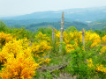
The deforested hillsides in the Waharday, Chéoux and Hodister area have been repopulated with various species of shrubs, notably broom, which has taken root there in their thousands.When they flower in May, they light up the whole area with their characteristic magnificent yellow colour.The icing on the cake is that the numerous meadows are also illuminated in yellow by buttercups.A real feast for the eyes.
Ardennes walk in Nassogne
 9.97 mi
+1,473 ft
-1,447 ft
5h 50
Moderate
Departure from Nassogne (Province de Luxembourg)
9.97 mi
+1,473 ft
-1,447 ft
5h 50
Moderate
Departure from Nassogne (Province de Luxembourg)
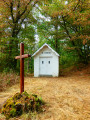
Here is a walk in Nassogne without running water, without the iconic Masblette, Diglette and other local tributaries of the Lomme.The walk is no less enjoyable for it! You’ll discover some lovely countryside scenery in a hilly setting, along with woodland sections featuring a variety of tree species typical of the region. The icing on the cake: there’s a giant sequoia in the small park surrounding the pond at the foot of Nassogne’s water tower.The Chapel of Saint-Léonard, the site itself and the Way of the Cross leading to it are a wonderful discovery. An information board there recounts the history – or perhaps, more likely, a version fuelled by the legend – of the hermit and his brother.
From Nassogne to Masbourg and Ambly
 9.09 mi
+1,394 ft
-1,424 ft
5h 25
Moderate
Departure from Nassogne (Province de Luxembourg)
9.09 mi
+1,394 ft
-1,424 ft
5h 25
Moderate
Departure from Nassogne (Province de Luxembourg)
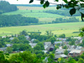
A pleasant hike through the hills and valleys of the Nassogne countryside and woods. It first takes you to the Chapel and Calvary of St-Léonard before descending towards the Masblette stream and the village of Masbourg. This is followed by a very steep climb up a very stony path on the agricultural plateau between Masbourg and Ambly. You may need a machete to approach Ambly, but the view on arrival is magnificent. The return to Nassogne is still a bit of a challenge for your calves, but you won't need a machete: the path is a little wider and properly cleared.
On the Art Trails between Sinsin, Heure and Nettinne
 10.99 mi
+840 ft
-863 ft
5h 45
Moderate
Departure from Somme-Leuze (Province de Namur)
10.99 mi
+840 ft
-863 ft
5h 45
Moderate
Departure from Somme-Leuze (Province de Namur)
Every May, the paths and trails of the Namur Condroz are enriched by a number of land art and street art installations. The most fragile ones, made from natural materials, deteriorate over time. Others, unfortunately, disappear as a result of vandalism.This circular walk allows you to discover a few of them. In order: ‘Bourgeons’, ‘Cercle des sentiers’, ‘Artbri cubique’, ‘Chemin des 4 lunes’, ‘Hé fée papillon’ (which has replaced ‘Les Nids du Marsupilami’), and ‘À l’ombre de la gaillarde’.In terms of atmosphere, the walk has a rather rural feel, with a stretch through the Bois d’Heure woodland, whilst the natural undulating terrain of the Condroz ensures a variety of landscapes.As for tarmac, there’s about 1 km before Les Bourgeons, 1 km on leaving Heure, 1 km in Nettinne and just over 1 km shortly before the end – that’s roughly a quarter of the route.
Between Lomme and Masblette
12.02 mi
+1,663 ft
-1,663 ft
7h 00
Moderate
Departure from Nassogne (Province de Luxembourg)
A walk through the rolling Ardennes countryside around two rivers that are emblematic of the region.
The Masblette is a tributary of the Lomme (also spelled L'Homme in some sources). Their confluence is located between the villages of Lesterny and Masbourg, south of Forrières.
For more walks, use our search engine .
The GPS track and description are the property of this route's author. Please do not copy them without permission.

