Borzée, or a beaver’s paradise

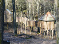
Borzée, the cul-de-sac hamlet in the woods halfway up between Maboge along the Ourthe and Samrée on the plateau, had become virtually deserted since the closure of its iconic Nature Centre. It has come back to life and will likely become even livelier once the final phases of the Anatura Ardenne project to build a holiday village are completed.
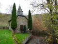
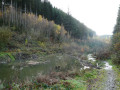
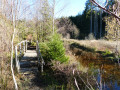
Borzée, the stream which officially rises in the hamlet’s pond behind the chapel and flows into the Mer stream barely 1.5 km further down, is literally overrun by beavers, whose dams, driftwood and gnawed, fallen tree trunks can be seen on either side of the valley.

Details

104717231
Creation:
Last update:
Last review:
  • Walking
    Activity: Walking
  • ↔
    Distance: 10.21 mi
  • ◔
    Average duration: 6h 00 
  • ▲
    Difficulty: Moderate

  • ⚐
    Back to start: Yes
  • ↗
    Ascent: + 1,490 ft
  • ↘
    Descent: - 1,463 ft

  • ▲
    Highest point: 1,890 ft
  • ▼
    Lowest point: 833 ft

Photos

Description of the walk

(S/E) Head due south towards ‘Le Clos René’ (the local tavern) then the Borzée Chapel

(1) Take the path down into the valley of the Borzée stream

(2) Just before Maboge, the route climbs the hill due north to the Croix de Broye

(3) The route veers left towards the Pafy neighbourhood

(4) Head due north towards the Diable Château pond (picnic tables)

(5) A short circular loop eastwards to reach the Col de la Haussire via forest tracks rather than on tarmac

(7) Head due east towards Samrée, which you pass twice

(8) and (9) Head due south, enjoying some lovely unobstructed views of the surrounding countryside before heading back into the woods to reach (S/E)

Waypoints

  1. S/E : mi 0 - alt. 1,168 ft - Anatura Ardenne car park
  2. 1 : mi 0.1 - alt. 1,145 ft - Chapel of Our Lady of the Immaculate Conception
  3. 2 : mi 1.51 - alt. 833 ft - Fork in the road towards Maboge - Ourthe (rivière) - Belgique
  4. 3 : mi 2.61 - alt. 1,309 ft - Croix de Broye
  5. 4 : mi 3.8 - alt. 1,125 ft - Fork in the road towards Pafy
  6. 5 : mi 4.65 - alt. 1,161 ft - Diable Château
  7. 6 : mi 5.21 - alt. 1,457 ft - Junction
  8. 7 : mi 6.34 - alt. 1,667 ft - Col de la Haussire
  9. 8 : mi 7.51 - alt. 1,814 ft - Entrance to Samrée
  10. 9 : mi 8.66 - alt. 1,749 ft - Entrance to Samrée
  11. S/E : mi 10.21 - alt. 1,168 ft - Anatura Ardenne car park

Worth a visit

Off the route:
- La Roche-en-Ardenne
- The Nisramont dam and the confluence of the two Ourthes

Other walks in the area

For more walks, use our search engine .

The GPS track and description are the property of this route's author. Please do not copy them without permission.