


The paths may be muddy in places. Please wear suitable footwear.
From the Malchamps Fagnes to the Barisart Springs


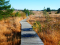
Set off to explore the western part of the Malchamps Fagnes, with a superb view to the east from the top of the Berinzenne Tower. Then head west along the ridge towards the Col du Rosier before turning off into the forest towards the Thiers des Rexhons ski run. A little further on, you’ll discover the Spa springs. The path linking the Fontaine de la Géronstère (to the south) with the Barisart spring (to the north) is simply splendid. And the path leading up towards Pouhon Pia is just as interesting. All that remains is to make your way back to the starting point, passing close to the picnic and barbecue area at the Domaine de Berinzenne.
Details
Creation:
Last update:
Last review:
–
–
-
 Activity: Walking
-
 Distance: 6.99 mi
-
 Average duration: 3h 55
-
 Difficulty: Moderate
-
-
 Back to start: Yes
-
 Ascent: + 817 ft
-
 Descent: - 827 ft
-
-
 Highest point: 1,883 ft
-
 Lowest point: 1,047 ft
-
 Country:
Belgium
-
 Area: Massif des Ardennes
-
 City:
Spa
-
 Start/End: N 50.458942° / E 5.882545°
-


 Hour-by-hour weather
Photos
Waypoints
- S/E : mi 0 - alt. 1,742 ft - Berinzenne car park
- 1 : mi 0.13 - alt. 1,772 ft - Forest and Water Museum
- 2 : mi 0.15 - alt. 1,781 ft - The former Berinzenne farm
- 3 : mi 0.47 - alt. 1,824 ft - Panoramic walk - Tour de Berinzenne
- 4 : mi 0.98 - alt. 1,864 ft - Mémorial du Lancaster du 550 Squadron à Berinzenne.
- 5 : mi 1.78 - alt. 1,867 ft - Croix Pottier
- 6 : mi 2.22 - alt. 1,844 ft - Col du Rosier
- 7 : mi 2.55 - alt. 1,854 ft - La Petite Vecquée
- 8 : mi 3.19 - alt. 1,762 ft - Ski run
- 9 : mi 4.05 - alt. 1,450 ft - Géronstère Fountain
- 10 : mi 4.91 - alt. 1,047 ft - Barisart Springs
- 11 : mi 5.41 - alt. 1,198 ft - Rue de Barisart
- 12 : mi 5.93 - alt. 1,467 ft - Pouhon Pia
- 13 : mi 6.84 - alt. 1,716 ft - Picnic and barbecue area
- S/E : mi 6.99 - alt. 1,742 ft - Berinzenne car park
Notes
Worth a visit
Nearby: the Forest and Water Museum.
Off the route: the towns of Spa and Stavelot, as well as the Coo Waterfall.
Other walks in the area
The Malchamps moor and the Roannay stream
 Visorando Member
 11.62 mi
+1,240 ft
-1,253 ft
6h 25
Moderate
 Departure from Spa (Province de Liège)
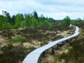
Whilst the two highlights of this walk are mentioned in the title, the rest of the route is through woodland and offers some fine views of the opposite slope and Mont des Brumes.Starting from the Domaine de Bérinzenne, the route heads due south, crosses the old Vecquée and descends towards Andrimont, where it turns eastwards to reach Chevrouheid and the Pont de Neuville over the Roannay stream.The walk follows the course of the Roannay for a good two kilometres, crossing numerous footbridges, and leaves it shortly before its source.This is followed by a bit of a winding route through a well-ventilated forest alternating between spruce and deciduous trees before reaching Malchamps.After the pylons, the route enters the Fagne de Malchamps via a path through the Vecquée covered with wooden decking to keep your feet dry. The Fagne landscape is guaranteed (moors, marshes, peat bogs, pools, shrubs and native flora) both from the path and from the top of the panoramic observation tower.
Loop around Creppe from Bérinzenne
 10.99 mi
+1,125 ft
-1,132 ft
6h 00
Moderate
Departure from Spa (Province de Liège)
Starting from the car park at Domaine de Bérinzenne, the hike begins by crossing the site before gradually entering the forest for just over a third of its total distance. This is followed by a few kilometres of countryside around the village of Creppe before rejoining the forest at the bottom of the Bois de Mambaye. After passing the castle of the same name, which has been converted into a nature education centre, the route quickly joins the Meyerbeer stream and follows it upstream to the Fontaine de Géronstère, one of the many springs in the spa town. Food and refreshments are available on site. Return through the forest and uphill to the starting point.
The Malchamps fens
 6.56 mi
+751 ft
-768 ft
3h 40
Moderate
Departure from Jalhay (Province de Liège)
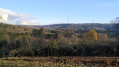
Walk in the Malchamps Fagnes region through peat bogs, forests and meadows. Set off at sunrise with the sound of deer bellowing in the background.
In the Spa Water Region
7.62 mi
+663 ft
-692 ft
4h 05
Moderate
Departure from Spa (Province de Liège)
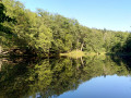
A lovely walk that will allow you to (re)discover Lake Warfaaz, with magnificent views over the town of Spa and its stunning Parc des Sept Heures.
The Gloriettes circular route starting from Spa
 6.92 mi
+935 ft
-958 ft
4h 00
 Difficult
Departure from Spa (Province de Liège)
Starting from Spa railway station, this circular route takes you past three gazebos and Chawion Pond._ A challenging hike, as the off-track section you’ll need to tackle at one point can be quite strenuous._ A GPX track is required
Circular route to Spa via the Col des Maquisards and Winamplanche
 12.41 mi
+1,755 ft
-1,729 ft
7h 15
Difficult
Departure from Spa (Province de Liège)
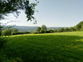
Starting from Spa station, we will pass through the Queen’s House park, climb up to the heights of Marteau with a stop at the Renard viewpoint, then descend towards the village of Marteau.
We’ll climb through the cool Rohaimont woods to the Col des Maquisards, where there’s a memorial stone in their honour.
We will pass through Gros-Thier to cross Winamplache, climb up to the edge of Creppe and return towards Spa via the Mambaye woods
The Spa Beaver Trail
 6.65 mi
+663 ft
-676 ft
3h 40
Moderate
Departure from Spa (Province de Liège)
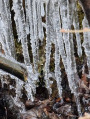
Starting from Spa, a walk in the woods of Staneux will take you along the little Chawion, where you can see several beaver dams. Further on, the Chawion pond is a good place to take a short break.
From Spa to Franchimont (circular route)
 13.18 mi
+1,923 ft
-1,939 ft
7h 45
Moderate
Departure from Spa (Province de Liège)
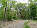
Starting from Spa railway station, you’ll take paths through the Staneux woods and the Lonhue woods, following the Grand-Chaxion and its beaver dams. Further on, you will see the Chène-de-Poleuhe and then the 11th-century Franchimont Castle. On your way back towards Spa, there is another remarkable tree, the Chène-de-la-Vierge, and you can then stop for a short break by the Chawion pond before returning to the station.
For more walks, use our search engine .
The GPS track and description are the property of this route's author. Please do not copy them without permission.

