


 Country:

 City:
City:


A few benches near the old branch of the Sambre (6).
The Grand Bois de Ham and the Sambre


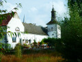
Here is a walk in the hills above the Sambre which begins by crossing the Taravisée plateau, with its wind turbines, strawberry fields, farm and castle, before entering the Grand Bois de Ham and reaching the Sambre via one of its oxbow lakes, before the river was channelled. The return route follows the towpath on the right bank, then climbs through the Bois Roly to return to the starting point.
Details
Creation:
Last update:
Last review:
–
–
-
 Activity: Walking
 -
 Distance: 6.55 mi
 -
 Average duration: 3h 25
 -
 Difficulty: Moderate
 -
-
 Back to start: Yes
 -
 Ascent: + 482 ft
 -
 Descent: - 479 ft
 -
-
 Highest point: 705 ft
 -
 Lowest point: 272 ft
Photos
Waypoints
- S/E : mi 0 - alt. 633 ft - Deminche Bridge
- 1 : mi 0.25 - alt. 630 ft - Taravisée wind farm
- 2 : mi 1.19 - alt. 682 ft - Taravisée Castle and Farm
- 3 : mi 2.28 - alt. 627 ft - War memorial
- 4 : mi 2.53 - alt. 568 ft - Grand Bois de Ham-sur-Sambre
- 5 : mi 3.75 - alt. 292 ft - Former, unchannelled branch of the Sambre - Sambre à finaliser
- 6 : mi 3.8 - alt. 299 ft - Benches - Sambre à finaliser
- 7 : mi 4.1 - alt. 299 ft - Towpath - Sambre à finaliser
- 8 : mi 4.29 - alt. 331 ft - Silica unloading quay - Sambre à finaliser
- 9 : mi 5.35 - alt. 272 ft - Lock - Sambre à finaliser
- 10 : mi 5.86 - alt. 492 ft - Bois Roly
- S/E : mi 6.55 - alt. 633 ft - Deminche Bridge
Notes
Other walks in the area
Ham-sur-Sambre circular
 Visorando Member
 6.45 mi
+486 ft
-495 ft
3h 25
Moderate
6.45 mi
+486 ft
-495 ft
3h 25
Moderate
 Departure from Fosses-la-Ville (Province de Namur)
A short hike in the woods of Ham and Roly, and along the Sambre. You can hike with a dog without any problems and also mountain bike, but perhaps in the other direction as the Bois Roly has quite a steep gradient, which is easier to descend by bike than to climb.
From Floreffe to Franière via the towpath, between the Sambre, the abbey and nature
 4.19 mi
+108 ft
-102 ft
2h 00
4.19 mi
+108 ft
-102 ft
2h 00
 Easy
Departure from Floreffe (Province de Namur)
Easy
Departure from Floreffe (Province de Namur)
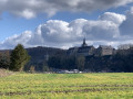
A charming walk in a green setting along the Sambre, connecting Floreffe to Franière and returning via the natural part of the towpath. During this visit, you will discover magnificent views of Floreffe Abbey, the autonomous port of Floreffe, but above all, a relaxing view of nature along the naturally vegetated banks of the Sambre, which adds extra charm to this wonderful walk. You are sure to encounter birds such as herons.
Adeps walk from the Floreffe Sports Centre by Mauditienne
3.26 mi
+98 ft
-98 ft
1h 35
Easy
Departure from Floreffe (Province de Namur)
Departure from the Sports Centre on Rue Célestin Hastir. The route is flat until Fontaine Ste-Gertrude. From km 2.4 to km 3.3, there is a gentle incline. After that, the route descends to the finish line. Beautiful views of the surrounding landscape.
Adeps walk from the Floreffe Sports Centre via Floriffoux
6.19 mi
+407 ft
-404 ft
3h 10
Moderate
Departure from Floreffe (Province de Namur)
The race starts at the Sports Centre on Rue Célestin Hastir. The course is flat until the first pond (2.4 km) and continues until km 3.8. After the Fontaine Ste-Gertrude, i.e. from km 6 to km 7, there is a gentle climb. After that, the course descends to the finish line. Beautiful views of the different landscapes.
Adeps walk from the Floreffe Sports Centre by Jordion
9.71 mi
+499 ft
-489 ft
4h 55
Moderate
Departure from Floreffe (Province de Namur)
Departure from the Sports Centre on Rue Célestin Hastir. The route is flat until you reach "Le Grand Saule" at 3.5 km and continues to the "Royal du Fayt" woods, just after 5 km. Then you walk through small woods and fields. A very varied route that is not too difficult.
The Orneau Valley from Spy to Onoz
 7.52 mi
+584 ft
-584 ft
4h 00
Moderate
Departure from Jemeppe-sur-Sambre (Province de Namur)
7.52 mi
+584 ft
-584 ft
4h 00
Moderate
Departure from Jemeppe-sur-Sambre (Province de Namur)
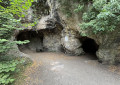
Starting from Spy Church, overlooking the square of the same name, the route leads to the small village of Onoz through fields, which can be seen at the bottom of a wooded valley along the Orneau. From there, shaded paths follow the banks of the stream and then explore the Bois de la Veuve and Bois du Bètch-aus-Rotches woods, located on the side of the valley. The route inevitably passes by the Spy Man's cave and the museum dedicated to him.
In the Betche aux Roches woods in search of the Man of Spy
 1.94 mi
+161 ft
-161 ft
1h 00
Easy
Departure from Jemeppe-sur-Sambre (Province de Namur)
1.94 mi
+161 ft
-161 ft
1h 00
Easy
Departure from Jemeppe-sur-Sambre (Province de Namur)
A short walk through the woods surrounding Spy Cave to the Orneau Valley.
Route A from Malonne Transitionne
 3.28 mi
+463 ft
-463 ft
1h 55
Moderate
Departure from Namur (Province de Namur)
3.28 mi
+463 ft
-463 ft
1h 55
Moderate
Departure from Namur (Province de Namur)
If you like to combine walking with history, geology and nature, the "valorisation des sentiers" (promotion of footpaths) group of Malonne Transitionne has created a 5 km route with 12 points of interest.
We strongly recommend using a GPS or smartphone to guide you!
Please read the "Practical Information" below carefully.
Enjoy your walk and happy exploring.
For more walks, use our search engine .
The GPS track and description are the property of this route's author. Please do not copy them without permission.

