


 Country:
 City:
City:


An alternative starting point is available at the Dolce La Hulpe Brussels visitor car park at (4).
Possible shortcuts at (5), (6), (7) and (9), turning left each time.
The Sonian Forest on the Solvay and Argenteuil side


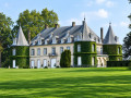
These magnificent beech woods in the Forest of Soignes are a feast for the eyes and offer a sense of tranquillity to walkers seeking peace and serenity. The Folon Museum and the green spaces around La Hulpe Castle are a true invitation to embark on a cultural and architectural journey amidst nature that has been splendidly landscaped within an extraordinary park. Towards the end, however, the proximity of the Brussels Eastern Ring Road and the walls of the Argenteuil estate somewhat detract from the natural feel of the start. That is why a few promising shortcuts are suggested.
Details
Creation:
Last update:
Last review:
–
–
-
 Activity: Walking
 -
 Distance: 8.84 mi
 -
 Average duration: 4h 35
 -
 Difficulty: Moderate
 -
-
 Back to start: Yes
 -
 Ascent: + 617 ft
 -
 Descent: - 594 ft
 -
-
 Highest point: 499 ft
 -
 Lowest point: 217 ft
Photos
Description of the walk
Waypoints
- S/E : mi 0 - alt. 272 ft - La Ramée car park
- 1 : mi 0.38 - alt. 233 ft - Espace Folon - Parking musée Folon
- 2 : mi 0.8 - alt. 318 ft - Magnificent view of the Sun and the Castle
- 3 : mi 1.59 - alt. 259 ft - Solvay Pond
- 4 : mi 3.16 - alt. 420 ft - Dolce La Hulpe Brussels car park
- 5 : mi 4.51 - alt. 453 ft - Shortcut via the Chemin de la Longue Queue
- 6 : mi 6.22 - alt. 374 ft - Shortcut via the Drève Joséphine
- 7 : mi 6.86 - alt. 443 ft - Shortcut via the Drève de la Ramée
- 8 : mi 7.16 - alt. 394 ft - Access to the former Sanatorium in the Soignes Forest
- 9 : mi 7.25 - alt. 404 ft - Shortcut via the Chemin du Fond des Ails
- 10 : mi 7.5 - alt. 410 ft - Entrance to Argenteuil Castle
- S/E : mi 8.84 - alt. 272 ft - La Ramée car park
Other walks in the area
Circular route in the Sonian Forest around Drève de la Ramée in La Hulpe
 Visorando Member
 3.40 mi
+351 ft
-354 ft
1h 50
3.40 mi
+351 ft
-354 ft
1h 50
 Easy
Easy
 Departure from La Hulpe (Brabant Wallon)
A very pretty 1½-hour circular route along quiet paths in the Sonian Forest, near the Folon Foundation and La Hulpe Castle. Absolutely peaceful for two-thirds of the route, though the section near the ring road is inevitably noisier. Relaxing and pleasant in all seasons. Particularly lovely when the wild garlic is in bloom. You may see and hear many birds.
Solvay Regional Estate and Château de La Hulpe
 5.51 mi
+308 ft
-312 ft
2h 50
Easy
Departure from La Hulpe (Brabant Wallon)
5.51 mi
+308 ft
-312 ft
2h 50
Easy
Departure from La Hulpe (Brabant Wallon)
After a trip to the Sonian Forest, Miss Kika will show you around the Solvay Estate and its "Moulinsart-style" castle. Perhaps you'll bump into Professor Calculus? However, there's no chance of seeing Captain Haddock, as the park's many lakes are for freshwater sailors only!
Walk along the trails of La Hulpe
3.40 mi
+269 ft
-259 ft
1h 50
Easy
Departure from La Hulpe (Brabant Wallon)
Walk along the quiet paths of Château de la Hulpe. Starting from the car park on Drève de la Ramée (Gaillemarde), stroll along peaceful forest paths far from the hustle and bustle. Take the time to listen to the birds singing and admire the beautiful vegetation.
Parc du Château de la Hulpe or Domaine Solvay
 Association / Club / Walk leader
 7.01 mi
+495 ft
-505 ft
3h 40
Moderate
Departure from La Hulpe (Brabant Wallon)
7.01 mi
+495 ft
-505 ft
3h 40
Moderate
Departure from La Hulpe (Brabant Wallon)
The Solvay Estate was built on land that was once part of the Sonian Forest. It owes its name to Ernest Solvay, an industrialist who invented a new process for manufacturing soda ash (used in glassmaking and metallurgy). In 1893, he acquired the estate to use as his second home. The Solvay Estate includes a beautiful château. In 1968, Ernest Solvay's grandson, Ernest-John Solvay, donated the estate to the state.
Tour of the grounds of La Hulpe Castle
 4.72 mi
+285 ft
-289 ft
2h 25
Easy
Departure from La Hulpe (Brabant Wallon)
4.72 mi
+285 ft
-289 ft
2h 25
Easy
Departure from La Hulpe (Brabant Wallon)
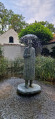
Starting from the estate’s car park on the forest side (Gaillemarde), this walk quickly leaves the estate itself to join the GR® 126, which you follow for part of the way. The landscape is that of the Forest of Soignes, with magnificent tall trees, mainly beech and oak. Beautiful avenues and forest paths lead to the Étang Solvay and the large grassy areas surrounded by rhododendrons and azaleas – which are superb when in bloom – leading up to the château. Not to mention the Folon Museum.
From Rhodes-Saint-Genèse to the Solvay Estate through the forest
 6.19 mi
+387 ft
-397 ft
3h 10
Moderate
Departure from Sint-Genesius-Rode (Brabant flamand)
6.19 mi
+387 ft
-397 ft
3h 10
Moderate
Departure from Sint-Genesius-Rode (Brabant flamand)
A very beautiful and varied route, set against the backdrop of the Sonian Forest.
Circular route around Waterloo Golf Course starting from Ransbeck
 2.62 mi
+266 ft
-266 ft
1h 25
Easy
Departure from Lasne (Brabant Wallon)
2.62 mi
+266 ft
-266 ft
1h 25
Easy
Departure from Lasne (Brabant Wallon)
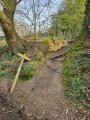
A lovely 4 km circular route around the Royal Golf Club of Waterloo, starting from the charming Place de Ransbeck. This route is a slightly longer version of the walk entitled ‘A short walk in Ransbeck’, with the difference that this route passes by the Chapelle Jacques.
A short walk in Ransbeck
 1.89 mi
+135 ft
-164 ft
1h 00
Easy
Departure from Lasne (Brabant Wallon)
1.89 mi
+135 ft
-164 ft
1h 00
Easy
Departure from Lasne (Brabant Wallon)
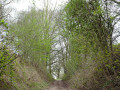
Here’s a short, circular walk to enjoy when you’re looking to unwind and don’t have much time. After a stretch of cobblestones, the path turns into a dirt track, then a sunken lane, before crossing the Royal Waterloo Golf Course. Another sunken lane leads us to a cobbled road, bringing the route to a close.
For more walks, use our search engine .
The GPS track and description are the property of this route's author. Please do not copy them without permission.

