


The Aisne Tourist Tramway and its Museum: ticket office at the departure point
The Megaliths Museum in the centre of the village of Wéris
Durbuy
The Ourthe Valley
Dolmens, menhirs and the Aisne Tourist Tramway


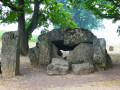
Megaliths – whether dolmens (covered passageways) or menhirs (standing stones) – are abundant in this region, where one comes across boulders that could well have been added to the collection at any bend in the forest path. One question remains: how on earth did our Neolithic ancestors manage to move, erect or stack these enormous boulders, some weighing up to 10 tonnes?
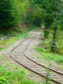
The Aisne Tourist Tram, on the other hand, is much more recent, dating from the 1960s, following the permanent closure of the local railway line from the first half ofthe 20th century, which linked the stations at Comblain-la-Tour and Melreux via Manhay.
Details
Creation:
Last update:
Last review:
–
–
-
 Activity: Walking
 -
 Distance: 13.38 mi
 -
 Average duration: 7h 25
 -
 Difficulty: Difficult
 -
-
 Back to start: Yes
 -
 Ascent: + 1,480 ft
 -
 Descent: - 1,480 ft
 -
-
 Highest point: 1,283 ft
 -
 Lowest point: 738 ft
-
 Country:
Belgium
Country:
Belgium
-
 Area: Massif des Ardennes
 -
 City:
Erezée
City:
Erezée -
 Start/End: N 50.288612° / E 5.549516°
 -


 Hour-by-hour weather
Photos
Waypoints
- S/E : mi 0 - alt. 886 ft - Érezée Tourist Office - Aisne (rivière) - Luxembourg - Affluent de l'Ourthe
- 1 : mi 0.66 - alt. 968 ft - Chapel of Our Lady of Luxembourg
- 2 : mi 0.78 - alt. 892 ft - TTA depot in Blier
- 3 : mi 0.9 - alt. 906 ft - Blier
- 4 : mi 1.82 - alt. 1,102 ft - Chapel of Our Lady of Lourdes
- 5 : mi 2.25 - alt. 1,115 ft - Picnic table
- 6 : mi 3.62 - alt. 1,017 ft - Rue du Château
- 7 : mi 6.26 - alt. 915 ft - Bouhaimont Wood
- 8 : mi 7.48 - alt. 938 ft - View of the Oppagne menhirs
- 9 : mi 8.17 - alt. 892 ft - Dolmens and menhirs ‘Wéris 2’
- 10 : mi 9.06 - alt. 928 ft - Wéris
- 11 : mi 9.6 - alt. 1,220 ft - Former quarry
- 12 : mi 10.91 - alt. 741 ft - Eveux, picnic area
- 13 : mi 13.08 - alt. 879 ft - Picnic table - Aisne (rivière) - Luxembourg - Affluent de l'Ourthe
- S/E : mi 13.38 - alt. 883 ft - Érezée Tourist Information Office - Aisne (rivière) - Luxembourg - Affluent de l'Ourthe
Worth a visit
Other walks in the area
Discover Wéris and its megaliths
 Visorando Member3.68 mi
+400 ft
-387 ft
2h 05
Visorando Member3.68 mi
+400 ft
-387 ft
2h 05
 Average
 Departure from Durbuy (Province de Luxembourg)
With a stated length of 6 km and an elevation gain of 125 m in a rural setting, we discovered a very pretty village with interesting architectural heritage and beautiful restorations. This hunt took us along streets and roads, country lanes and forest paths. There is a significant elevation gain, which is not mandatory, to find the Pierre de Haina.
From the TTA station at Forge-à-la-Plez to the Lafosse mill
4.77 mi
+259 ft
-256 ft
2h 25
 Easy
Departure from Erezée (Province de Luxembourg)
Easy
Departure from Erezée (Province de Luxembourg)
This hike (on foot or by mountain bike) takes you to the Lafosse mill from the Forge-à-la-Plez station on the Aisne Tourist Tramway. The hike follows the Aisne river all the way. The return journey is via the same route.
Around Heyd and Morville
 10.44 mi
+1,194 ft
-1,198 ft
5h 50
Average
Departure from Durbuy (Province de Luxembourg)
10.44 mi
+1,194 ft
-1,198 ft
5h 50
Average
Departure from Durbuy (Province de Luxembourg)
A walk offering varied scenery, alternating between countryside and woodland, paths, tracks, village streets, short stretches of country roads and cycle paths, starting from Wéris, one of Wallonia’s most beautiful villages, well known for its megaliths and its museum.
Discover the megaliths and puddingstone around Wéris
 11.82 mi
+1,181 ft
-1,168 ft
6h 30
Difficult
Departure from Durbuy (Province de Luxembourg)
11.82 mi
+1,181 ft
-1,168 ft
6h 30
Difficult
Departure from Durbuy (Province de Luxembourg)
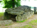
Alternating between forest and countryside, the hike takes you on a journey of discovery to some of the megaliths in the region. You will see two magnificent dolmens and a few blocks of puddingstone, some standing and some lying down.
From Chlorophylle to La Houssière
 11.04 mi
+1,237 ft
-1,220 ft
6h 10
Average
Departure from Manhay (Province de Luxembourg)
11.04 mi
+1,237 ft
-1,220 ft
6h 10
Average
Departure from Manhay (Province de Luxembourg)
This hike, half in the forest and half in the countryside, starts at the car park of Chlorophylle Park, a forest theme park offering recreation, education and art. The path starts between the reception building, restaurant, terrace, toilets and souvenir shop, and the park itself.
Around Rendeux
11.20 mi
+1,112 ft
-1,119 ft
6h 05
Average
Departure from Rendeux (Province de Luxembourg)
Start at Robert Lenoir Park in Rendeux and head towards Bois d'Arlogne. Once there, the hike passes through Marcouray. Then, from the village, head towards Cielle and descend towards La Boverie to finally follow the Ourthe to Rendeux via Jupille and Marcourt. A beautiful circular route to discover the villages of our municipality!
In search of a lost cross in Rendeux
 9.44 mi
+1,155 ft
-1,142 ft
5h 20
Average
Departure from Rendeux (Province de Luxembourg)
9.44 mi
+1,155 ft
-1,142 ft
5h 20
Average
Departure from Rendeux (Province de Luxembourg)
We went in search of the Croix Monseur-Kinet located near the Chapelle Saint-Thibaut. We didn't find it! But we found others. A mainly forestroute offering panoramic views of the Ourthe valley and its tributaries here and there.
Forest walk at Deux-Rys
 9.82 mi
+1,604 ft
-1,604 ft
5h 55
Average
Departure from Erezée (Province de Luxembourg)
9.82 mi
+1,604 ft
-1,604 ft
5h 55
Average
Departure from Erezée (Province de Luxembourg)
Almost entirely through woodland, this walk offers a very pleasant mix of deciduous and coniferous trees, high forests, clearings and clear-cut areas, which then reveal beautiful views over the surrounding valleys.The few rural stretches around Hoursinne (Petite and Grande) and the final kilometre also offer lovely scenery.From the Château du Bois de Harre, nothing can be seen, not even the farm, since the recent planting of a tall hedge of beech or hornbeam trees along the Chemin des Charbonniers, one of the last public paths ‘saved’ in this 550-hectare private woodland.After the first long climb, the route descends towards the Ai l’Oiseau stream – the very same one that flows at the starting point – before climbing up the opposite slope, where you can see a pond, before turning off towards Hoursinne, first Petite Hoursinne and then Grande Hoursinne, hamlets of Érezée at the end of a cul-de-sac.
For more walks, use our search engine .
The GPS track and description are the property of this route's author. Please do not copy them without permission.

