


 Country:

 City:
City:


Well-marked paths.
There are plenty of picnic tables along the route.
Val di Peio from the Prabon car park


A magnificent mountain hike in the Stelvio National Park to the Cevedale ‘G. Larcher’ mountain hut, starting from the Prabòn car park.
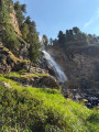
On the outward journey, the route passes Malga Mare (reservoir, mountain restaurant, etc.), the splendid Salt dei Gembri waterfall and Plan Venezia.
On the return journey, the route takes you past the Marmotte, Nero and Careser lakes before descending back to Malga Mare.
The outward and return journeys between the starting point and Malga Mare follow different paths on either side of the Noce Bianco stream.
Details
Creation:
Last update:
Last review:
–
–
-
 Activity: Walking
 -
 Distance: 10.21 mi
 -
 Average duration: 7h 50
 -
 Difficulty: Difficult
 -
-
 Back to start: Yes
 -
 Ascent: + 3,593 ft
 -
 Descent: - 3,612 ft
 -
-
 Highest point: 8,917 ft
 -
 Lowest point: 5,771 ft
Photos
Waypoints
- S/E : mi 0 - alt. 5,791 ft - Prabòn car park
- 1 : mi 1.07 - alt. 6,463 ft - Malga Mare
- 2 : mi 1.56 - alt. 6,942 ft - Salt dei Gembri Waterfall
- 3 : mi 2.26 - alt. 7,451 ft - Plan Venezia
- 4 : mi 3.62 - alt. 8,458 ft - Rifugio Cevedale “Guido Larcher”
- 5 : mi 4.23 - alt. 8,898 ft - Lago delle Marmotte
- 6 : mi 5.71 - alt. 8,642 ft - Lago Nero
- 7 : mi 6.22 - alt. 8,491 ft - Lago del Careser
- S/E : mi 10.21 - alt. 5,791 ft - Prabòn car park
Notes
Other walks in the area
The walk around Lago di Tovel starting from Tuenno
 Visorando Member8.84 mi
+1,670 ft
-1,683 ft
5h 30
Visorando Member8.84 mi
+1,670 ft
-1,683 ft
5h 30
 Moderate
 Departure from Ville d'Anaunia (Provincia di Trento)
A lovely walk that climbs up to a lake, which you walk round before heading back down the same path. There are a few sections that require a bit of care, but nothing too difficult. The lake is a magnificent blue!
For more walks, use our search engine .
The GPS track and description are the property of this route's author. Please do not copy them without permission.

