


 Country:
 City:
City:


Very few benches along the route.
Plenty of tarmac/concrete but little traffic: land consolidation tracks and village streets estimated to make up around 50 per cent of the route.
Some motorway noise along approximately 10 per cent of the route.
On the heights above the Meuse between Moha, Bas-Oha and Couthuin


Farmland and manorial estates – that’s what’s on offer.
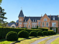
Numerous castles and manor houses await you – sometimes clearly visible, sometimes nearby, sometimes well hidden, sometimes slightly off the route – each with its own story!
In order: Lamalle, Laminne, Blanc, Envoz, Temple and Moha, whilst Potesta and Fosseroule lie just off the route.
Details
Creation:
Last update:
Last review:
–
–
-
 Activity: Walking
 -
 Distance: 11.94 mi
 -
 Average duration: 6h 10
 -
 Difficulty: Moderate
 -
-
 Back to start: Yes
 -
 Ascent: + 741 ft
 -
 Descent: - 745 ft
 -
-
 Highest point: 636 ft
 -
 Lowest point: 272 ft
Photos

Waypoints
- S/E : mi 0 - alt. 282 ft - Place Jules Galloy
- 1 : mi 1.41 - alt. 440 ft - Saint-Sauveur
- 2 : mi 2.58 - alt. 476 ft - Lamalle Castle and Castle Farm
- 3 : mi 2.66 - alt. 469 ft - Laminne Castle and Farm
- 4 : mi 3.43 - alt. 282 ft - Bois le Prêtre - Meuse (fleuve)
- 5 : mi 4.31 - alt. 522 ft - At Les Bornes
- 6 : mi 5.72 - alt. 568 ft - Château Blanc
- 7 : mi 5.91 - alt. 551 ft - Envoz Castle
- 8 : mi 6.75 - alt. 515 ft - Potale Au Vî Bon d'Ju d'Giblou
- 9 : mi 7.15 - alt. 551 ft - The hamlet of Envoz
- 10 : mi 8.07 - alt. 512 ft - Couthuin
- 11 : mi 9.35 - alt. 390 ft - Longpré Quarry
- 12 : mi 9.57 - alt. 387 ft - Château du Temple (Alpha School)
- 13 : mi 9.63 - alt. 387 ft - The Longpré Gardens
- 14 : mi 11.04 - alt. 367 ft - Moha Quarry
- 15 : mi 11.86 - alt. 279 ft - Reception at Moha Castle
- S/E : mi 11.94 - alt. 282 ft - Place Jules Galloy
Notes
Worth a visit
Near the starting point: the ruins of the medieval castle of Moha (admission fee applies).
Off the route: Huy, on the Meuse river, with its collegiate church, citadel and cable car.
Other walks in the area
Around the feudal castle of Moha
 Visorando Member
 10.04 mi
+692 ft
-689 ft
5h 15
Moderate
10.04 mi
+692 ft
-689 ft
5h 15
Moderate
 Departure from Wanze (Province de Liège)
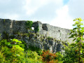
The feudal castle of Moha is one of the region's jewels. It is located at the top of a rocky spur on the heights of the Mehaigne, on the edge of the limestone quarries (both old and still in operation), and was apparently built in several phases between the 11th and 14th centuries. Archaeological excavations have revealed a much older presence.
Towards the Mehaigne Valley from the village of Longpré
 8.17 mi
+607 ft
-630 ft
4h 15
Moderate
Departure from Wanze (Province de Liège)
8.17 mi
+607 ft
-630 ft
4h 15
Moderate
Departure from Wanze (Province de Liège)
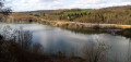
A leisurely walk towards the Mehaigne valley, starting from the village of Longpré. The route leads to the village of Huccorgne through the fields, before following the Mehaigne river to Moha and its feudal castle. Along this route, the landscape is shaped by limestone quarries, parts of which have been converted into nature reserves.
Au Vî Bon d'Ju d'Giblou
 10.37 mi
+702 ft
-699 ft
5h 25
Moderate
Departure from Wanze (Province de Liège)
10.37 mi
+702 ft
-699 ft
5h 25
Moderate
Departure from Wanze (Province de Liège)
Land of the Meuse, land of farms, land of stone, land of (rail)ways, land of castles. The hike takes you through countryside and forests, starting from the Château à l'Horloge in Bas-Oha (SNCB station nearby).
Walk in Ferrières
3.27 mi
+338 ft
-322 ft
1h 50
 Easy
Departure from Héron (Province de Liège)
Easy
Departure from Héron (Province de Liège)
A gentle walk starting from the Ferrières mill. It crosses the Bois de Ferrières, passes by the Château le Temple farm and returns via Le Sokeu to the Bois de Ferrières and the mill.
Vallon de la Solières
 4.42 mi
+597 ft
-581 ft
2h 35
Moderate
Departure from Wanze (Province de Liège)
4.42 mi
+597 ft
-581 ft
2h 35
Moderate
Departure from Wanze (Province de Liège)
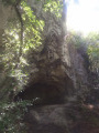
Not far from Huy, discover a steep-sided valley with lush vegetation, caves and rock shelters, as well as the Lovegnée-Bosquet nature reserve.
From La Mehaigne to La Burdinale via Fumal, Huccorgne and Marneffe
 7.86 mi
+643 ft
-636 ft
4h 10
Moderate
Departure from Braives (Province de Liège)
7.86 mi
+643 ft
-636 ft
4h 10
Moderate
Departure from Braives (Province de Liège)
This circular route starting from Fumal winds through the Burdinale-Mehaigne Nature Park, passing successively through the villages of Huccorgne and Marneffe, before returning to Fumal via the countryside around Fallais.
Southern slope of the Meuse valley: from Gives to Bousalle
 8.30 mi
+915 ft
-915 ft
4h 35
Moderate
Departure from Wanze (Province de Liège)
8.30 mi
+915 ft
-915 ft
4h 35
Moderate
Departure from Wanze (Province de Liège)
A very lovely walk, much of it through woodland, starting from the banks of the Meuse and heading up the small valley of the Bousalle stream to reach the hamlet of the same name. The return journey takes you back up through the Bois de Gives before descending back into the valley.The route can quite easily be shortened to around ten kilometres, if necessary.
In the Seigneur vineyards, on the slopes of the Meuse
 3.91 mi
+640 ft
-610 ft
2h 20
Moderate
Departure from Wanze (Province de Liège)
3.91 mi
+640 ft
-610 ft
2h 20
Moderate
Departure from Wanze (Province de Liège)
A lovely walk along the Meuse hillsides. Where there are hillsides, there are slopes, and where there are slopes along the Meuse, one might expect vineyards. And there are plenty!
For more walks, use our search engine .
The GPS track and description are the property of this route's author. Please do not copy them without permission.

