Country:
 City:
City:


A few details:
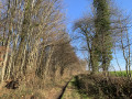
(4) At the bend in this country lane, look out for the huge RTBF transmission tower and glance to the right, towards the fields, past the few houses. An ‘Iron Man’ stands atop this small hill in the Planty (212 m). This is the Mont-Sainte-Geneviève triangulation point, which, along with 85 others, helped to map the nascent Kingdom of Belgium in the mid-19th century.
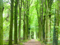
(6) The walk continues straight on along the magnificent Drève des Hêtres, then turns right twice to head up the Drève des Douglas.
It is possible to shorten the walk by turning off to the right here.
(9) The suggested route heads off to the left.
Here, you can shorten the walk by avoiding the wooded, more or less straight section (RAVeL and Voie Royale) to the south-east of the route by continuing straight on here. Further on, take the RAVeL to the right and head for the point (13)
 Tourist office
 Easy
Easy 
 Visorando Member