


 Country:
 City:


The Bois du Cazier site (admission fee applies)
The Bois du Prince and Bois du Cazier, via the Eau d’Heure


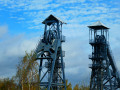
The Saint-Charles Sud slag heap of the former Bois du Cazier coal mine may not be the ‘roof of the Pays Noir’, but it offers a remarkable vantage point over its history! Its summit provides a 360° panoramic view of the Charleroi region.
Combined with the splendid Bois du Prince, the old railway line 133 that linked Couillet to Jamioulx, the Eau d’Heure and the Jamioulx State Nature Reserve (a former Visian limestone quarry and lime production site), this walk takes you on a journey of discovery through a genuine green lung to the south of Charleroi!
Details
Creation:
Last update:
Last review:
–
–
-
 Activity: Walking
-
 Distance: 10.99 mi
-
 Average duration: 5h 50
-
 Difficulty: Moderate
-
-
 Back to start: Yes
-
 Ascent: + 932 ft
-
 Descent: - 932 ft
-
-
 Highest point: 771 ft
-
 Lowest point: 374 ft
Photos
Waypoints
- S/E : mi 0 - alt. 492 ft - Les Cygnes car park
- 1 : mi 0.32 - alt. 591 ft - Marcinelle Leisure Centre
- 2 : mi 1.08 - alt. 515 ft - The Fontaine Qui Bout
- 3 : mi 1.38 - alt. 535 ft - Sart Saint-Nicolas-Les Haies
- 4 : mi 2.25 - alt. 735 ft - Summit of the Saint-Charles Sud slag heap
- 5 : mi 3.17 - alt. 476 ft - Entrance to the Bois du Cazier site
- 6 : mi 4.16 - alt. 489 ft - Marcinelle school complex – Haies
- 7 : mi 4.6 - alt. 509 ft - Former Line 133 near Marcinelle
- 8 : mi 4.89 - alt. 502 ft - View of the Terril du Cerisier
- 9 : mi 5.41 - alt. 446 ft - Former Line 133 near Mont-sur-Marchienne
- 10 : mi 6.05 - alt. 374 ft - Former Line 133 near Jamioulx
- 11 : mi 6.21 - alt. 394 ft - Eau d'Heure (rivière)
- 12 : mi 6.86 - alt. 420 ft - Jamioulx railway station
- 13 : mi 7.21 - alt. 436 ft - Jamioulx State Nature Reserve
- 14 : mi 7.93 - alt. 715 ft - Bois Servais Fontaine
- 15 : mi 8.25 - alt. 715 ft - Route
- 16 : mi 8.82 - alt. 709 ft - Noir Chien
- 17 : mi 9.94 - alt. 702 ft - Bois du Prince
- 18 : mi 10.41 - alt. 538 ft - Allée des Templiers
- S/E : mi 10.99 - alt. 492 ft - Les Cygnes car park
Worth a visit
Other walks in the area
Forest around the Marcinelle recreation centre
 Visorando Member
 2.58 mi
+180 ft
-180 ft
1h 20
 Easy
 Departure from Charleroi (Hainaut)
Easy walk, very flat and accessible to all (except wheelchair users). A very pleasant outing that follows a stream resurgence after the quarry and the memorial.
JOLMA 3 trail in Marcinelle
1.97 mi
+125 ft
-121 ft
1h 00
Easy
Departure from Charleroi (Hainaut)
A short walk starting from the Bois du Cazier mining site in Marcinelle. This is a circular walk that is not suitable for pushchairs. The walk passes by the Fontaine qui bout. There is a car park on site.
At the sources of the Eaux d'Heure towards Jamioulx
9.30 mi
+807 ft
-823 ft
5h 00
Moderate
Departure from Ham-sur-Heure-Nalinnes (Hainaut)
This hike offers a gentle immersion between Haies and Jamioulx, along rural paths, tranquil woods and discreet valleys. The landscape alternates between rolling hills, open meadows and wooded areas, offering a varied and soothing walk. Streams punctuate the route and bring a cool atmosphere, while the place names recall an agricultural and forestry past that is still perceptible. It is a walk where you take the time to observe, listen and feel, surrounded by living nature, local history and simple landscapes.
Towards the Gerpinois countryside from Bouffioulx
 9.85 mi
+436 ft
-423 ft
4h 55
Moderate
Departure from Châtelet (Hainaut)
A walk that should delight everyone. RAVeL, paths, trails, country roads, woods and beautiful neighbourhoods are all on the menu for this walk.
Loop between Bomerée and Jamioulx
 6.07 mi
+574 ft
-571 ft
3h 20
Moderate
Departure from Montigny-le-Tilleul (Hainaut)
A pleasant circular walk in the woods near Charleroi. Discover part of the Eau d'Heure valley and the charming village of Jamioulx.
The Eau d'Heure is a small river that flows into the Sambre at Marchienne-au-Pont. It gets its name from its unique ability to rise in an hour and fall just as quickly.
A circular countryside and woodland loop in Nalinnes
 5.96 mi
+108 ft
-98 ft
2h 50
Easy
Departure from Ham-sur-Heure-Nalinnes (Hainaut)
Set off to explore the unspoilt landscapes of the Thudinie region on this superb circular walk starting from the historic centre of Nalinnes. This well-balanced route invites you to immerse yourself in the countryside as you follow rural paths and very quiet country lanes, winding through beautiful scenery. With no technical difficulties and generally gentle terrain, this route offers a peaceful and varied walk, ideal for observing wildlife and savouring the tranquillity of our agricultural plains. A perfect walk for lovers of wide open spaces and unspoilt countryside.
In the heart of the Nalinnois countryside
 8.24 mi
+322 ft
-312 ft
4h 05
Moderate
Departure from Ham-sur-Heure-Nalinnes (Hainaut)
A lovely circular route that takes you through the countryside so you can enjoy our magnificent scenery. The start is at the Place du Centre in Nalinnes, where you can admire the magnificent bandstand and Notre-Dame Church. You’ll follow small country lanes before cutting across the fields to reach Gourdinne, where you can visit the wash house. You’ll then rejoin the path leading to the Baconval woods. Once out of the woods, you’ll pass by a lovely pond and head up to Les Six Chemins, before returning to the starting point.
ADEPS circular in Warchais
 Association / Club / Walk leader3.36 mi
+217 ft
-217 ft
1h 45
Easy
Departure from Montigny-le-Tilleul (Hainaut)
Starting from the AS Montigny football club (asmontigny.be), you can enjoy a 5.40 km walk through the streets and alleyways of the charming town of Montigny-le-Tilleul, in Hainaut. The first half is generally downhill (from 176 metres to 110 metres), whilst the second half is a steady climb back to the club. The lowest point is at around the 2.96 km mark (Marbaix area, on the edge of the woods).
For more walks, use our search engine .
The GPS track and description are the property of this route's author. Please do not copy them without permission.

