


 Country:

 City:
City:


Please note: the Tournibus State Forest is criss-crossed with paths and tracks to which access is prohibited by the DNF (Nature and Forests Division). Do not enter these areas, as you may be fined.
In the countryside and the Tournibus Forest


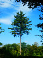
A circular route through the countryside (fields of maize, flax, potatoes, etc., and cattle and horse farms) between the villages and hamlets to the east of the municipality of Mettet. It is interspersed with a long stretch through the Tournibus State Forest.
Details
Creation:
Last update:
Last review:
–
–
-
 Activity: Walking
 -
 Distance: 9.92 mi
 -
 Average duration: 5h 05
 -
 Difficulty: Moderate
 -
-
 Back to start: Yes
 -
 Ascent: + 600 ft
 -
 Descent: - 571 ft
 -
-
 Highest point: 909 ft
 -
 Lowest point: 640 ft
Photos
Waypoints
- S/E : mi 0 - alt. 643 ft - Car park below the Tiranrue farm
- 1 : mi 0.33 - alt. 650 ft - Sluice gate of the leat from the old mill
- 2 : mi 0.69 - alt. 705 ft - Prée
- 3 : mi 1.07 - alt. 728 ft - Potale at the Rouge Fontaine
- 4 : mi 1.28 - alt. 774 ft - Ferme de la Belle Haie
- 5 : mi 2.73 - alt. 781 ft - Fork in the road on the outskirts of Oret
- 6 : mi 5.57 - alt. 823 ft - Bois d’Hanzinne
- 7 : mi 7.9 - alt. 823 ft - Fountain and statue
- 8 : mi 9.09 - alt. 735 ft - Rock
- S/E : mi 9.92 - alt. 643 ft - Car park below the Tiranrue farm
Notes
Other walks in the area
Loop through the woods and countryside north of Biesme (part of Mettet)
 Visorando Member
 7.04 mi
+469 ft
-440 ft
3h 40
Moderate
7.04 mi
+469 ft
-440 ft
3h 40
Moderate
 Departure from Mettet (Province de Namur)
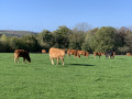
Enjoy this beautiful, peaceful hike with a few hills between countryside, woods and rivers. For those who would like a few extra kilometres, see my other hike in the same area (No. 6600390).
In the Bois du Grand Fréchy in Biesme
 3.34 mi
+305 ft
-299 ft
1h 50
3.34 mi
+305 ft
-299 ft
1h 50
 Easy
Departure from Mettet (Province de Namur)
Easy
Departure from Mettet (Province de Namur)
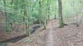
Whatever the season, this route will allow you to discover the splendours of the Bois du Grand Fréchy, all along the Ruisseau de l'Étang du Diable. A truly exotic route despite its short distance. I suggest another route in the same area: "Around the Bois du Grand Fréchy" (17 km). See hunting dates below
Around the Bois du Grand Fréchy
 10.99 mi
+873 ft
-876 ft
5h 50
Moderate
Departure from Mettet (Province de Namur)
10.99 mi
+873 ft
-876 ft
5h 50
Moderate
Departure from Mettet (Province de Namur)
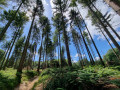
A beautiful hike (just over 3 hours), much appreciated, combining forests, streams, ponds and countryside. You will also be able to admire the castle of Sart-Eustache. There are a few short sections on tarmac, but these are necessary to reach other beautiful sections where the forest dominates. Hunting dates below
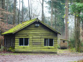
A tour on the Tournibus
 9.25 mi
+463 ft
-472 ft
4h 40
Moderate
Departure from Mettet (Province de Namur)
9.25 mi
+463 ft
-472 ft
4h 40
Moderate
Departure from Mettet (Province de Namur)
Starting from the hamlet of Les Bruyères, this walk first takes you to Wagnée before introducing you to the Tournibus forest and the surrounding countryside on the borders of Biesme (Mettet), Fromiée (Gerpinnes) and Hanzinelle (Florennes).Superb forest and countryside landscapes, peaceful and sheltered from the hustle and bustle of modern life.A real delight of trees, crops and flowers in tune with the seasons.A unique discovery between the GR® 129 Renaix-Dinant and the GRP® 125 Tour de l'Entre-Sambre-et-Meuse.You can also start at Place d'Hanzinelle (easy parking) if you are coming from Florennes or Gerpinnes.
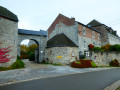
Circular around Thy-le-Bauduin
 11.14 mi
+509 ft
-495 ft
5h 35
Moderate
Departure from Florennes (Province de Namur)
11.14 mi
+509 ft
-495 ft
5h 35
Moderate
Departure from Florennes (Province de Namur)
Set off to explore the countryside and forests to the north-west of Florennes and north-east of Walcourt. This is south of Gerpinnes and the stronghold of the marches and pilgrimages of Entre-Sambre-et-Meuse.Shortly after setting off, the route passes the majestic Ferme de la Prévôté (information board) and the imposing church of Hanzinne.The walk passes through the outskirts of Tarcienne, in the national forest and then through the centre of Morialmé before reaching the villages of Hanzinelle and returning to Hanzinne.
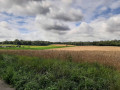
The Tournibus forest at the start of Hanzinelle
 7.95 mi
+492 ft
-509 ft
4h 05
Moderate
Departure from Florennes (Province de Namur)
7.95 mi
+492 ft
-509 ft
4h 05
Moderate
Departure from Florennes (Province de Namur)
Set off to explore the woods of Tournibus and the vast, gently rolling landscapes of this part of Entre Sambre-et-Meuse along wide forest paths and discover its history, which was sometimes tragic, such as the Battle of Wagnée on 24 August 1914. It was at Hanzinelle Castle that the "Hanzinelle Agreements" were signed in 1978, restructuring the Walloon steel industry. Not to mention its folklore with the famous Marches de l'entre Sambre-et-Meuse, re-enactments in period costume of Napoleon's armies.
Upstream from the Molignée from Biesmerée
 10.78 mi
+866 ft
-866 ft
5h 45
Moderate
Departure from Mettet (Province de Namur)
10.78 mi
+866 ft
-866 ft
5h 45
Moderate
Departure from Mettet (Province de Namur)
The Molignée is a small river in Wallonia formed by the confluence of the Biesmerée and Behoûde streams at Ermonton-sur-Biert. This circular walk follows these two streams and the nascent Molignée.
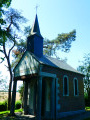
Circular route in the Morialmé and Saint-Aubin forest
 11.81 mi
+666 ft
-696 ft
6h 00
Moderate
Departure from Florennes (Province de Namur)
11.81 mi
+666 ft
-696 ft
6h 00
Moderate
Departure from Florennes (Province de Namur)
Also known as the Forêt des Minières due to the region’s mining history, this forest will enchant many a hiker. Nature reigns supreme here and, apart from a bit of noise pollution near the N932, it is utterly peaceful, with birdsong or the rustling of leaves in the wind depending on the season and the weather.
For more walks, use our search engine .
The GPS track and description are the property of this route's author. Please do not copy them without permission.

