


Plenty of benches just after the start...
Around 30 per cent of the route is on tarmac.
Please note: the path marked (7) is private; pedestrians are permitted to use it except on hunting days in October–November.
Circular countryside loop starting from Xhoris


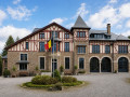
This beautiful and pleasant circular route between Xhoris and Filot, on the border between the Liège Condroz, the Calestienne, the Famenne and the Ardennes, is mainly rural and offers panoramic views of the northern slopes of the Ourthe. The two villages you pass through feature some pretty stone buildings, but the architectural highlight of the day is the Château d’Insegotte.
Details
Creation:
Last update:
Last review:
–
–
-
 Activity: Walking
 -
 Distance: 9.65 mi
 -
 Average duration: 5h 15
 -
 Difficulty: Moderate
 -
-
 Back to start: Yes
 -
 Ascent: + 906 ft
 -
 Descent: - 879 ft
 -
-
 Highest point: 1,040 ft
 -
 Lowest point: 663 ft
-
 Country:
Belgium
Country:
Belgium
-
 Area: Massif des Ardennes
 -
 City:
Hamoir
City:
Hamoir -
 Start/End: N 50.44453° / E 5.602395°
 -


 Hour-by-hour weather
Photos
Waypoints
- S/E : mi 0 - alt. 778 ft - Xhoris, Place La Vaux
- 1 : mi 0.07 - alt. 801 ft - Xhoris Church
- 2 : mi 1.07 - alt. 981 ft - Insegottes Stream
- 3 : mi 1.9 - alt. 843 ft - Insegotte Castle
- 4 : mi 2.81 - alt. 761 ft - Filot
- 5 : mi 3.59 - alt. 722 ft - Junction
- 6 : mi 5.18 - alt. 915 ft - Godinri Cross
- 7 : mi 7.07 - alt. 725 ft - Private path
- 8 : mi 7.63 - alt. 755 ft - Royal Football Club of Xhoris
- 9 : mi 8.67 - alt. 817 ft - Fanson Chapel
- S/E : mi 9.65 - alt. 778 ft - Xhoris, Place La Vaux
Notes
Other walks in the area
Forest walk between Saint-Roch and Sainte-Anne
 Visorando Member
 9.42 mi
+1,004 ft
-997 ft
5h 10
Moderate
9.42 mi
+1,004 ft
-997 ft
5h 10
Moderate
 Departure from Ferrières (Belgique) (Province de Liège)
Mainly through woodland, as its name suggests, this circular walk takes you on a journey of discovery through the Pouhon valley, starting from the car park and barbecue area near the Saint-Roch secondary school, which is well known throughout the region.Shortly after crossing the Pouhon near the hamlet of La Levée, the route passes by the Sainte-Anne Chapel and a second barbecue area where you’ll find everything you need for a picnic break or shelter if it rains.At the five-kilometre mark, after the riding centre, don’t hesitate to enter the grounds of the Misery Brewery and head to the right of the manor house, as the public footpath starts right next to it, between the building and the Paradis stream.Towards the end of the route, you’ll come across Saint-Roch Chapel between two stretches of countryside.The return to the starting point follows a section of the old country lane that once linked Comblain-la-Tour to Hotton via Ferrières and Manhay.
Walk in Filot
9.21 mi
+850 ft
-869 ft
5h 00
Moderate
Departure from Hamoir (Province de Liège)
This walk takes you through the countryside and forests on either side of the Tige de Xhoris to discover, on the north side, the undulating landscape of the Ourthe valley and, on the south side, once you leave the woods, that of the Lembrée valley.
Circular route to Xhoris from Harzé
 4.73 mi
+656 ft
-640 ft
2h 45
4.73 mi
+656 ft
-640 ft
2h 45
 Easy
Departure from Aywaille (Province de Liège)
Easy
Departure from Aywaille (Province de Liège)
This route takes you through alternating woods and hedgerows with occasional unobstructed views of the countryside. The forests are generally not very overgrown. If you remain quiet, you may see game.
Comblain-au-Pont - Remouchamps
 12.17 mi
+1,677 ft
-1,585 ft
7h 05
12.17 mi
+1,677 ft
-1,585 ft
7h 05
 Difficult
Departure from Comblain-au-Pont (Province de Liège)
Difficult
Departure from Comblain-au-Pont (Province de Liège)
This stage ofthe GRP®571starts at Pont-de-Sçay near the confluence of the Ourthe and Amblève rivers, climbs up the Amblève slope, crosses Oneux and Chambralles, rejoins the valley and crosses the river at Martinrive. It continues on the other bank of the Amblève, passing through Aywaille, Heid des Gattes and Remouchamps.
Amblève and Salm: two valleys of legends
 58.07 mi
+9,199 ft
-8,009 ft
5 days
Difficult
Departure from Comblain-au-Pont (Province de Liège)
58.07 mi
+9,199 ft
-8,009 ft
5 days
Difficult
Departure from Comblain-au-Pont (Province de Liège)
From mischievous nutons in the Ardennes forests to Satan, who in a fit of rage created the Fonds de Quarreux, to macralles bewitching hikers in the woods around Vielsalm, many legends haunt the Amblève and Salm valleys.
The Ourthe Valley from Rivage to Hamoir
9.28 mi
+1,106 ft
-1,060 ft
5h 15
Moderate
Departure from Comblain-au-Pont (Province de Liège)
This hike will take you from Rivage station to Hamoir station via the villages of Pont-de-Sçay, Comblain-au-Pont and Comblain-Fairon. Along the way, you will pass through vast agricultural and forest areas, discover the Ourthe valley at times, and pass close to the Abîme cave and an imposing square farm, typical of the Condroz region.
Along the Amblève and Oneux from Fraiture
 11.44 mi
+1,414 ft
-1,411 ft
6h 30
Difficult
Departure from Sprimont (Province de Liège)
11.44 mi
+1,414 ft
-1,411 ft
6h 30
Difficult
Departure from Sprimont (Province de Liège)
You will descend towards the Amblève, which you will follow along the left bank.
You will climb back up towards Oneux, where you will have a beautiful view of the Amblève valley.
After a circular route, you’ll return to Oneux to head down what the locals call ‘les tartines’.
A few metres after the start of the descent, straight ahead, you will see a lovely viewpoint overlooking Comblain-aux-Ponts and the Ourthe valley.
Ferrières and the tour of the Ruisseau de la Souris
3.70 mi
+387 ft
-387 ft
2h 00
Moderate
Departure from Ferrières (Belgique) (Province de Liège)
A peaceful stroll with magnificent views of the forests. It ends on a welcoming terrace. The walk starts in the village. Halfway along, you reach the highest point. Here, the walk takes you along a quiet road. Then you descend towards the village through a small wood, passing an enclosure occupied by long-haired pigs!
For more walks, use our search engine .
The GPS track and description are the property of this route's author. Please do not copy them without permission.

