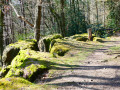
A walk through the countryside and woodland north of Strée-lez-Huy

Rural in character at the start, in the middle and at the end, this walk on the heights above the Meuse passes through beautiful woodland areas with a variety of tree species for much of the route. Three easy shortcuts allow you to shorten the distance if necessary.

Details

107237159
Creation:
Last update:
Last review:
  • Walking
    Activity: Walking
  • ↔
    Distance: 11.31 mi
  • ◔
    Average duration: 5h 55 
  • ▲
    Difficulty: Moderate

  • ⚐
    Back to start: Yes
  • ↗
    Ascent: + 814 ft
  • ↘
    Descent: - 804 ft

  • ▲
    Highest point: 889 ft
  • ▼
    Lowest point: 623 ft

Photos

Description of the walk

No detailed point-by-point description.
Follow the GPS route downloaded in advance onto the Visorando app.
A few details and tips below to help you avoid getting lost and/or encountering any inconvenience.

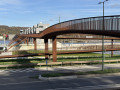
(1) Please note: the construction of the Strée bypass has significantly altered the path that linked Les Gottes to the centre of Strée. Here, you must turn right, use the footbridge or the cycle ramp to cross the road, and turn left immediately afterwards.

(3) The path that branches off to the left leads to a small park with a few benches. At the time of writing, in September 2026, it is still signposted ‘Strée centre’. It has, in fact, become a dead end since the latest developments in this business park. You must continue straight on here to reach the centre of Strée.

(7) A possible shortcut is to turn left towards (13).

(20) Possible shortcuts by continuing straight on a little further and turning right onto Rue des Neuf Bonniers towards (23) or, shortly afterwards, turning left towards (26).

(25) The path that once linked (24) directly to (26) has been cut off by the construction of the N684. The passage shown on the OSM map is beneath the carriageway and is intended for the passage of either water or small game. It is in no way suitable for pedestrians. You must therefore go round this obstacle, either via a slightly steep path or by stepping over the road’s safety barriers. This is possible, but care must be taken when crossing.

Waypoints

  1. S/E : mi 0 - alt. 797 ft - Local school / Les Gottes playground
  2. 1 : mi 0.28 - alt. 817 ft - Junction
  3. 2 : mi 0.36 - alt. 810 ft - Footbridge
  4. 3 : mi 1.06 - alt. 820 ft - Rest area: park and benches
  5. 4 : mi 1.39 - alt. 876 ft - Water tower / police station
  6. 5 : mi 1.61 - alt. 833 ft - Ferme de la Cornette
  7. 6 : mi 1.98 - alt. 860 ft - Footbridge
  8. 7 : mi 2.72 - alt. 751 ft - Junction
  9. 8 : mi 3.09 - alt. 699 ft - Armoulin
  10. 9 : mi 3.9 - alt. 853 ft - Fork in the road on the outskirts of Scry (Tinlot)
  11. 10 : mi 4.36 - alt. 653 ft - Fork in the road on the outskirts of Villers-le-Temple (Nandrin)
  12. 11 : mi 4.7 - alt. 682 ft - Junction
  13. 12 : mi 4.89 - alt. 673 ft - Junction
  14. 13 : mi 5.37 - alt. 771 ft - Junction
  15. 14 : mi 5.73 - alt. 758 ft - Rue Saint-Jean-Sart
  16. 15 : mi 6.02 - alt. 751 ft - Entrance to the woods and fork in the path
  17. 16 : mi 6.28 - alt. 659 ft - Crossing a minor road
  18. 17 : mi 6.68 - alt. 633 ft - Junction
  19. 18 : mi 6.88 - alt. 784 ft - Junction
  20. 19 : mi 7.6 - alt. 712 ft - Ford and junction
  21. 20 : mi 7.96 - alt. 784 ft - Junction
  22. 21 : mi 8.96 - alt. 623 ft - Junction
  23. 22 : mi 9.77 - alt. 755 ft - Dragonfly pond and bench
  24. 23 : mi 10.14 - alt. 774 ft - Crossing the roundabout
  25. 24 : mi 10.35 - alt. 764 ft - Junction
  26. 25 : mi 10.46 - alt. 771 ft - A slightly tricky section
  27. 26 : mi 10.59 - alt. 774 ft - Junction
  28. S/E : mi 11.31 - alt. 797 ft - Local school / Les Gottes playground

Notes

Very few benches were encountered. The only two found are located at (3) and (22).
There is a short stretch of tarmac when passing through the hamlet of Les Gottes (at the start and end), as well as in the centre of Strée and in Villers-le-Temple.
The N684, which has been under construction since around 2020, is now partially open to traffic. Its construction has slightly altered the local landscape and the paths crossing it have been partially re-routed: see the detailed description at key points.

Other walks in the area

For more walks, use our search engine .

The GPS track and description are the property of this route's author. Please do not copy them without permission.