


There is a picnic shelter at (4) and benches dotted here and there.
For those who want to go a bit further: turn right at (5), head towards the Deux Hêtres site, cross the road and take the tarmac path opposite, then turn left at the first opportunity to reach .
Circular Ardennes route between Brisy, Taverneux, Alhoumont and Cetturu


Typical of the Ardennes, alternating between countryside (fields and pastures) and woodland (deciduous and coniferous), this circular walk through the valley and across the hills of the eastern Ourthe, to the east of Houffalize, is a wonderful experience to be enjoyed in all seasons.
Details
Creation:
Last update:
Last review:
–
–
-
 Activity: Walking
 -
 Distance: 10.85 mi
 -
 Average duration: 6h 05
 -
 Difficulty: Moderate
 -
-
 Back to start: Yes
 -
 Ascent: + 1,227 ft
 -
 Descent: - 1,257 ft
 -
-
 Highest point: 1,575 ft
 -
 Lowest point: 1,129 ft
-
 Country:
Belgium
Country:
Belgium
-
 Area: Massif des Ardennes
 -
 City:
Gouvy
City:
Gouvy -
 Start/End: N 50.158443° / E 5.85099°
 -


 Hour-by-hour weather
Photos
Waypoints
- S/E : mi 0 - alt. 1,329 ft - Brisy Church
- 1 : mi 1.69 - alt. 1,240 ft - Sommerain Stream
- 2 : mi 2.77 - alt. 1,398 ft - Fork in the road on the outskirts of Taverneux
- 3 : mi 3.68 - alt. 1,227 ft - Viewpoint / bench
- 4 : mi 4.06 - alt. 1,132 ft - Ermitage hamlet / picnic shelter - Ourthe orientale (rivière) - Affluent de l'Ourthe
- 5 : mi 4.63 - alt. 1,299 ft - Alternative starting point
- 6 : mi 5.14 - alt. 1,427 ft - Fork in the road under Alhoumont and the Deux Hêtres
- 7 : mi 6.7 - alt. 1,463 ft - Cetturu Chapel, bench and sundial
- 8 : mi 7.39 - alt. 1,476 ft - Clear-cut area, magnificent view to the north
- 9 : mi 8.11 - alt. 1,555 ft - Cetturu on the eastern side – bench
- 10 : mi 9.91 - alt. 1,227 ft - Brisy Stream and - Ourthe orientale (rivière) - Affluent de l'Ourthe
- S/E : mi 10.85 - alt. 1,329 ft - Brisy Church
Notes
Other walks in the area
Around the eastern Ourthe and a few of its tributaries from Sommerain onwards
 Visorando Member
 13.55 mi
+1,152 ft
-1,165 ft
7h 15
13.55 mi
+1,152 ft
-1,165 ft
7h 15
 Difficult
 Departure from Houffalize (Province de Luxembourg)
Running through woodland on both the northern and southern sides, this long walk on the heights of the eastern Ourthe is predominantly rural and offers lovely views of the surrounding countryside as well as, in the distance, the villages of the Gouvy area.
Cherain - Rettigny et la vallée de l' Ourthe
8.46 mi
+846 ft
-827 ft
4h 40
Moderate
Departure from Gouvy (Province de Luxembourg)
This is a reposing walk between the fields and along small rivers. Recommend for people who love the country and nature.
Nature getaway in Sterpigny
 14.68 mi
+1,214 ft
-1,227 ft
7h 50
Difficult
Departure from Gouvy (Province de Luxembourg)
14.68 mi
+1,214 ft
-1,227 ft
7h 50
Difficult
Departure from Gouvy (Province de Luxembourg)
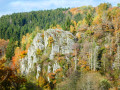
Crossed by the Ourthe Orientale, Gouvy boasts magnificent landscapes to discover as you follow the river, with countryside and forests alternating between deciduous and coniferous trees. In autumn, it is of course the deciduous trees that leave the greatest impression!
In the heart of one of our Ardennes forests around Montleban
6.40 mi
+564 ft
-564 ft
3h 25
Moderate
Departure from Gouvy (Province de Luxembourg)
As a resident of the pretty little village of Montleban, I’d like to suggest a route to my fellow walkers and/or joggers that consists of 90% wooded paths and 10% quiet, unpaved roads.
Throughout the walk, you may be lucky enough to encounter a family of wild boars or deer.
Sterpigny – Rodt Sankt-Vith
 14.25 mi
+840 ft
-587 ft
7h 15
Difficult
Departure from Gouvy (Province de Luxembourg)
14.25 mi
+840 ft
-587 ft
7h 15
Difficult
Departure from Gouvy (Province de Luxembourg)
Here we are in the Eastern Cantons. This region isn’t part of Wallonia, but I’ve included it in my ‘Parkin’son tour of Wallonia’ all the same. Through a succession of climbs, some of which are quite steep, as are the descents, we gradually make our way towards the highest altitudes in Belgium. Mainly via paths, tracks and back roads, we link up the various villages and small towns situated between Sterpigny and Rodt, namely Gouvy, Aldringen, Maldingen and Crombach.
Via Limerlé from Steinbach
 4.53 mi
+394 ft
-420 ft
2h 25
4.53 mi
+394 ft
-420 ft
2h 25
 Easy
Departure from Gouvy (Province de Luxembourg)
Easy
Departure from Gouvy (Province de Luxembourg)
The route passes through the Ourthe Orientale nature reserve. Here, in particular, you can admire the typical flora and fauna.Steinbach is a charming Ardennes village with an agricultural heritage, featuring numerous farms and small farmhouses built of schist stone and roofed with slate (cherbins = local slate). Its historical past is evident in the presence of castle-like farms and enclosed farmsteads dating back to the 17th and 18th centuries, which have been carefully restored.
The Eastern Ourthe between Taverneux and Cetturu
 10.10 mi
+1,079 ft
-1,066 ft
5h 35
Moderate
Departure from Houffalize (Province de Luxembourg)
10.10 mi
+1,079 ft
-1,066 ft
5h 35
Moderate
Departure from Houffalize (Province de Luxembourg)
Starting from the viewpoint overlooking the village of Tarverneux, the route heads east at first, then north-east as far as the Sommerain stream.After crossing it, the route heads out into the countryside on the heights of Brisy. A long descent towards the Ourthe follows… here it is the river’s eastern branch; the western branch flows successively through the communes of Libramont-Chevigny, Sainte-Ode, Tenneville and Bertogne before joining the main river at the Nisramont dam. The long climb that follows reaches the outskirts of Cetturu before descending again towards the Tavigny Stream. The next highest point of the walk is at a place known as ‘Les Deux Hêtres’. From there, the route descends towards the Ourthe, passing the Blancs Bois picnic shelter and barbecue area. Near the confluence of the Eastern Ourthe and the Cowan Stream, a little further upstream along the latter, stands the Moulin de l’Ermitage, which gave its name to the locality known as l’Hermitage. All that remains is to head back up to the starting point.
Walk around Houffalize
 11.24 mi
+1,079 ft
-1,070 ft
6h 05
Moderate
Departure from Houffalize (Province de Luxembourg)
11.24 mi
+1,079 ft
-1,070 ft
6h 05
Moderate
Departure from Houffalize (Province de Luxembourg)
The countryside around Houffalize town centre is open and hilly, offering beautiful views of this lush green region.The eastern Ourthe and its tributaries are (still) fairly wild streams with sometimes rushing waters. The forests are mainly fir forests... there are not many deciduous forests in this area.
For more walks, use our search engine .
The GPS track and description are the property of this route's author. Please do not copy them without permission.

