


Apples, pears, castles and a transparent church on the way to Heers


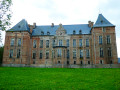
Orchards, apple trees, pear trees – there are legions (Roman) of them in the Limburg Hesbaye. And there’s also that famous ancient Roman road which the walk follows along (almost) its entire northern section between Tongeren and Sint-Truiden! Whether up close or from a distance, slightly hidden or clearly visible, walkers will be able to admire a number of castles along this very rural route. The walk passes by the region’s magnificent, unmissable work of art, ‘Reading between the lines’ – the famous transparent church made of Corten steel.
Details
Creation:
Last update:
Last review:
–
–
-
 Activity: Walking
-
 Distance: 13.70 mi
-
 Average duration: 6h 50
-
 Difficulty: Difficult
-
-
 Back to start: Yes
-
 Ascent: + 617 ft
-
 Descent: - 620 ft
-
-
 Highest point: 404 ft
-
 Lowest point: 184 ft
 Country:
 City:


Photos
Waypoints
- S/E : mi 0 - alt. 302 ft - Heers sports grounds
- 1 : mi 1.78 - alt. 249 ft - Fork in the road towards Horpmaal
- 2 : mi 3.27 - alt. 223 ft - Heks
- 3 : mi 3.91 - alt. 262 ft - Artwork
- 4 : mi 4.59 - alt. 249 ft - Bench
- 5 : mi 4.71 - alt. 262 ft - Bench
- 6 : mi 4.99 - alt. 341 ft - Bench
- 7 : mi 5.73 - alt. 305 ft - Junction
- 8 : mi 6.2 - alt. 384 ft - Picnic tables
- 9 : mi 6.62 - alt. 394 ft - Transparent church – Reading between the lines
- 10 : mi 6.72 - alt. 404 ft - Picnic tables
- 11 : mi 6.99 - alt. 361 ft - Roman villa and picnic table
- 12 : mi 7.61 - alt. 289 ft - Distant view of Hulsberg Castle
- 13 : mi 8.59 - alt. 200 ft - Tornaco Castle
- 14 : mi 9.32 - alt. 292 ft - Tjenne Tree (1970) and benches
- 15 : mi 9.43 - alt. 276 ft - A work of art dedicated to Tjenne – the witch
- 16 : mi 10.63 - alt. 203 ft - Mettekoven
- 17 : mi 11.06 - alt. 220 ft - Knoppel Nature Reserve
- 18 : mi 12.43 - alt. 246 ft - Veulen Castle
- 19 : mi 13.28 - alt. 253 ft - Heers Castle
- 20 : mi 13.33 - alt. 256 ft - Benches and picnic tables
- S/E : mi 13.7 - alt. 302 ft - Heers sports grounds
Other walks in the area
From castles to orchards in Sint-Pieters-Heurne
 Visorando Member
 10.32 mi
+374 ft
-354 ft
5h 05
 Moderate
 Departure from Heers (Province de Limbourg)
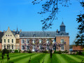
Starting from Sint-Pieters-Heurne, the walk takes you through the rather hilly countryside of Limburg Hesbaye, passing by a castle here, a chapel there, a limestone cave, an orchard, or a large square-shaped Hesbaye farmhouse.Although the region is criss-crossed by land consolidation tracks and concrete cycle paths, traffic is usually limited to a few farm vehicles, bicycles and occasionally a group or two of Vespa enthusiasts.That said, the route also follows numerous country lanes and forest tracks where you mainly come across only walkers or joggers.The numerous orchards (pear and apple trees) add a pleasant touch to the route when in bloom.
Walk around Oreye
6.39 mi
+190 ft
-171 ft
3h 05
Moderate
Departure from Oreye (Province de Liège)
A walk passing through the villages of Oreye, Otrange and Lauw (in Flanders). Half of the walk follows the River Geer through a lush, relaxing green setting. The other half winds through the villages and takes you up a slight incline.
Circular through the Limburg orchards starting from Helshoven
 8.11 mi
+213 ft
-220 ft
3h 55
Moderate
Departure from Borgloon (Province de Limbourg)
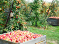
Pear, apple and cherry trees, as well as vines, strawberry plants and currant bushes, ensure the wealth and reputation of this part of Limburg's Hesbaye region for its fruit production. There are orchards galore to admire in spring when they are in bloom and later in the season when they are producing fruit.
Borgloon and its Transparent Chapel
3.43 mi
+174 ft
-167 ft
1h 45
 Easy
Departure from Borgloon (Province de Limbourg)
A short, peaceful walk in Borgloon, through the countryside and past fruit orchards. The walk follows land consolidation and country lanes used by a few farm vehicles and cyclists, with a brief detour past the Transparent Chapel and the Roman Villa landmark.
Through the orchards around Hoepertingen
 11.38 mi
+266 ft
-246 ft
5h 30
Moderate
Departure from Sint-Truiden (Province de Limbourg)
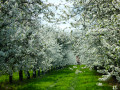
Pear, apple and cherry trees, a few vines and strawberry plants ensure the richness and reputation for fruit-growing of this part of the Limburg Hesbaye. Orchards galore to admire in spring during the blossom and later in the season for their fruit production.
Tongrian Hesbaye: Lauw – Hestappe
 7.82 mi
+200 ft
-190 ft
3h 45
Moderate
Departure from Tongeren (Province de Limbourg)
A refreshing country walk in Tongrian Hesbaye, taking us from the small village of Rutten to Lauw, following the River Geer and returning via Herstappe, a Walloon enclave in the heart of Flemish Limburg.
Walk organised by the walking club ‘Les Pantouflards de Wihogne’ (FFBMP, LG041)
Route des Châteaux à Tongeren
 8.40 mi
+272 ft
-279 ft
4h 05
Moderate
Departure from Tongeren (Province de Limbourg)
A pleasant walk in the north-western part of the town of Tongeren, following old tree-lined railway tracks, crossing the Herkwinning Nature Reserve and taking in a few castles and fortified farms in a varied environment of copses, low-stem orchards, meadows and fields.
Route proposed by the walking club "Les Pantouflards de Wihogne" (FFBMP, LG041).
Historic centre of Tongeren and Kevie Nature Reserve
 7.73 mi
+66 ft
-69 ft
3h 35
Moderate
Departure from Tongeren (Province de Limbourg)
A pleasant and varied walk, combining culture and exercise, in and around Tongeren, Belgium’s oldest town. It takes you through the historic districts (the Beguinage, the ramparts, the basilica, etc.) as well as the adjoining nature reserve. The Geer (Jeker in Dutch), its branches and tributaries are a defining feature of the region.
For more walks, use our search engine .
The GPS track and description are the property of this route's author. Please do not copy them without permission.

