


The Bocq de Bauche valley in Chansin, starting from Crupet


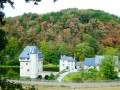
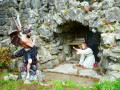
After the magnificent view at the start of the walk over the Carondelet keep and its immediate surroundings, the walk passes by (and through) the surprising Crupet cave, built by the parish priest of the time (1866–1926), before heading towards Bauche along a lovely forest path.
Just after the Bauche bridge, the route turns onto a path on the left, quickly joining the Bocq Tourist Railway, which it follows as far as the first level crossing.
From there, the route begins to follow the River Bocq, passing under the railway line several times beneath the arches of beautiful stone bridges … or through tunnels, until it reaches the old Durnal-Dorinne station at Chansin.
After the steep climb towards Durnal, the walk continues through the countryside towards Herbefays before turning left onto the small ridge road (this is the Condroz) and its northern viewpoint overlooking Maillen and Jassogne.
Return to the starting point via the Bois des Comognes in Jassogne and the Insefy path.
Details
–
-
 Activity: Walking
 -
 Distance: 9.78 mi
 -
 Average duration: 5h 30
 -
 Difficulty: Moderate
 -
-
 Back to start: Yes
 -
 Ascent: + 1,158 ft
 -
 Descent: - 1,161 ft
 -
-
 Highest point: 968 ft
 -
 Lowest point: 390 ft
 Country:

 City:
City:


Photos
Waypoints
- S/E : mi 0 - alt. 633 ft - Crupet car park
- 1 : mi 0.06 - alt. 653 ft - The Cave and its Priest (1866–1926)
- 2 : mi 0.59 - alt. 610 ft - Pirauchamps
- 3 : mi 2.23 - alt. 390 ft - Bauche Bridge
- 4 : mi 2.42 - alt. 413 ft - The Bocq (tourist) railway line
- 5 : mi 2.45 - alt. 413 ft - Former Bauche-Évrehailles railway station
- 6 : mi 2.9 - alt. 430 ft - Bocq (rivière)
- 7 : mi 4.33 - alt. 518 ft - Fork in the road - Bocq (rivière)
- 8 : mi 4.97 - alt. 784 ft - Bois du Sergent
- 9 : mi 5.76 - alt. 784 ft - Fork in the road on the outskirts of Dorinne
- 10 : mi 6.53 - alt. 551 ft - Former Chansin-Dorinne-Durnal railway station - Bocq (rivière)
- 11 : mi 7.44 - alt. 823 ft - Crossroads on the outskirts of Durnal
- 12 : mi 8.6 - alt. 961 ft - Viewpoint over Maillen and Jassogne
- S/E : mi 9.78 - alt. 633 ft - Crupet car park
Other walks in the area
Totemus in Crupet
 Visorando Member
 3.98 mi
+469 ft
-469 ft
2h 15
3.98 mi
+469 ft
-469 ft
2h 15
 Easy
Easy
 Departure from Assesse (Province de Namur)
From Crupet to Ronchine
 3.05 mi
+397 ft
-407 ft
1h 45
Moderate
Departure from Assesse (Province de Namur)
3.05 mi
+397 ft
-407 ft
1h 45
Moderate
Departure from Assesse (Province de Namur)
Along the wild Bocq from Crupet
9.41 mi
+1,093 ft
-1,093 ft
5h 15
Moderate
Departure from Assesse (Province de Namur)
Circular through the woods and along the Bocq river from Bordon.
5.04 mi
+577 ft
-587 ft
2h 50
Moderate
Departure from Yvoir (Province de Namur)
Jassogne to Crupet
4.73 mi
+846 ft
-840 ft
2h 55
Moderate
Departure from Assesse (Province de Namur)
Circular between Ivoy and Godinne via Mont, Bauche and Crupet.
 11.78 mi
+1,552 ft
-1,578 ft
6h 45
Moderate
Departure from Assesse (Province de Namur)
11.78 mi
+1,552 ft
-1,578 ft
6h 45
Moderate
Departure from Assesse (Province de Namur)
A detour via Bocq from Bauche
 10.85 mi
+1,362 ft
-1,375 ft
6h 10
Moderate
Departure from Assesse (Province de Namur)
10.85 mi
+1,362 ft
-1,375 ft
6h 10
Moderate
Departure from Assesse (Province de Namur)
Bauche to Durnal and back down to the Bocq valley
4.19 mi
+587 ft
-558 ft
2h 25
Moderate
Departure from Assesse (Province de Namur)
For more walks, use our search engine .
The GPS track and description are the property of this route's author. Please do not copy them without permission.

