


The Anciennes Troufferies de Libin Nature Reserves


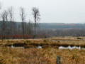
The walk runs alongside and through the two nature reserves set up to preserve the former peat bogs or fens situated between the N40 and the railway line linking Brussels to Luxembourg. These sections offer a landscape typical of the ‘fagne’ region, with heathland, pools and shrubs.
The entire route runs through woodland, with a wide variety of tree species offering a fairly balanced mix of conifers and deciduous trees. There is little undergrowth, allowing you to appreciate the forest in all its splendour.
There are lovely views of the Large Fontaine stream just before the 3 km mark, the Fagne de Tailsus stream around the 6 km mark, and the Lomme stream at the 8 km mark, just before the steepest climb of the day.
Details
–
–
-
 Activity: Walking
 -
 Distance: 8.60 mi
 -
 Average duration: 4h 40
 -
 Difficulty: Moderate
 -
-
 Back to start: Yes
 -
 Ascent: + 830 ft
 -
 Descent: - 856 ft
 -
-
 Highest point: 1,673 ft
 -
 Lowest point: 1,257 ft
-
 Country:
Belgium
Country:
Belgium
-
 Area: Massif des Ardennes
 -
 City:
Libin
City:
Libin -
 Start/End: N 49.94966° / E 5.289338°
 -


 Hour-by-hour weather


Photos
Waypoints
- S/E : mi 0 - alt. 1,673 ft - Roumont
- 1 : mi 1.02 - alt. 1,555 ft - Les Troufferies Nature Reserve
- 2 : mi 1.33 - alt. 1,535 ft - A place known as La Haie Courbôle
- 3 : mi 1.82 - alt. 1,368 ft - Large Fontaine stream
- 4 : mi 2.3 - alt. 1,424 ft - A place known as Sapins Pelzer
- 5 : mi 3.21 - alt. 1,411 ft - La Roche de Contranhé
- 6 : mi 3.79 - alt. 1,263 ft - Fagne de Tailsus stream
- 7 : mi 5.02 - alt. 1,286 ft - Lomme Valley
- 8 : mi 6.74 - alt. 1,440 ft - The Anciennes Troufferies Nature Reserve
- S/E : mi 8.6 - alt. 1,673 ft - Roumont
Other walks in the area
The Libin Truffle Fields
 Visorando Member
 3.70 mi
+299 ft
-299 ft
2h 00
3.70 mi
+299 ft
-299 ft
2h 00
 Easy
Easy
 Departure from Libin (Province de Luxembourg)
La Roche de Contranhé and the Troufferies de Libin Nature Reserve
 11.27 mi
+1,037 ft
-1,033 ft
6h 05
Moderate
Departure from Libin (Province de Luxembourg)
11.27 mi
+1,037 ft
-1,033 ft
6h 05
Moderate
Departure from Libin (Province de Luxembourg)
The first meanders of the Lesse from Ochamps
 11.36 mi
+948 ft
-955 ft
6h 05
Moderate
Departure from Libin (Province de Luxembourg)
11.36 mi
+948 ft
-955 ft
6h 05
Moderate
Departure from Libin (Province de Luxembourg)
Bané Campsite – Villance
 15.10 mi
+1,358 ft
-1,716 ft
8h 10
15.10 mi
+1,358 ft
-1,716 ft
8h 10
 Difficult
Departure from Libin (Province de Luxembourg)
Difficult
Departure from Libin (Province de Luxembourg)
Legendary site of Rocher du Cuy
 3.44 mi
+377 ft
-381 ft
1h 55
Easy
Departure from Libin (Province de Luxembourg)
3.44 mi
+377 ft
-381 ft
1h 55
Easy
Departure from Libin (Province de Luxembourg)
Forest paths and country roads in Villance
 4.46 mi
+377 ft
-381 ft
2h 25
Easy
Departure from Libin (Province de Luxembourg)
4.46 mi
+377 ft
-381 ft
2h 25
Easy
Departure from Libin (Province de Luxembourg)
Villance – Bané Bivouac
 17.24 mi
+1,381 ft
-1,033 ft
9h 10
Difficult
Departure from Libin (Province de Luxembourg)
17.24 mi
+1,381 ft
-1,033 ft
9h 10
Difficult
Departure from Libin (Province de Luxembourg)
Two days between Lesse and Lomme around Libin
 32.33 mi
+2,740 ft
-2,749 ft
2 days
Difficult
Departure from Libin (Province de Luxembourg)
32.33 mi
+2,740 ft
-2,749 ft
2 days
Difficult
Departure from Libin (Province de Luxembourg)
For more walks, use our search engine .
The GPS track and description are the property of this route's author. Please do not copy them without permission.

