Medium-length walk around the Grottes de Han estate

This medium-length walk around the Grottes de Han estate naturally differs in a few respects from the walk known as the ‘Grand Tour of the Grottes de Han estate’. It does not follow the course of the Lesse between Belvaux and Resteigne Castle, but it does take in the hermitage site and, above all, involves climbing to the top of the rocky cliff face to the north of the estate via an alpine-style path. This walk is probably not suitable for all children, but the bravest and most determined will enjoy the small playground at the starting point, the famous ‘alpine’ trail, and spotting animals on the outskirts of the park or from the Griffaloux viewpoint.

Details

n°108434789
Creation:
Last update:
Last review:
–
  • Walking
    Activity: Walking
  • ↔
    Distance: 9.56 mi
  • ◔
    Average duration: 5h 35 
  • ▲
    Difficulty: Difficult

  • ⚐
    Back to start: Yes
  • ↗
    Ascent: + 1,332 ft
  • ↘
    Descent: - 1,352 ft

  • ▲
    Highest point: 945 ft
  • ▼
    Lowest point: 495 ft

Photos

Description of the walk

A few details:

(1) The watermill is the first house in the row. Turn left after the last house to see the leat and the wheel of the old mill.

(3) To see and (try to) decipher the stone inscriptions commissioned by the hermit, take the small path leading down to the north of the site. The inscriptions are carved into a pile of rocks situated below the ruins of the tower.
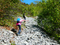
(7) The path that climbs from the edge of the woodland to the viewpoint (8) is described as ‘alpine’ because the slope is quite steep and it crosses a scree slope worthy of those in the Alps. Caution is essential, even though it is by no means a ledge. It is strongly advised against for the descent. It is this section that leads me to describe the route as difficult. The rest of the route presents no particular problems.

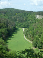
(12) The Griffaloux viewpoint offers a bird’s-eye view of one end of the wildlife park, where fallow deer and Heck horses usually graze. Be careful – there is no guardrail at the edge of the precipice! It’s an excellent spot for a picnic with a distant view of the Royal Castle of Ciergnon.

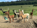
(13) The route runs alongside the fence (on the outside) of the wildlife park. You may (or may not) spot Heck aurochs, deer (does and stags), storks, lynx and vultures (near the gate at (14)).

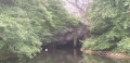
(14) The Gouffre de Belvaux was privatised a very long time ago… which is great news for the conservation of the site and its operators, but much less so for walkers who’d like to see this exceptional chantoir without having to pay for a full tour of the caves or the wildlife park!

Waypoints

  1. S/E : mi 0 - alt. 564 ft - Belvaux Chapel
  2. 1 : mi 0.17 - alt. 561 ft - Former watermill in Belvaux
  3. 2 : mi 1.39 - alt. 928 ft - Edmond d’Hoffschmidt de Resteigne’s Hermitage
  4. 3 : mi 1.44 - alt. 912 ft - Inscriptions carved into stone
  5. 4 : mi 2.52 - alt. 676 ft - Viewpoint over the Grignaux anticline
  6. 5 : mi 3.75 - alt. 499 ft - lesse (rivière) - Belgique
  7. 6 : mi 4.39 - alt. 538 ft - Resurgence of the - lesse (rivière) - Belgique
  8. 7 : mi 5.42 - alt. 587 ft - Alpine trail – scree slope
  9. 8 : mi 5.55 - alt. 774 ft - Viewpoint
  10. 9 : mi 5.7 - alt. 751 ft - Calcareous meadow
  11. 10 : mi 6.05 - alt. 568 ft - Saint-Martin Fountain
  12. 11 : mi 6.51 - alt. 574 ft - Inter-Allied Monument
  13. 12 : mi 7.04 - alt. 728 ft - Griffaloux rock and viewpoint
  14. 13 : mi 8.32 - alt. 623 ft - Wildlife park
  15. 14 : mi 8.51 - alt. 568 ft - Near the Gouffre de Belvaux
  16. S/E : mi 9.56 - alt. 564 ft - Belvaux Chapel

Notes

There are a few benches here and there, but not many. The one at (8) is particularly well situated for a picnic break.
There’s a small children’s playground at the starting point (S/E) and a few benches for a snack break after your walk and before heading back.

Worth a visit

Han-sur-Lesse: caves and wildlife park (admission fee applies – check opening hours)

Other walks in the area

For more walks, use our search engine .

The GPS track and description are the property of this route's author. Please do not copy them without permission.