


 Country:

 City:
City:


(8) If you have to make a choice, this is the place! Either carry on straight ahead along the tarmac road (an easy route) or climb the path starting from this picnic area… and that’s quite a workout, even a bit of a challenge, with ropes to help you up! Pure joy, but definitely a ‘hard’ climb! Around 90 metres of elevation gain over a horizontal distance of about 150 metres. The children loved it, whilst the adults found it a bit more challenging! Probably best avoided in wet weather!
Waulsort and the Meuse ridges, starting from Falmignoul


Whilst some sections are very easy and practically flat along the Meuse, those higher up can prove more challenging and resemble a proper trail run. But the reward is simply marvellous… even when done with fit children! A few lovely views of the Meuse from the heights add a real treat to the route.
And the particularly difficult section, which might interest children, is very easy to avoid.
Please note: the ferry service (free boat crossing of the Meuse for pedestrians) only operates between April and October… check the timetables online.
The walk is classified as difficult due to its elevation gain and the steepness of some of the paths.
Details
Creation:
Last update:
Last review:
–
–
-
 Activity: Walking
 -
 Distance: 10.15 mi
 -
 Average duration: 5h 50
 -
 Difficulty: Difficult
 -
-
 Back to start: Yes
 -
 Ascent: + 1,339 ft
 -
 Descent: - 1,345 ft
 -
-
 Highest point: 814 ft
 -
 Lowest point: 292 ft
Photos
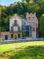
Description of the walk
Waypoints
- S/E : mi 0 - alt. 719 ft - Chapelle Rue des Crêtes
- 1 : mi 0.52 - alt. 614 ft - Start and end of the woodland
- 2 : mi 0.8 - alt. 620 ft - The Drapeau rock and viewpoint
- 3 : mi 1.15 - alt. 607 ft - Ruins of Château Thierry
- 4 : mi 3.5 - alt. 351 ft - Passeur d’Eau (in season) - Meuse (fleuve)
- 5 : mi 3.71 - alt. 348 ft - Waulsort Church
- 6 : mi 5.29 - alt. 587 ft - Roman Camp
- 7 : mi 5.71 - alt. 335 ft - Fond de Vaux - Meuse (fleuve)
- 8 : mi 5.85 - alt. 341 ft - Crossroads - Meuse (fleuve)
- 9 : mi 6 - alt. 554 ft - Viewpoint
- 10 : mi 6.66 - alt. 312 ft - Waulsort Lock - Meuse (fleuve)
- 11 : mi 7.01 - alt. 308 ft - Waulsort Dam - Meuse (fleuve)
- 12 : mi 7.39 - alt. 328 ft - Former Hermitage of Les Cascatelles - Meuse (fleuve)
- 13 : mi 7.46 - alt. 358 ft - Sentier des Cascatelles - Meuse (fleuve)
- 14 : mi 7.61 - alt. 489 ft - Les Cascatelles
- 15 : mi 8.02 - alt. 666 ft - A bit of a scramble
- S/E : mi 10.15 - alt. 719 ft - Chapelle Rue des Crêtes
Other walks in the area
Tour along the rocks of the Meuse
 Visorando Member7.58 mi
+797 ft
-778 ft
4h 10
Visorando Member7.58 mi
+797 ft
-778 ft
4h 10
 Moderate
 Departure from Dinant (Province de Namur)
A very beautiful tour along narrow paths, with beautiful views, steep slopes, high cliffs and lots of beautiful nature. Sturdy shoes are required, as well as a camera, as there are many photo opportunities. Have fun :)
Circular route starting from Falmagne
 8.59 mi
+787 ft
-787 ft
4h 40
Moderate
Departure from Dinant (Province de Namur)
8.59 mi
+787 ft
-787 ft
4h 40
Moderate
Departure from Dinant (Province de Namur)
This circular walk allows you to combine two of the Dinant region’s finest attractions: the Rocher de Freyr and the Chemin des Cascatelles.
The Cascatelles from Falmignoul
 4.41 mi
+669 ft
-643 ft
2h 35
Moderate
Departure from Dinant (Province de Namur)
4.41 mi
+669 ft
-643 ft
2h 35
Moderate
Departure from Dinant (Province de Namur)
From Falmignoul, descend via the Chemin du Crestia, followed by a short walk along the Meuse before returning to the village via the enchanting Cascatelles trail.
From Falmignoul to the banks of the Meuse, medium version
 6.38 mi
+794 ft
-794 ft
3h 40
Moderate
Departure from Dinant (Province de Namur)
6.38 mi
+794 ft
-794 ft
3h 40
Moderate
Departure from Dinant (Province de Namur)
From the ruins of Château Thierry to the Cascatelles, passing by the Drapeau viewpoint and the banks of the Meuse.
From Falmignoul to the banks of the Meuse, challenging version
 5.72 mi
+1,083 ft
-1,079 ft
3h 35
Moderate
Departure from Dinant (Province de Namur)
5.72 mi
+1,083 ft
-1,079 ft
3h 35
Moderate
Departure from Dinant (Province de Namur)
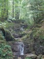
A challenging walk from the descent at Les Cascatelles to the steep climb up to the ruins of Château Thierry, passing first by the ascent up the Ruisseau de la Roule.Medium route: HERE
Falmignoul, the Rocher de Freyr and the waterfall
 9.20 mi
+876 ft
-873 ft
5h 00
Moderate
Departure from Dinant (Province de Namur)
9.20 mi
+876 ft
-873 ft
5h 00
Moderate
Departure from Dinant (Province de Namur)
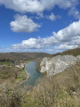
A lovely, fairly challenging walk for the first 7 kilometres, as some sections are quite narrow with slippery descents in wet weather. There are some very beautiful views, including the Rocher de Feyr. The return route takes you through the countryside along the water’s edge, up to the waterfalls, and finishes with a country lane that leads back to the starting point.
From the Meuse Ridges to the Waulsort Waterfalls
6.63 mi
+840 ft
-814 ft
3h 45
Moderate
Departure from Dinant (Province de Namur)
This circular walk reveals several different facets of the Upper Meuse as you walk along.
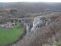
After a climb through the woods, the ridges reveal three successive viewpoints, including the Drapeau viewpoint, offering a panoramic view of the Meuse, Waulsort, its castle and the limestone cliffs that shape the valley.
The route then reaches the riverbanks before heading up the Cascatelles valley, where the stream runs alongside the path amongst the small waterfalls. The return journey across the agricultural plateaus offers a final change of scenery before reaching Falmignoul.
For more walks, use our search engine .
The GPS track and description are the property of this route's author. Please do not copy them without permission.

