


Orando974

 Visorando Member
 Administrator
 Premium user
 Sign up:
Published route(s)
 From Tapage to La Fenêtre
 7.42 mi
 +3,123 ft
 -3,117 ft
 6h 10
6h 10
 Difficult
 Departure from Saint-Louis (La Réunion) (Réunion)
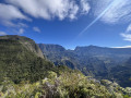
This hike takes you to Les Makes (at the La Fenêtre viewpoint) via a rarely visited spot: Le Tapage. This route offers magnificent views of the Cirque de Cilaos and the south of the island. On the way back, we take a detour through the beautiful Bras Patate valley.
Piton de Bois Vert or Piton de Bert
 7.90 mi
+305 ft
-308 ft
3h 55
7.90 mi
+305 ft
-308 ft
3h 55
 Average
Departure from Sainte-Rose (La Réunion) (Réunion)
Average
Departure from Sainte-Rose (La Réunion) (Réunion)
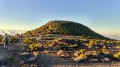
This hike offers beautiful views of the Enclos Fouqué and the Plaine des Sables region. We did this hike to see the volcanic eruption of May 2015! To do so, we got up early in the morning to enjoy the best possible view.
Le Trou de Fer via the Bélouve lodge and the Allée Cavalière trail
 5.89 mi
+738 ft
-722 ft
3h 20
Average
Departure from Salazie (Réunion)
5.89 mi
+738 ft
-722 ft
3h 20
Average
Departure from Salazie (Réunion)
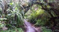
Le Trou de Fer is an iconic location on Reunion Island. Countless waterfalls plunge into this immense and impressive cavity. Located in the east of Reunion, it is one of the wettest places on the island! It can be reached from Bras-Panon and from the Bélouve forest. From this dense forest, there are three possible access routes: via the Trou de Fer trail, the bridle path or the École Normale trail.
The Col du Taïbit from the road from Ilet to Cordes
 4.62 mi
+2,805 ft
-2,805 ft
4h 35
Difficult
Departure from Cilaos (Réunion)
4.62 mi
+2,805 ft
-2,805 ft
4h 35
Difficult
Departure from Cilaos (Réunion)
This hike provides access to the Cirque de Mafate from the Îlet à Cordes road, leading to the Cirque de Cilaos. It is a classic route in this part of the island. It also forms part ofthe GR® R1 andGR® R2 trails. Admittedly, this hike is not for everyone, but the view from the pass is spectacular when the weather permits. We will pass through Îlet des Salazes, known for its herbal tea.
From Les Canaux to Le Grand Serré
 2.70 mi
+1,138 ft
-1,129 ft
2h 15
Average
Departure from Saint-Louis (La Réunion) (Réunion)
2.70 mi
+1,138 ft
-1,129 ft
2h 15
Average
Departure from Saint-Louis (La Réunion) (Réunion)
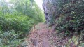
This walk takes you to Les Canaux in Le Grand Serré, a village you pass through on your way to Les Makes, offering beautiful panoramic views of this part of the island. There are several information boards along the first part of the route, providing details about the plant species you’ll encounter. There are no particular difficulties on this walk apart from the descent at Ravine Montplaisir, which is technically challenging and can be slippery depending on conditions.
From Camp Montplaisir to La Fenêtre via Les Fleurs Jaunes
 3.70 mi
+1,273 ft
-1,296 ft
2h 50
Average
Departure from Saint-Louis (La Réunion) (Réunion)
3.70 mi
+1,273 ft
-1,296 ft
2h 50
Average
Departure from Saint-Louis (La Réunion) (Réunion)
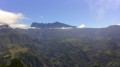
This hike offers beautiful panoramic views of Cilaos! On the way back, we pass through the magnificent Bras Patate valley.
The Grande Ferme Forest Road
 4.66 mi
+581 ft
-581 ft
2h 40
4.66 mi
+581 ft
-581 ft
2h 40
 Easy
Departure from Saint-Joseph (La Réunion) (Réunion)
Easy
Departure from Saint-Joseph (La Réunion) (Réunion)
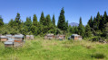
This old road once connected the Route du Volcan to Grande-Ferme. This family walk is not difficult. The first part of the circular route offers beautiful views of Bourg-Murat and its surroundings, Piton des Neiges and the south coast from Saint-Pierre to Étang-Salé-les-Hauts, while the second part is under cryptomeria trees with a few gaps offering views of Piton des Neiges.
A circular walk in Curepipe
 4.15 mi
+725 ft
-725 ft
2h 30
Easy
Departure from Saint-Louis (La Réunion) (Réunion)
4.15 mi
+725 ft
-725 ft
2h 30
Easy
Departure from Saint-Louis (La Réunion) (Réunion)
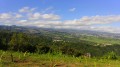
It’s always possible to go for a walk in an area where there are no marked footpaths. This walk, which starts in the Curepipe neighbourhood at La Rivière, follows dirt tracks and offers beautiful views of the ocean and the plains.
Piton de la Croix
 1.20 mi
+630 ft
-630 ft
1h 05
Average
Departure from L'Étang-Salé (Réunion)
1.20 mi
+630 ft
-630 ft
1h 05
Average
Departure from L'Étang-Salé (Réunion)
Piton la Croix is a peak in the commune of Étang-Salé. From its summit, you can enjoy one of the island’s most beautiful views! Indeed, from up there you have a 360° panorama stretching from Saint-Pierre to Étang-Salé-les-Bains, taking in Piton des Neiges, the hills above Étang-Salé, Saint-Louis, Le Tampon, L’Étang-Salé-les-Hauts, La Rivière and L’Entre-Deux! It’s also a wonderful spot for quiet reflection!
From the Plateau des Chênes to La Roche Merveilleuse
 3.15 mi
+856 ft
-833 ft
2h 10
Easy
Departure from Cilaos (Réunion)
3.15 mi
+856 ft
-833 ft
2h 10
Easy
Departure from Cilaos (Réunion)
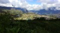
La Roche Merveilleuse offers a beautiful view of the Cirque de Cilaos. It would be a shame to miss it. There are a few trails here and there that allow you to hike peacefully around the viewpoint. There is even a discovery trail. The proposed hike is not particularly difficult.
The circular of the Canals
 4.56 mi
+1,759 ft
-1,759 ft
3h 40
Average
Departure from Saint-Louis (La Réunion) (Réunion)
4.56 mi
+1,759 ft
-1,759 ft
3h 40
Average
Departure from Saint-Louis (La Réunion) (Réunion)
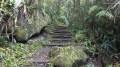
This is an original way to hike off the GR® trails. There are few trails winding through the Chaîne du Bois de Nèfle. This route takes you deep into the heart of this mountain range through a dense forest of colourful woods and offers some panoramic views of the south of the island and Les Makes. In addition, a picnic area has been set up at the end of the hike. Avoid this route in rainy weather!
Terre Rouge, Cap Jaune and the Plateau
 1.79 mi
+161 ft
-138 ft
1h 00
Easy
Departure from Saint-Joseph (La Réunion) (Réunion)
1.79 mi
+161 ft
-138 ft
1h 00
Easy
Departure from Saint-Joseph (La Réunion) (Réunion)
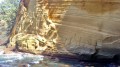
Located in the south of the island, Cap Jaune is a natural curiosity that is a must-see if you come to Vincendo. This site owes its name to its yellow colour! The trail runs along the coastline and offers superb panoramic views! It also crosses landscapes specific to the Wild South (jagged landscapes, vackoas, volcanic rocks, blowholes, etc.).
Moderator's note added on 21/07/2021: There have been a few changes to the terrain since this hike was published. See reviews.
Les Canaux from Gol-les-Hauts via the Ravine des Merles
 3.69 mi
+571 ft
-561 ft
2h 10
Easy
Departure from Saint-Louis (La Réunion) (Réunion)
3.69 mi
+571 ft
-561 ft
2h 10
Easy
Departure from Saint-Louis (La Réunion) (Réunion)
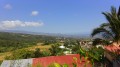
Here’s a lovely idea for a family walk off the beaten track. This route lets you explore the Canaux and Gol-les-Hauts area via a few small paths and old alleyways. The route offers some stunning panoramic views, especially when the reeds have been cut back!
The Piton de Partage (or Piton Sale)
 2.76 mi
+292 ft
-295 ft
1h 30
Easy
Departure from Sainte-Rose (La Réunion) (Réunion)
2.76 mi
+292 ft
-295 ft
1h 30
Easy
Departure from Sainte-Rose (La Réunion) (Réunion)
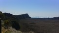
This route leads to the Piton de Partage (or Piton Sale), a peak situated to the north-west of the Piton de la Fournaise enclosure. There are numerous splendid panoramic views from here, including of the Savane Cimetière and the most recent eruption of Piton de la Fournaise, which took place just a few months ago! Once you reach Piton de Partage, you can even see the Pointe des Cascades and the Bois-Blanc coastline in the distance!
 Le Bras Long
 1.53 mi
+374 ft
-374 ft
30 mins
Easy
Departure from L'Entre-Deux (Réunion)
1.53 mi
+374 ft
-374 ft
30 mins
Easy
Departure from L'Entre-Deux (Réunion)
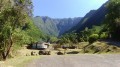
Located on the heights of the Entre-Deux, this short mountain bike ride follows the Bras Long, passing by the eponymous picnic area which is very popular at weekends. It allows you to discover a little-known part of the Dimitile whilst riding between the Crête du Bras Long and the Zèbre.
The Porters’ Trail
 0.74 mi
+233 ft
-233 ft
0h 35
Easy
Departure from Cilaos (Réunion)
0.74 mi
+233 ft
-233 ft
0h 35
Easy
Departure from Cilaos (Réunion)
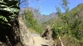
Located in Cilaos, the Sentier des Porteurs is a section of the old Route de Cilaos. Very short, it takes you from the Piton des Neiges Multimedia Centre to the D242 in around 15 minutes. It is very popular with families coming to walk with their children at the weekend. This trail takes its name from the fact that, in the past, one of the most common ways of travelling to Cilaos was by sedan chair. The porters were often slaves.
The Bras Rouge Waterfall
 2.61 mi
+1,047 ft
-1,066 ft
2h 05
Average
Departure from Cilaos (Réunion)
2.61 mi
+1,047 ft
-1,066 ft
2h 05
Average
Departure from Cilaos (Réunion)
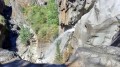
_The Bras Rouge Waterfall is a must-see attraction in the Cirque de Cilaos. Two trails lead to the waterfall: the first starts at the old thermal baths and the second at the start of the Taïbit trail. This route is the first of the two. Easy and suitable for families, it offers beautiful views of the western part of the cirque. It’s a classic Cilaos walk and is very popular!
The Bassin Sassa
 1.46 mi
+157 ft
-157 ft
0h 50
Easy
Departure from L'Entre-Deux (Réunion)
1.46 mi
+157 ft
-157 ft
0h 50
Easy
Departure from L'Entre-Deux (Réunion)
The Bassin Sassa takes its name from a slave called Sassa. This short circular walk takes you as close as possible to the basin, allows you to walk along part of the Bras Long and explore the town of L’Entre-Deux. This family-friendly route is one of the easiest in the area. However, it should be avoided during or after heavy rain, as nearly half the route runs along the bottom of a ravine.
From Gravier to Pointe Coton
 4.20 mi
+157 ft
-148 ft
2h 05
Easy
Departure from Rodrigues
4.20 mi
+157 ft
-148 ft
2h 05
Easy
Departure from Rodrigues
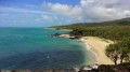
This is one of the most popular hikes on Rodrigues. Easy, family-friendly and not very long, this route runs along much of the east coast of Rodrigues. You will encounter a succession of coves and sandy beaches, each as beautiful as the next. It's the perfect opportunity to take a dip. This hike offers beautiful views of the region. It is easy to see why Rodrigues is nicknamed "the Pearl of the Mascarene Islands".
La Mare via the Forêt des Hauts de Mont Vert
 3.66 mi
+545 ft
-535 ft
2h 10
Easy
Departure from Saint-Joseph (La Réunion) (Réunion)
3.66 mi
+545 ft
-535 ft
2h 10
Easy
Departure from Saint-Joseph (La Réunion) (Réunion)
La Mare is a very small lake surrounded by arum plants, situated in the hamlet of the same name in the hills above Petite-Île. This walk, starting from the D36, passes through the beautiful Forêt des Hauts de Mont Vert, offering stunning views of the south of the island at the end of the route, as well as of the Rivière des Remparts, whilst following a well-maintained track lined with arums. It is possible to extend the walk to the Relais de Petite Île or to the Domaine Vidot.
The climb up Ravine Barrage
 4.74 mi
+449 ft
-449 ft
2h 35
Average
Departure from Saint-Louis (La Réunion) (Réunion)
4.74 mi
+449 ft
-449 ft
2h 35
Average
Departure from Saint-Louis (La Réunion) (Réunion)
The Ravine du Gol is fed by three main branches: the Ravine de Bellevue, the Ravine Barrage and the Ravine Goyaves. This guide allows you to hike the entire length of the Ravine Barrage as far as the Source de l’Éperon. The stream is usually dry, but a few springs provide patches of water here and there. The going isn’t too difficult over the pebbles, and those who enjoy large boulders will be in their element!
The Providence Botanical Trail
 1.59 mi
+614 ft
-614 ft
1h 15
Easy
Departure from Saint-Denis (La Réunion) (Réunion)
1.59 mi
+614 ft
-614 ft
1h 15
Easy
Departure from Saint-Denis (La Réunion) (Réunion)
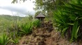
Located a short walk from Saint-Denis, this short trail allows you to discover some of the island’s endemic plants. It winds through one of the first forests to have been altered by humans. This trail is easily manageable with young children and offers beautiful views of Saint-Denis during the first part of the walk. It is also the starting point ofthe GR® R2. This walk shares a section with the Sentier Mercure, one of the island’s most popular trails.
The Mercure Trail
 6.27 mi
+2,635 ft
-2,635 ft
5h 10
Average
Departure from Saint-Denis (La Réunion) (Réunion)
6.27 mi
+2,635 ft
-2,635 ft
5h 10
Average
Departure from Saint-Denis (La Réunion) (Réunion)
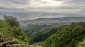
The Mercure Trail is one of the island’s most popular trails. It connects La Providence to Le Brulé. It is also the first stage of the GRR2, or the last, depending on which direction you take it. The first part of the trail shares a section with the botanical trail. It runs the entire length through the beautiful Providence Departmental Forest, one of the first forests to be modified by humans and a true green lung just a stone’s throw from the town.
The Pic Adam circular
 4.64 mi
+1,873 ft
-1,873 ft
3h 45
Average
Departure from Saint-Denis (La Réunion) (Réunion)
4.64 mi
+1,873 ft
-1,873 ft
3h 45
Average
Departure from Saint-Denis (La Réunion) (Réunion)
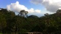
Pic Adam is a peak in the north of the island that is visible for several kilometres around due to its distinctive shape. There are two ways to reach it, both of which are described in this guide. This hike allows you to explore a small section of the trail linking La Roche Écrite to Bois de Nèfles. From its vantage point, there is a breathtaking panorama of the entire north. Its name comes from one of the island's first botanists.
The Pic Adam culvert
 2.13 mi
+518 ft
-512 ft
1h 25
Average
Departure from Saint-Denis (La Réunion) (Réunion)
2.13 mi
+518 ft
-512 ft
1h 25
Average
Departure from Saint-Denis (La Réunion) (Réunion)
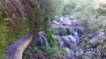
Pic Adam is named after one of the island’s botanists. Its western flank is criss-crossed by numerous small streams that often carry water. Several catchments were subsequently created and are linked by a pipeline designed to supply water to the homes downstream. It is possible to follow this pipeline on a walk that presents no major difficulties, but which does include some tricky sections for children, particularly on the way to the beautiful waterfall on the Ravine Blanche.
The tour of the Plaine d'Affouche via Îlet à Guillaume
 16.08 mi
+5,591 ft
-5,591 ft
12h 15
Difficult
Departure from Saint-Denis (La Réunion) (Réunion)
16.08 mi
+5,591 ft
-5,591 ft
12h 15
Difficult
Departure from Saint-Denis (La Réunion) (Réunion)
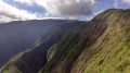
Located at an altitude of around 1,400 metres, the Plaine d’Affouche overlooks Îlet à Guillaume and forms an integral part of the Roche Écrite Reserve. Keep your ears and eyes peeled, as you may spot or hear the tuit-tuit, a bird found only on Réunion and exclusively in this part of the island.
Please note: this hike can be completed in under 8 hours. The elevation gain is overestimated: there is approximately 1,500 metres of ascent and descent, not 2,375.
Part of the Sentier des Foulées de la Fraise
 4.57 mi
+1,198 ft
-1,217 ft
3h 10
Average
Departure from Saint-Pierre (La Réunion) (Réunion)
4.57 mi
+1,198 ft
-1,217 ft
3h 10
Average
Departure from Saint-Pierre (La Réunion) (Réunion)
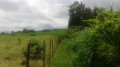
This walk is part of the Sentier des Foulées de la Fraise trail. It is also a section of the Grand Raid. As you pass by the pastures, you’ll also have the chance to enjoy beautiful views towards the west and south. This section follows the Sentier des Foulées de la Fraise trail between Domaine Vidot and the first strawberry field. Fairly easy, although with a few steep steps, it is possible to continue much higher up towards Notre-Dame de la Paix.
The Grand Case Trail circular loop
 7.39 mi
+2,238 ft
-2,238 ft
5h 20
Difficult
Departure from Saint-Louis (La Réunion) (Réunion)
7.39 mi
+2,238 ft
-2,238 ft
5h 20
Difficult
Departure from Saint-Louis (La Réunion) (Réunion)
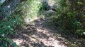
La Pièce Jeanne is best known for its peaceful atmosphere, far from the hustle and bustle. However, this area does offer a few hiking options. The best-known trail links La Pièce Jeanne to Les Makes. But it is possible to do a circular route by returning via the little-known Sentier Grand Case, which is actually well signposted despite not appearing on maps or in guidebooks. This circular route offers stunning views of the south and north of the island and is not particularly difficult.
The Bras Patate valley
2.76 mi
+722 ft
-735 ft
1h 55
Easy
Departure from Saint-Louis (La Réunion) (Réunion)
The Makes region offers a wealth of hiking opportunities. The Bras Patate valley trail is one of the easiest and best known. The trail winds its way through a magnificent valley, offering superb views of Cilaos. Bras Patate was the entrance to the Cirque de Cilaos before the Piton des Neiges collapsed. However, the water did not have time to carve out a deep canyon like the Bras de Cilaos, but be sure to bring your camera: you will see many endemic birds.
Circular loop at Pointe de Langevin
0.93 mi
+36 ft
-36 ft
0h 25
Easy
Departure from Saint-Joseph (La Réunion) (Réunion)
This route offers a circular path at Pointe de Langevin on a very popular, high-quality trail. Lovers of rugged landscapes will delight in the spectacle of the sea crashing against this rugged coastline. It is also possible to take a dip in the pools of the Langevin River.
Piton de Mont-Vert
1.07 mi
+351 ft
-351 ft
0h 50
Average
Departure from Saint-Pierre (La Réunion) (Réunion)
Rising to an altitude of 636 metres, the Piton de Mont Vert is an iconic peak in the south of the island. It is an ancient crater dating back 30,000 years! Visible for kilometres around, it is criss-crossed by several kilometres of footpaths. Winding through a beautiful forest, these paths are the best way to discover the flora and fauna of this piton. The climb is sometimes steep but only for short stretches.
Bassin Dix-Huit and the Terre Rouge circular loop
2.69 mi
+299 ft
-289 ft
1h 30
Average
Departure from Saint-Pierre (La Réunion) (Réunion)
Bassin Dix-Huit (or Bassin 18) is one of the best-known pools in the south. Several legends circulate about it. The approach is very short but quite technical: best avoided with children, which explains its ‘medium’ difficulty rating. The pool is deep and the water is beautifully clear! To extend the walk, this route suggests completing a circular route at Pointe du Bois de Buis. This section, which follows the coast and offers some lovely views, presents no difficulty whatsoever.
Piton Babet
0.92 mi
+354 ft
-338 ft
0h 45
Easy
Departure from Saint-Joseph (La Réunion) (Réunion)
Piton Babet is an iconic peak in the commune of Saint-Joseph. It is named after the former mayor, who is buried at the summit of the peak. This walk is very short and can easily be combined with another hike, such as Piton de l’Entonnoir. The sound of the waves will never cease. Just before the start of the climb, don’t miss the Caverne des Hirondelles. It’s also possible to walk all the way round the piton, but this has the drawback of passing through built-up areas.
Le Zèbre via the Sentier Marron from Bras Long and the Sentier Rosélie
5.52 mi
+2,123 ft
-2,119 ft
4h 25
Difficult
Departure from L'Entre-Deux (Réunion)
L'Entre-Deux is a hiker’s paradise. This route follows the Sentier Rosélie and the Sentier du Zèbre. The latter is, in fact, one of the best-known trails in the region. You can complete a circular route by taking the Sentier Marron du Bras Long: it is very strenuous, quite demanding and technical, and is only recommended for very experienced walkers. This trail was little known before but is becoming increasingly popular. It also offers the chance to enjoy splendid panoramic views.
The Petite Ravine Trail
1.93 mi
+1,440 ft
-1,440 ft
2h 10
Average
Departure from L'Entre-Deux (Réunion)
There are several ways to reach the Bras de la Plaine. The route via the Sentier de la Petite Ravine is fairly well-known but rarely featured in guidebooks! This relatively short path leads right next to the beautiful Caverne de la Petite Ravine. If the opportunity arises, don’t hesitate to have a swim in the river or go and see the magnificent gorges downstream from the cave: do not attempt either of these if the water level is too high!
Nez de Bœuf from Bourg-Murat
 8.51 mi
+1,870 ft
-1,867 ft
5h 35
Average
Departure from Le Tampon (Réunion)
8.51 mi
+1,870 ft
-1,867 ft
5h 35
Average
Departure from Le Tampon (Réunion)
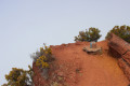
Nez de Bœuf is an iconic peak on the Route du Volcan. There is a magnificent viewpoint at its foot. However, the view from the summit is much better. This hike takes you there from the peaceful village of Bourg Murat, crossing rural landscapes with magnificent views. However, it is strongly recommended that you start at 7 a.m. at the latest to get the best views. Especially the one at the summit, which will leave you with unforgettable memories.
Piton Plaine des Fougères via Maison Martin and the Plaine des Fougères
9.66 mi
+2,152 ft
-2,152 ft
6h 20
Average
Departure from Sainte-Marie (La Réunion) (Réunion)
The Cirque de Salazie is dominated by several peaks, including Piton Plaine des Fougères. Two trails, starting from the Plaine des Fougères, lead to the eponymous peak and form a circular route. The plain is home to countless tamarind trees, each as remarkable as the next. The return trail features a few information boards. The southernmost section runs alongside an imposing escarpment, offering magnificent views of the Cirque de Salazie.
Saint-Louis – l’Étang-Salé les Bains
 11.19 mi
+102 ft
-285 ft
5h 15
Average
Departure from Saint-Louis (La Réunion) (Réunion)
11.19 mi
+102 ft
-285 ft
5h 15
Average
Departure from Saint-Louis (La Réunion) (Réunion)
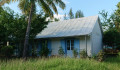
The second stage of the walk runs closest to the railway line; it begins in the multicultural town of Saint-Louis and takes you past two branch lines of the railway. It then winds through the Étang-Salé forest, following the main railway line as closely as possible, before arriving at the peaceful seaside village of Étang-Salé les Bains. Of course, you’ll come across a few remnants of the railway line.
L’Étang-Salé les Bains – Saint-Leu
 8.39 mi
+141 ft
-138 ft
4h 00
Average
Departure from L'Étang-Salé (Réunion)
8.39 mi
+141 ft
-138 ft
4h 00
Average
Departure from L'Étang-Salé (Réunion)
The third stage of the route runs closest to the railway line. It starts in the charming seaside village of Étang-Salé les Bains and ends in another seaside town: Saint-Leu. The terrain is flat throughout, but a few off-trail sections are tricky. There are numerous remains of the railway line on this stage, far more than on the previous one. This stage runs constantly along the coast and also offers some beautiful views of the ocean and the hills.
Saint-Gilles – Saint-Paul
6.73 mi
+673 ft
-679 ft
3h 40
Easy
Departure from Saint-Paul (La Réunion) (Réunion)
Fifth stage of the island tour, running close to the railway line. This stage is flat and relatively easy. The first section is urban and passes through the tourist towns of Saint-Gilles and Boucan Canot, renowned for their white sandy beaches. The second section is more rural, running along the cliffs of Cap la Houssaye. The final section is urban once again and takes you through the town of Saint-Paul. Along the way, you’ll come across around ten remnants of the railway line.
The Bras de la Plaine Gorges from the Entre-Deux
6.10 mi
+3,150 ft
-3,173 ft
5h 35
Average
Departure from L'Entre-Deux (Réunion)
Here is an extraordinary water-based hike. This ascent of the Bras de la Plaine through the gorges is a hike that has to be earned. All along the way, it is a succession of caves, rock formations and very narrow passages where light struggles to penetrate. You will very often get your feet wet in this magnificent area, and that is what makes this hike so charming. However, GPS reception is very poor in the steep-sided sections.
The Sentier de l’Échelle
1.61 mi
+961 ft
-974 ft
1h 35
Average
Departure from Sainte-Marie (La Réunion) (Réunion)
This family-friendly circular walk is situated in the hills above Saint-Denis. It can be completed in under an hour but does feature steep slopes with very high steps! This walk offers the chance to spot species endemic to the island, and much of the path is shaded. The path is regularly maintained by a local charity. The southernmost section, however, is in the open and offers magnificent views of the north of the island.
Le Dimitile via the Sentier de la Chapelle trail
5.86 mi
+2,546 ft
-2,546 ft
4h 55
Average
Departure from L'Entre-Deux (Réunion)
Dimitile is known for its many hiking trails. The shortest and easiest route to the summit is via the Sentier de la Chapelle trail. This hike offers magnificent views of the south of the island and then the Cirque de Cilaos at the end of the climb. It allows you to encounter some endemic plants and see various types of vegetation. It also provides a historical perspective on slavery with the character of Dimitile and the current Camp Marron.
La Possession – Grande Chaloupe
4.76 mi
+1,122 ft
-1,135 ft
3h 10
Average
Departure from Réunion
Eighth stage of the island tour, following the railway line as closely as possible. After the long flat stretch of the previous stages, this short stage sees a return to uphill terrain. As access to the tunnel is officially prohibited, you must go via the Chemin des Anglais, which includes sections with steep gradients. This is a very old paved path that is now a must-do hike on the island.
Sainte-Marie – Sainte-Suzanne
4.65 mi
+105 ft
-112 ft
2h 15
Easy
Departure from Sainte-Marie (La Réunion) (Réunion)
The eleventh stage of the walk takes you right alongside the railway line. This stage is short and very easy. It is also the only section where you’ll follow the entire route of the railway line. This section is regularly used by joggers. The path runs fairly close to the coast and occasionally offers some lovely views of the sea. There are also numerous railway remains along this section.
Sainte-Suzanne – Cambuston
4.24 mi
+79 ft
-23 ft
2h 00
Average
Departure from Sainte-Suzanne (La Réunion) (Réunion)
Twelfth stage, running close to the railway line. This stage is flat, but crossing the Sainte-Suzanne and Saint-Jean rivers may pose a problem for beginners. It is the second-shortest stage of the trek. This stage is divided into three sections: the first is urban, the second rural, and the third is urban again. However, there are fewer railway remains on this section, and those that are present have been left to fall into disrepair.
Hell Bourg and the Three Waterfalls
 3.94 mi
+1,089 ft
-1,093 ft
2h 45
Average
Departure from Salazie (Réunion)
3.94 mi
+1,089 ft
-1,093 ft
2h 45
Average
Departure from Salazie (Réunion)
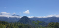
The village of Hell Bourg is one of the most beautiful on the island. Many tourists come specifically to see its beautiful Creole houses and their ‘guétali’. The village is home to numerous museums and offers a wide range of accommodation options. This circular walk takes in the village’s main attractions; it is suitable for families, and the only challenging part is the round trip to the Trois Cascades: the path is a bit of a workout, but it’s a short climb and the site is enchanting.
From Hell-Bourg to Bélouve
3.32 mi
+1,791 ft
-1,795 ft
3h 05
Average
Departure from Salazie (Réunion)
The Cirque de Salazie is renowned for its hikes. The one linking Hell-Bourg to Bélouve is a classic. It climbs along a rampart for about 500 m of elevation gain. The climb is often winding and rarely difficult, although the slope is present almost all the way. Much of the hike is in the undergrowth. However, this climb offers sumptuous views of the entire cirque, with the final viewpoint at the lodge providing a spectacular finale.
The Mare Longue botanical trail
 1.32 mi
+325 ft
-325 ft
0h 55
Easy
Departure from Saint-Philippe (La Réunion) (Réunion)
1.32 mi
+325 ft
-325 ft
0h 55
Easy
Departure from Saint-Philippe (La Réunion) (Réunion)
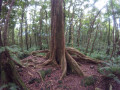
Réunion has many botanical trails. The Mare Longue trail is one of the best known. It offers a short family walk through the forest. The route consists of two circular loops, and it is possible to do just one. The forest you walk through is a remnant of the Bas colour-wood forest. Many of the species encountered are endemic and sometimes have remarkable aerial roots.
Cap Anglais
8.70 mi
+4,117 ft
-4,098 ft
7 hrs
 Very difficult
Departure from Salazie (Réunion)
Very difficult
Departure from Salazie (Réunion)
A very challenging circular walk that takes you through the beautiful, colourful forest on the heights of Bélouve whilst offering splendid views across the entire Cirque de Salazie. The climb to Cap Anglais is gruelling and very difficult, and most of the elevation gain is on this section. Going the other way, the circular route is a little easier. The walk passes through the village of Hell-Bourg, where you can stock up on supplies. Allow a little extra time to visit the village.